Exclusive Reykjanes Peninsula Day Tour: A Volcanic Adventure
80.943 ISK
4 klukkustundir

Auðvelt
190.000 ISK
Vinsamlegast athugið:
Veðrið getur verið ófyrirsjáanlegt á Íslandi svo á veturna gætirðu búist við því að við þurfum stundum að breyta ferðaáætluninni ef veður/vegaðstæður eru óhagstæðar.
Laus: Allt árið
Lengd: Approx. 8hrs, depending on your time spent at each stop and the duration of any activity added.
Upptaka: Frá hótelinu/gistingunni á höfuðborgarsvæðinu í Reykjavík.
Hápunktar
Lýsing
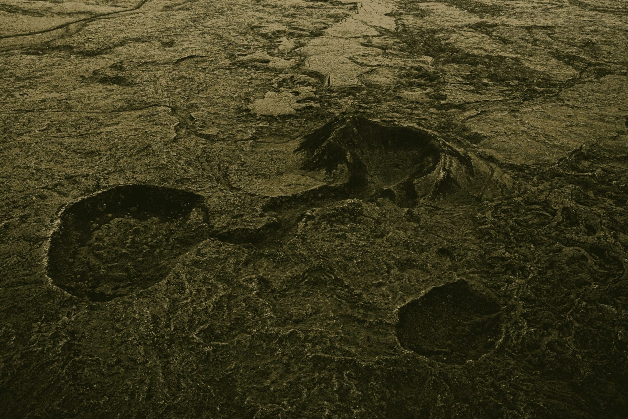
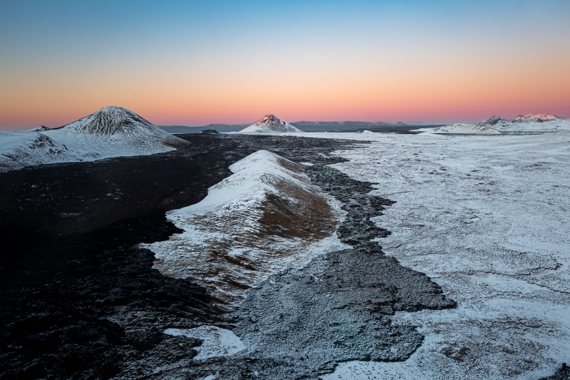
The Reykjanes peninsula is a 2,000 km² (772 mi²) area characterized by various formations of palagonite tuff, pillow lava, and basaltic lava flows shaped by volcanic activity during interglacial periods, mostly in the last 11,500 years. The Mið-Atlantshafshryggurinn rises above sea level on this peninsula and it is lined with four volcanic systems from SW to NE, containing craters, faults, open volcanic fissures, large and small lava shields, and high-temperature geothermal fields. Fisheries have long been a lifeline of the locals, with fishing towns and villages along the black-sanded coastline, some even dating back centuries.
In 2015, Reykjanes was recognized as a Global Geopark eftir UNESCO (United Nations Educational, Scientific, and Cultural Organization) for its geological heritage in connection with the area's natural and cultural heritage. UNESCO Global Geoparks have sites and landscapes of international geological significance, managed with a holistic concept of education, protection, and sustainability.
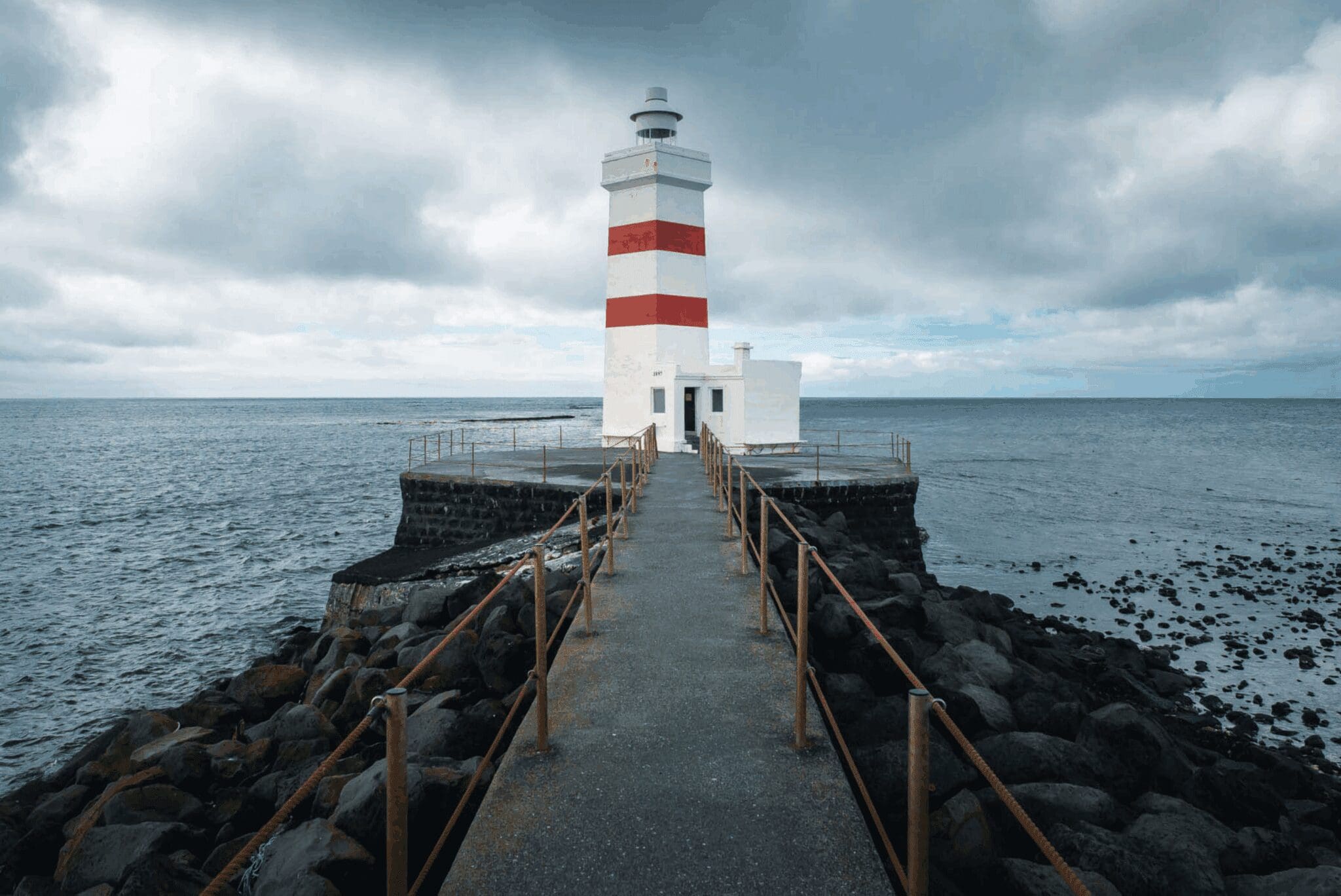
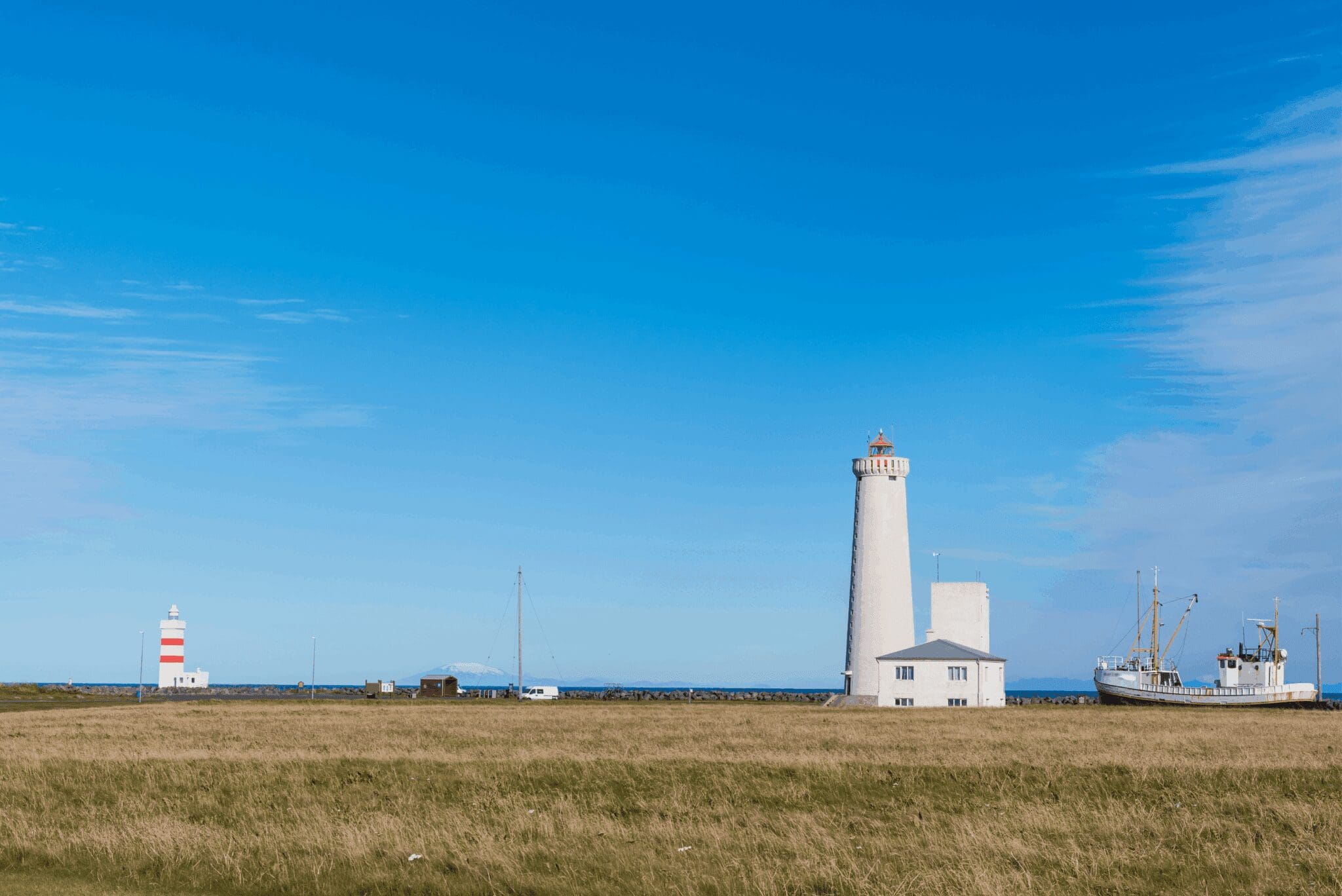
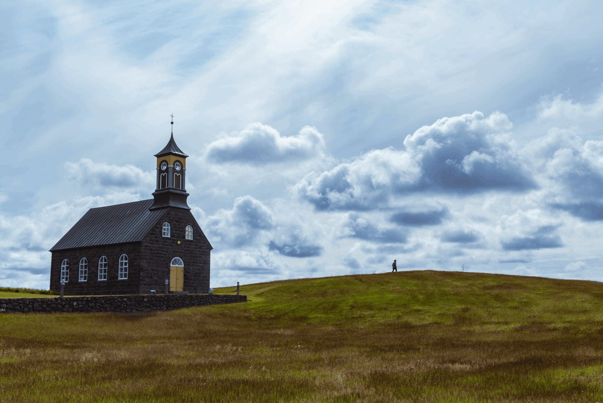
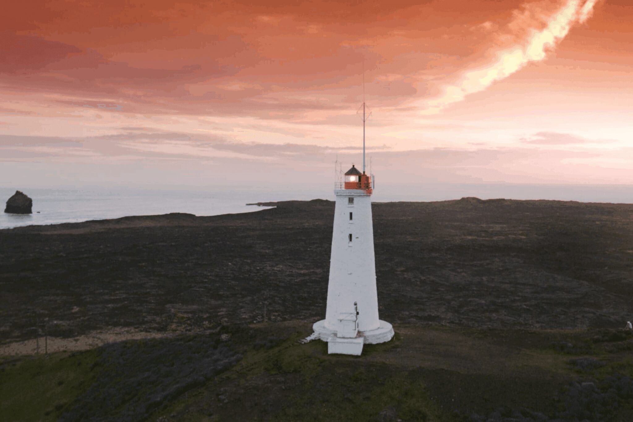
The Reykjanes UNESCO Global Geopark has 55 geosites and we will start on the outermost point of the peninsula at Garðskagi. Two lighthouses stand there bearing the same name Garðskagaviti. The older one dating back to 1897 is the second oldest lighthouse in Iceland while the newer one dating back to 1944 is the tallest lighthouse in our country. Both lighthouses offer a unique 360° view over the Atlantshaf and inland, and by the coast are varied species of sea birds, seals, and whales. Heading south from Garðskagi by the coastline, we next stop at the unique black church Hvalsneskirkja. This is among our favorite Icelandic churches, built with basalt lava rocks and crafted inside with driftwood, both collected within the region by locals. Its colorful tower makes for a great contrast against the basalt exterior and the surrounding mossy lava field.
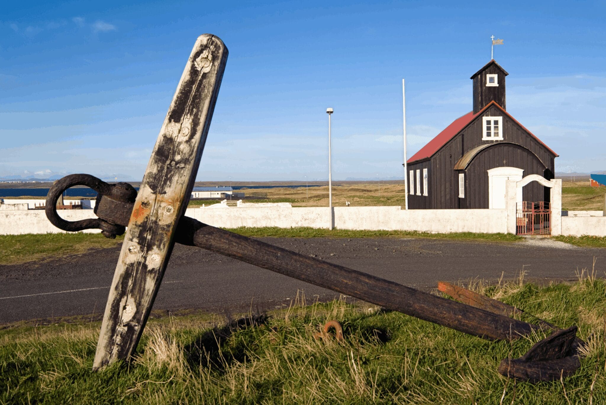
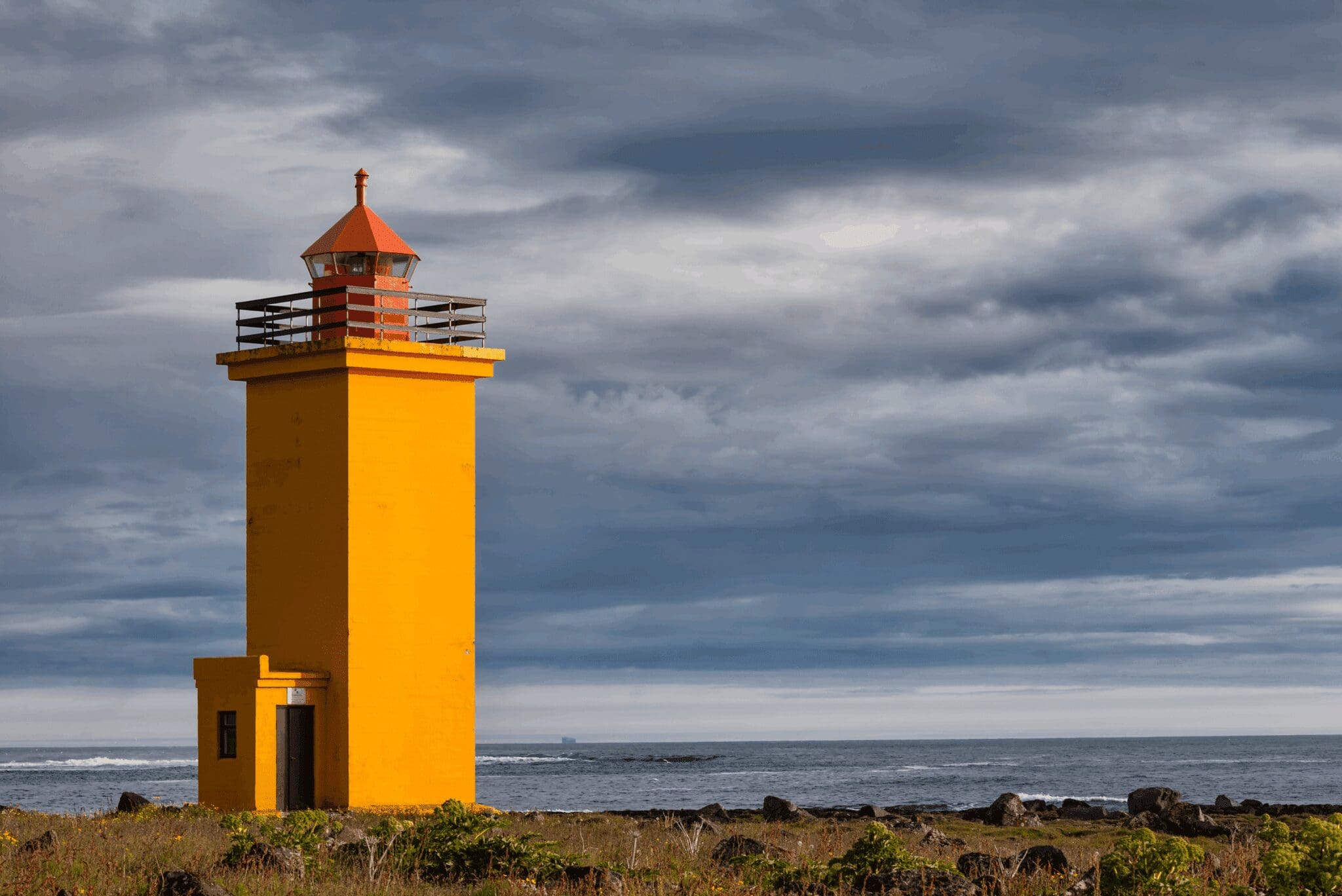
Closeby is another lighthouse, the picturesque yellow-colored Stafnesviti, overlooking the rocky coast of Básendar which used to be the largest fishing and trading post in the area before a flood caused by a terrible storm destroyed the whole town in 1799, changing the shoreline forever. We then head further south through the lava field with the rocky coastline to our right, to the wooden black church Kirkjuvogskirkja in the fishing village Hafnir. This is the oldest church on the Reykjanes peninsula, dating back to 1860. Standing close to shore, an anchor from the sailing ship Jamestown is kept to commemorate when the residents woke up one morning finding that the ship had run aground after drifting abandoned and filled with valuable timber over the Atlantic Ocean. Most of that timber was then used for building houses and bridges all over Iceland.
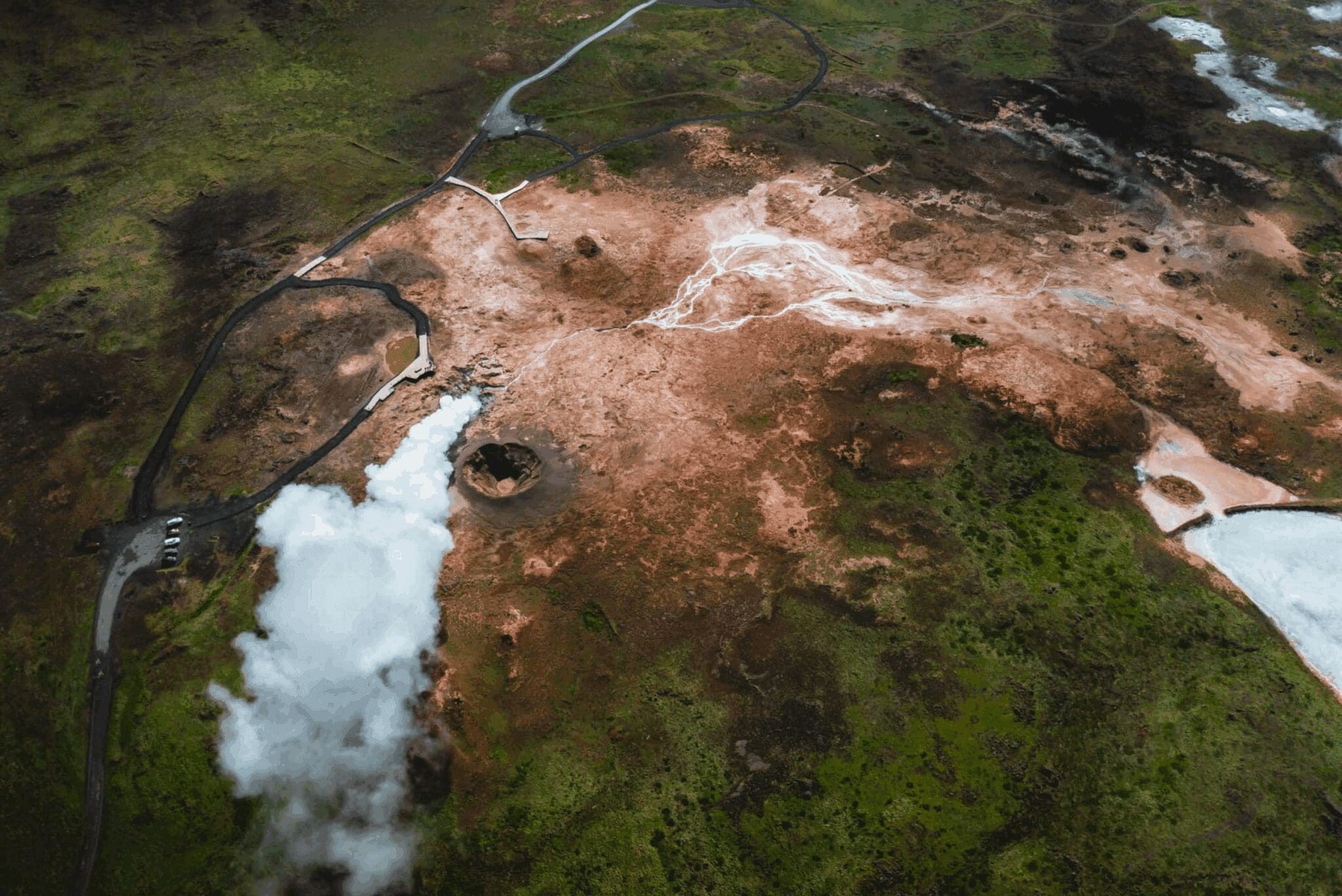
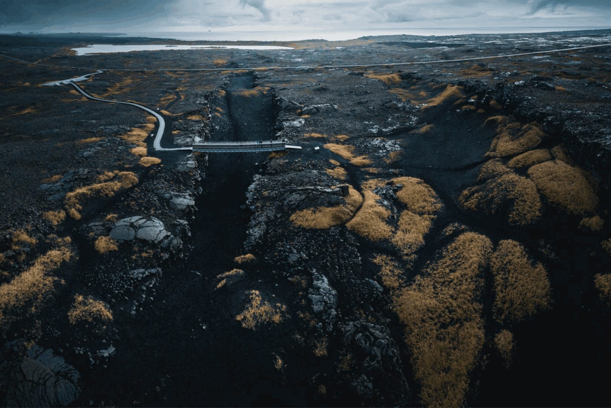
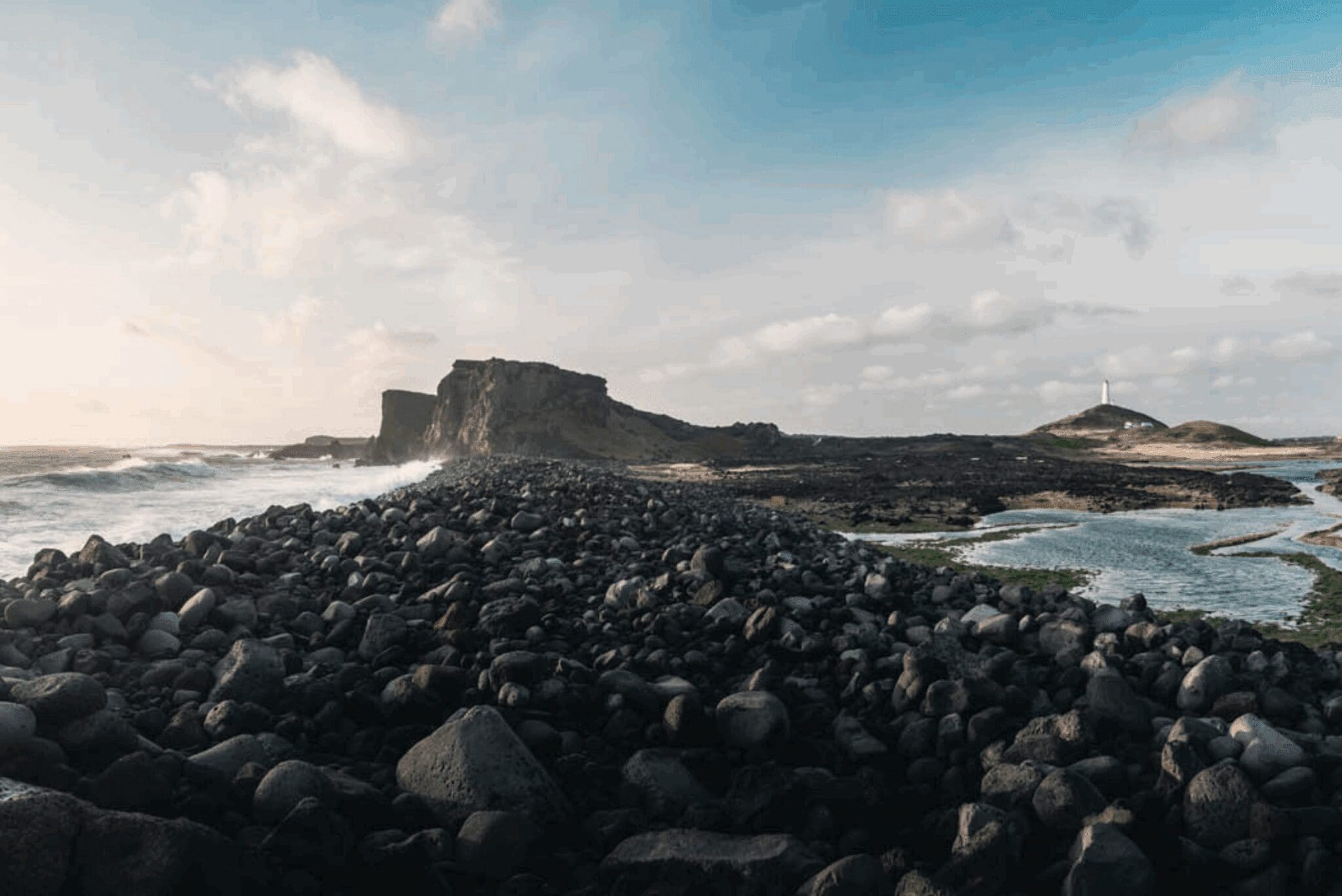
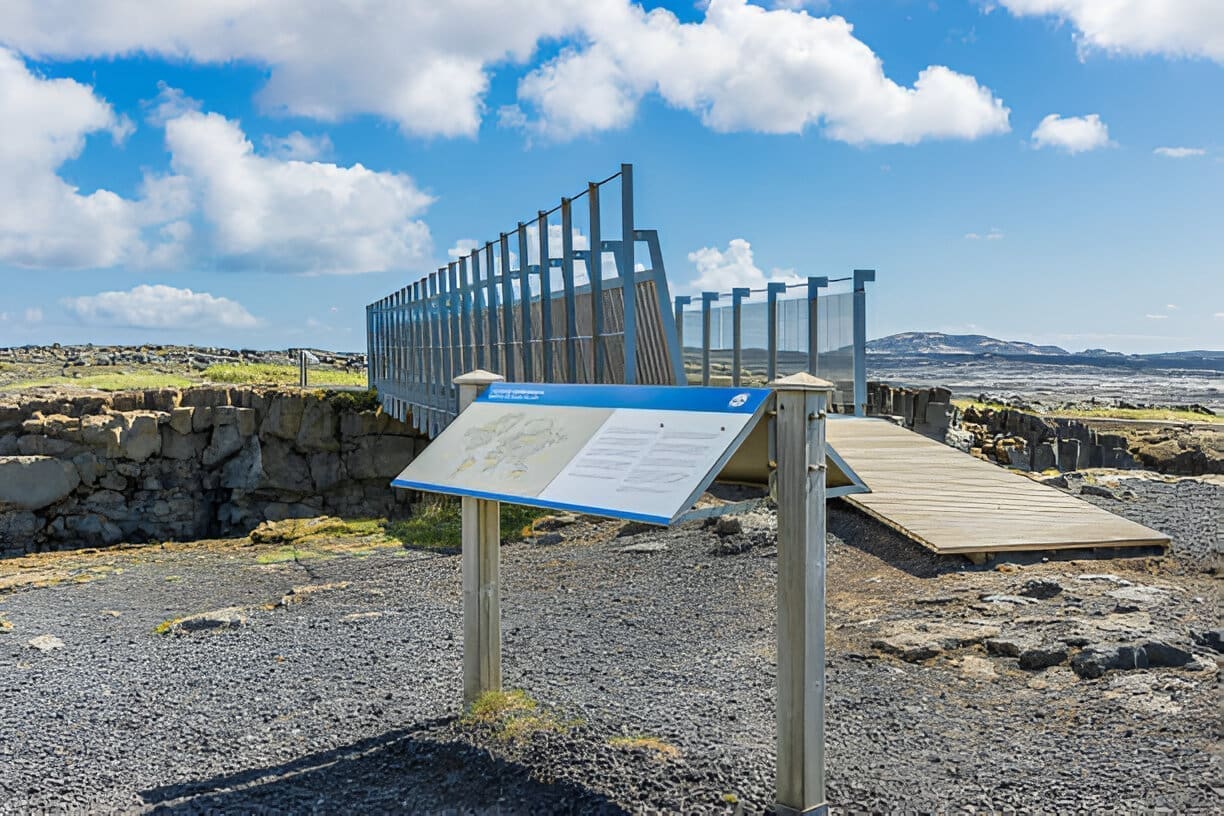
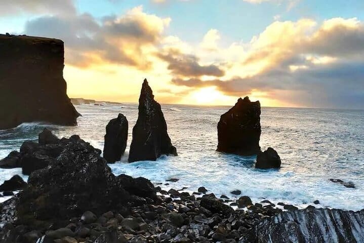
We continue our way to the Brú milli heimsálfa, a symbolic bridge over a fissure between the North American og Eurasian tectonic plates. With the Mid-Atlantic Ridge lying through and these plates constantly rafting, this is among the few places on Earth where they can be seen above ground. Next up is the colorful and active geothermal area Gunnuhver, with mud pools, hot springs, and steam vents surrounded by lava fields and a sulphuric landscape. Walking trails run throughout the area between observation decks, overlooking this spectacular ever-changing area. A short drive from there takes you to Reykjanesviti, the oldest lighthouse in Iceland on top of a hill dating back to 1907. A walking path leads to the peak of Valahnúkur, where the first-ever lighthouse built in Iceland stood, before being damaged by earthquakes and powerful waves on this most southwestern point of the peninsula. Valahnúkur is an eroded sea cliff that formed in an eruption over 10,000 years ago and is now a popular nesting site for seabirds. The music video Volcano Man starring Will Ferrell og Rachel McAdams was mainly shot here. Valahnúkamöll is a beach filled with large boulders created by powerful storms and waves, and looking out into the Atlantic Ocean is Eldey, a high stack of islands with the largest gannet colony in the world. The last mating pair of Great Auks were killed there in 1844, and by Valahnúkur is a statue of a Great Auk in memory of this extinct species.
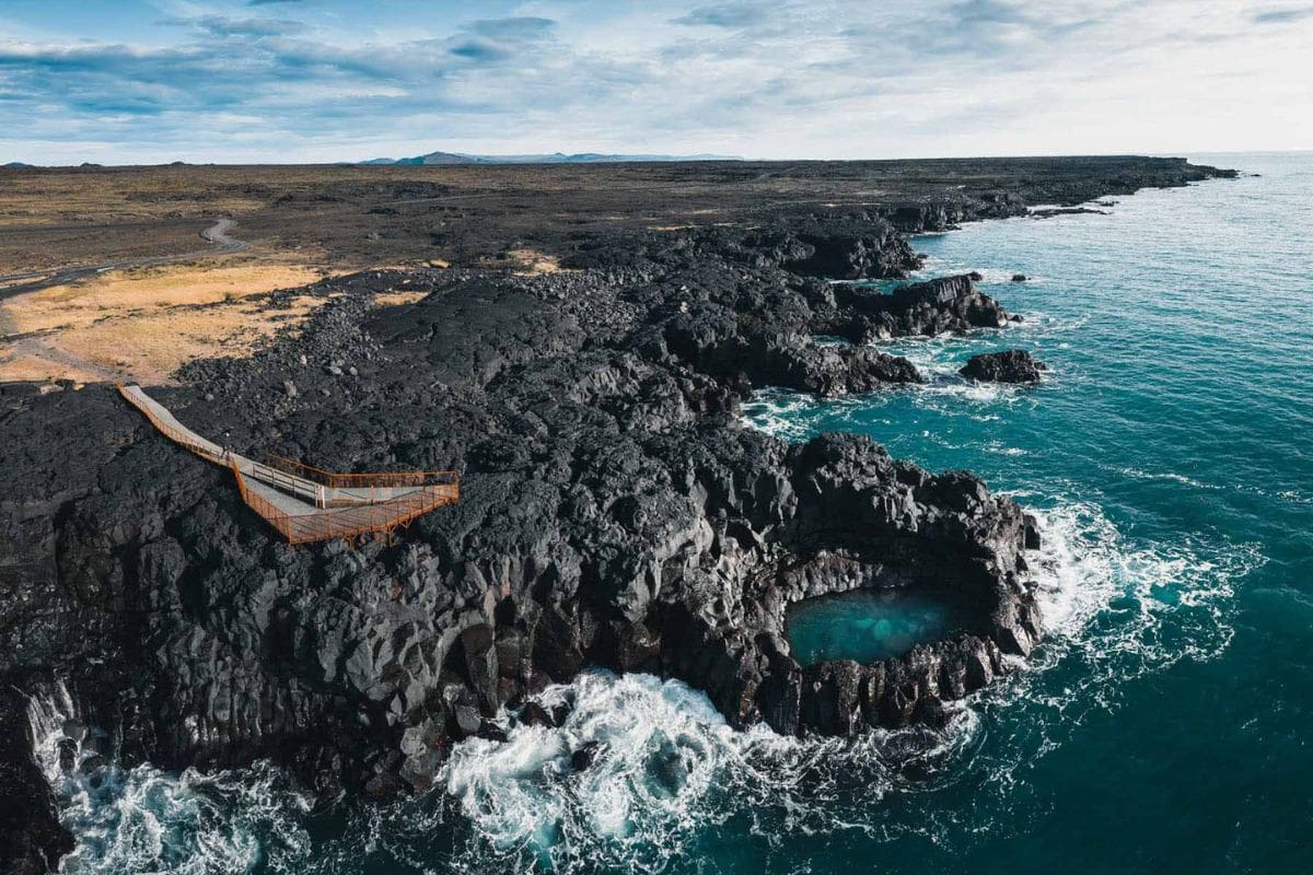
Heading east we stop by the small coastal rock pool Fleytibóla which rests by the coastline. Pounding waves have carved the cliffs throughout the years and formed this pool, which looks tempting to take a dip in when the weather is calm, but it is highly advised against due to sudden waves sneaking up on you and sucking you out to sea. Instead, there's an observation platform overlooking this spectacular formation.
Garðskagi is the outermost point of the Reykjanesi peninsula, with two lighthouses standing that bear the same name Garðskagaviti. The smaller lighthouse further out, white and red striped, is the older one built in 1897, and the newer and taller one standing further in was built in 1944. The older one is the second oldest lighthouse in Iceland after Reykjanesviti lighthouse, and also the second oldest concrete building, while the newer lighthouse is the tallest lighthouse in Iceland.
This is a very popular place to visit due to the unique 360° view the lighthouses offer. On sunny days you can see all the way to the Snæfell glacier on the Snæfellsnes peninsula, Esja mountain hovering over the Höfuðborgarsvæði Reykjavíkur, and surrounding mountain rows. Garðskagi is also the home of varied sea bird species and some days you can even spot seals and whales playing, from the dock of the Old Lighthouse Café.
Hvalsneskirkja is a beautiful black church and among our favorites. Built 1886-1887 with basal lava blocks collected from the surrounding region and the interior crafted from driftwood that locals collected from the nearby shoreline, it along with its graveyard was preserved in 1990 due to age and its uniqueness. This has been a church estate from 1200, but this is the first church to stand outside of the graveyard. The colorful tower makes this church very popular for photography.
The picturesque yellow-colored Stafnesviti lighthouse stands on the headland Stafnes and was built in 1925. It overlooks the scenic rocky coast of Básendar, a former market town, and old fishing and trading post which was the largest royal fishery at the time. Since before the 16th century it was the biggest fishery in the area until 1799 when a powerful storm swept over. This caused the worst flood ever to happen in the area, named Básendaflóð. The flood destroyed all buildings and changed the shoreline forever, killing only one woman.
In stormy weather in 1928, the first trawler wrought especially for Icelanders called Jón forseti (e. President Jón) stranded in the reed outside of Stafnesiviti with 25 onboard. Fifteen of them lost their lives and Básendar hasn’t been populated ever since. The trawler had been named in honor of Jón Sigurðarsson, the primary leader of the Icelandic independence movement, nicknamed president after serving several times as president of the Icelandic Parliament, known as Alþingi. After this accident, Slysavarnafélag Íslands (e. The National Life-Saving Association of Iceland) was founded. A lot of children lost their fathers in the accident, so Mæðrastyrksnefnd (e. Mothers’ Aid Society) was also launched.
A monument now stands in Stafnes to commemorate this tragic stranding.
Built from 1860 to 1861, Kirkjuvogskirkja is a black wooden church located in the village Hafnir and the oldest church on the Reykjanesi peninsula. Like Hvalsneskirkja church, it was preserved in 1990 for its age and significance.
In 1881 the American abandoned sailing ship Jamestown ran aground in Hafnir. When crossing the Atlantshaf, the ship encountered heavy seas tearing the rudder off. The captain and his crew were rescued and the Jamestown left to drift for the next four months. On the morning of June 26th, the residents of Hafnir woke up finding the Jamestown had run aground. Carrying high-quality timber to transport from Boston að Liverpool, the valuable timber was sold at auction by the locals and used to build houses and bridges widely in Iceland. An anchor from this ship is situated outside of the Kirkjuvogskirkja church.
The Brú milli heimsálfa (is. Brú milli heimsálfa, also Miðlína, meaning “Centreline”), aka Leif the Lucky Bridge, is a symbolic footbridge spanning a rocky fissure between the North American og Eurasian tectonic plates. This wide tension crack opened up between these plates due to their constant movements, rafting on average about 2 cm every year. The Mið-Atlantshafshryggurinn runs through Iceland from the North-East corner to the South-West corner and the tectonic plates can only be seen above ground in a few locations.
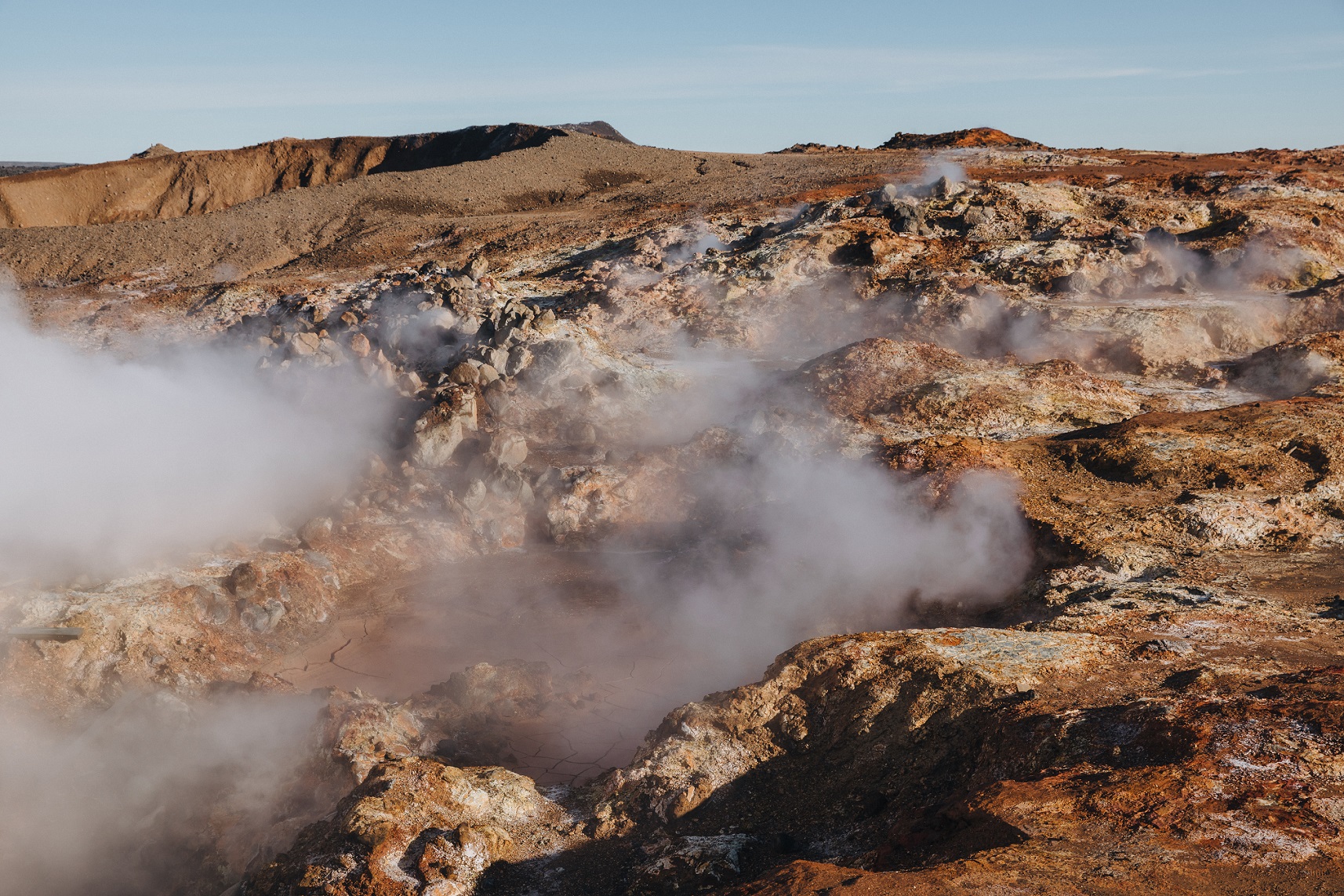
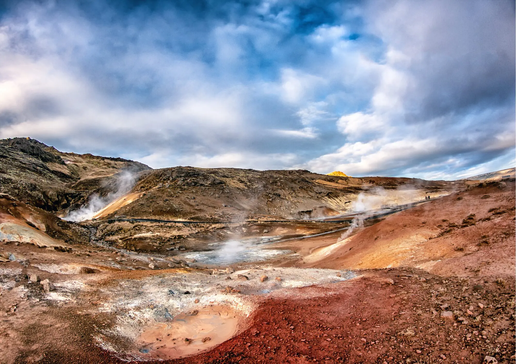
Close to the Reykjanesviti lighthouse is a highly active and colorful geothermal area, surrounded by lava fields and a sulphuric landscape. It is collectively known as Gunnuhver and consists of vigorous mud pools, hot springs, and steam vents, forming after an earthquake in 1967. In this area resides the largest mud pool in Iceland, 20 m (65 ft) wide. What makes these hot springs unique is the groundwater that is 100% boiling seawater, unlike other hot springs in Iceland. This area is very active and is constantly shifting and changing its behavior due to earthquakes. The ground is over 300°C (570°F) in temperature so care must be taken when treading the labeled walking trails between observation decks and be aware of your surroundings as hot steam can sometimes blow in your way.
Gunnuhver is a hot spring in this area, stemming from the tale of Guðrún Önundardóttir (1646-1706) called Gunna. She lived in poverty with her son and daughter on a farm close to the former municipality Sandgerði. She was unable to pay her rent to the landlord, who took Gunna’s cooking pot as payment, which was among her only possessions. She threatened to starve herself until she got it back, but since the landlord didn’t return it she starved to death. Long story short, she haunted him until one day he was found dead; bruised with his bones crushed. She then similarly killed his wife and kept on haunting other residents in the area. In exchange for brennivín (Icelandic schnapps, also known as “Black Death”, a priest set a trap for Gunna’s ghost and lured her into one of the hot springs, never to disturb anyone ever after. Since then that spring has been called Gunnuhver, or Gunna’s Hot Spring.
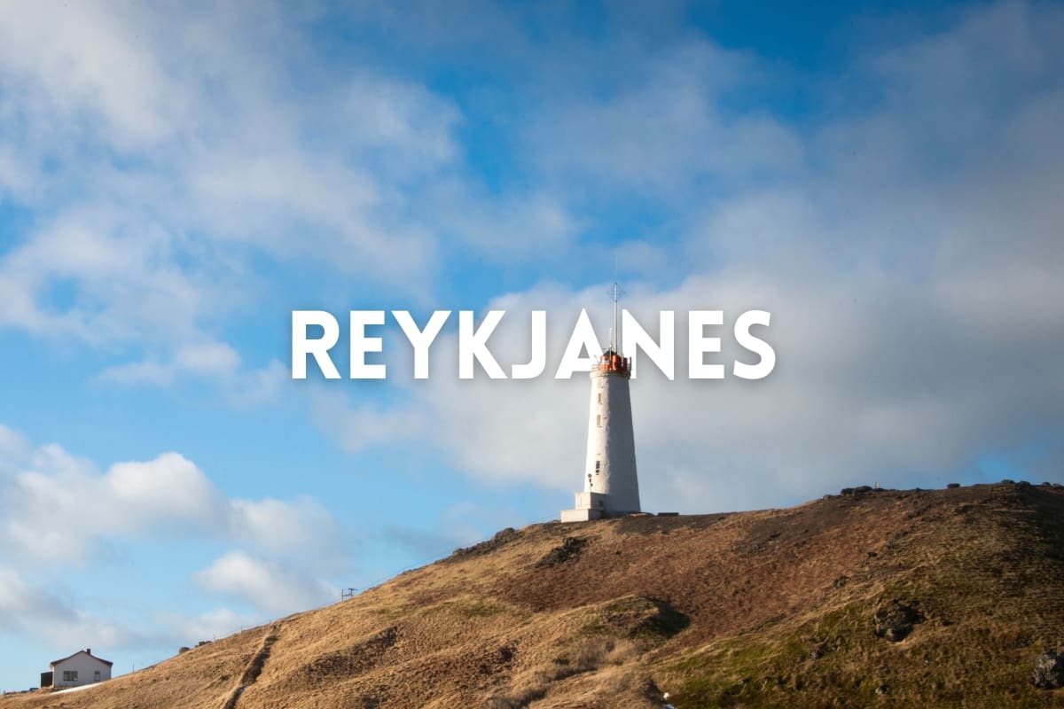
Built from 1907 to 1908 the lighthouse Reykjanesviti stands on top of the hill Vatnsfell (ranglega kallað Bæjarfell by some). It is the oldest lighthouse currently standing in Iceland and was preserved in 2003 due to its age, but the first lighthouse was built in this area from columnar basalt on the Valahnúkur peak in 1878. Due to earthquakes and rogue waves scarring Valahnúkur in the following years and cracks forming on top of it, that lighthouse got damaged. It was blown up to prevent it from falling off Valahnúkur into the sea, but its remains can still be found in the area.
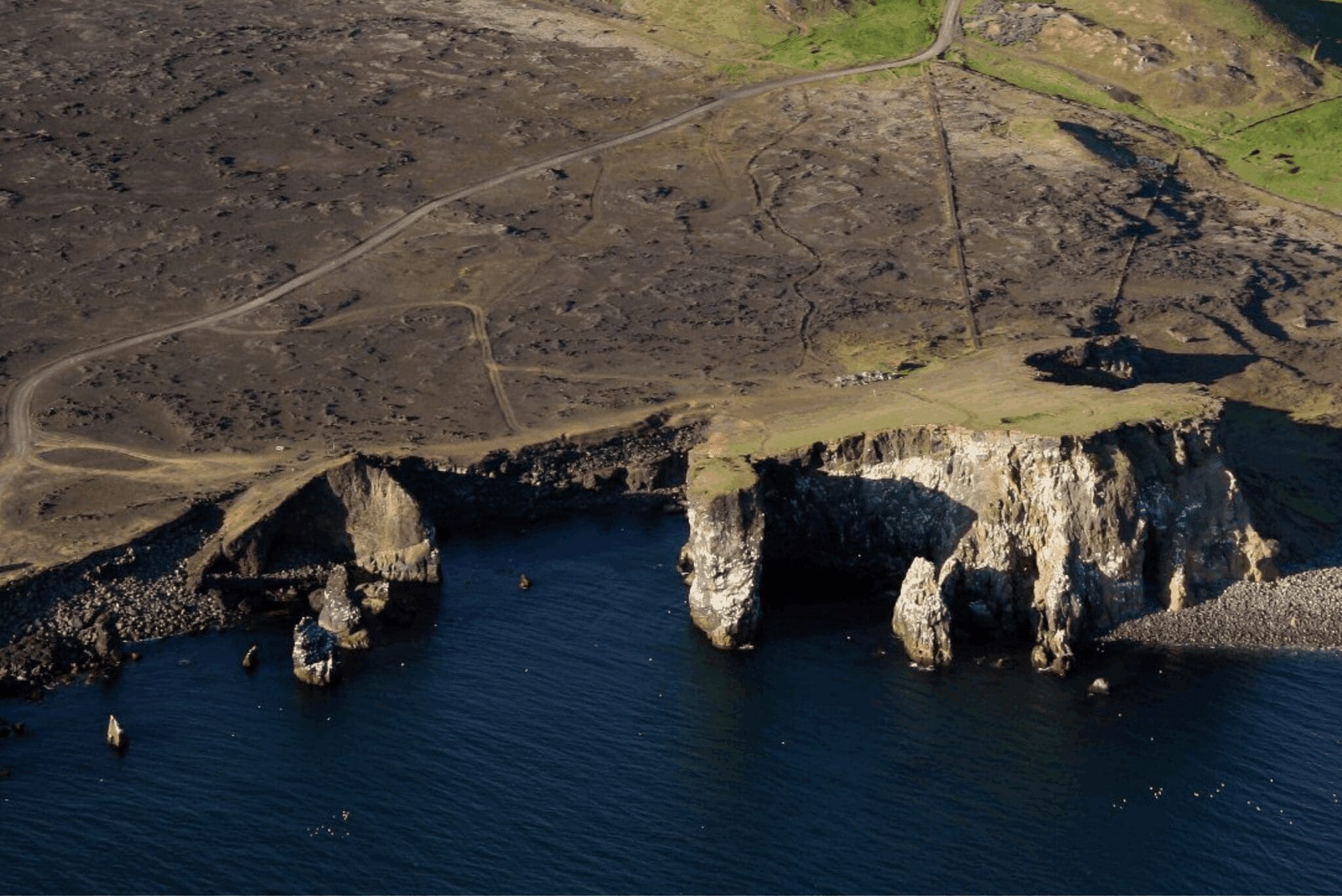
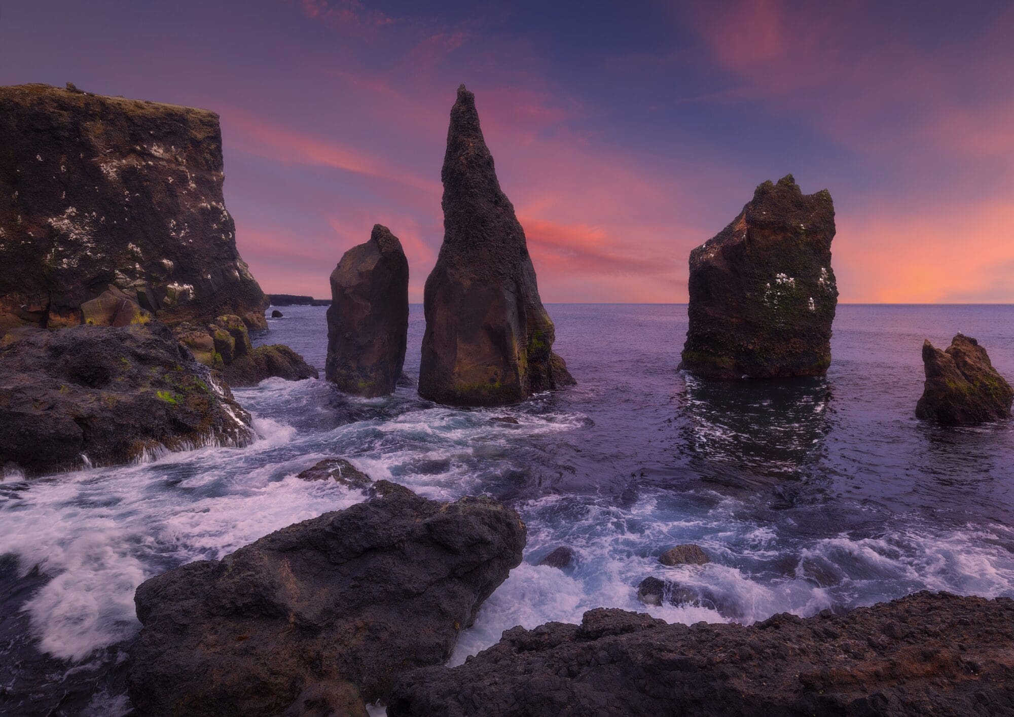
Valahnúkur is the most south-western point of the Reykjanes peninsula. It is an eroded sea cliff made of palagonite tuff layers, pillow lava, and volcanic agglomerate. This peak formed in a single eruption 10,000 years ago but its surroundings show evidence of other eruptions too. Its palagonite tuff formed in explosions during the eruption when the 1200°C (2192°F) melted lava rapidly cooled while flowing into the sea. The pillow lava is however believed to have formed in a sub-glacial eruption since these formations develop during eruptions underwater and under glaciers. Valahnúkur is a popular nesting place for herring gulls, fulmars, kittiwakes, and ravens. If you’ve seen the film Eurovision Song Contest: The Story of Fire Saga, featuring Will Ferrell og Rachel McAdams, you may notice that the music video for Volcano Man was shot by Valahnúkur. Next to Valahnúkur is the beach Valahnúkamöll which is made of large boulders created by powerful storms and high waves. A 52 m (170 ft) high palagonite pillar called Karl (e. Man) stands not far from Valahnúkur out in the sea.
From Valahnúkur is a beautiful and dramatic view of the 77 m (252 ft) high Eldey, a tall island stack offshore with the biggest gannet colony in the world of about 70,000 birds, making it a wildlife refuge. This palagonite layered island formed in a tephra eruption and is situated on the Mið-Atlantshafshryggurinn. This area is estimated to have erupted at least ten times. The last two Great Auks were killed on this island in 1844, and a statue of a Great Auk is located close to Valahnúkur to commemorate this extinct specie.
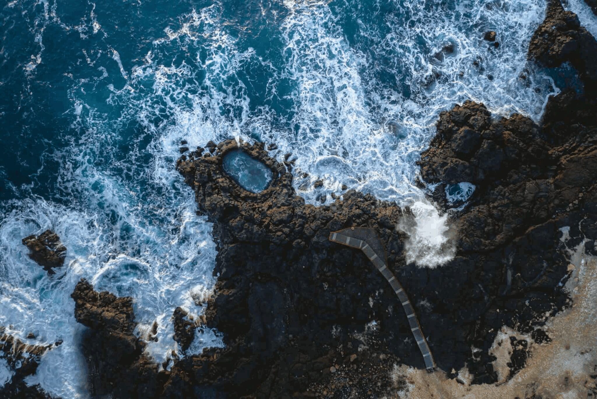
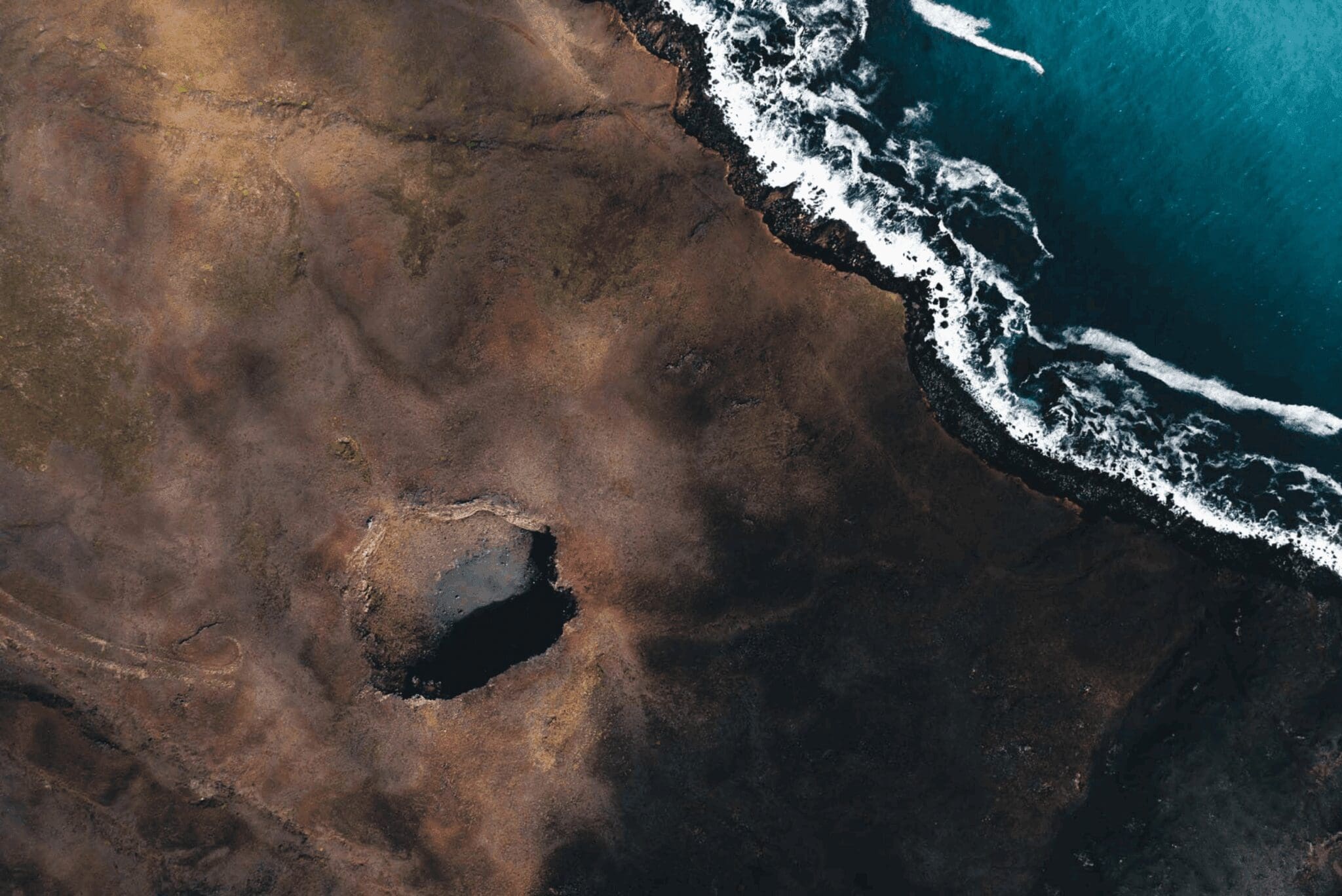
Sitting at the bottom of a cliff by the ocean, Fleytibóla is a small coastal rock pool. It’s made of lava rocks from eruptions in the area and its shape has formed due to constant pounding waves hitting it and carving throughout the years. These waves can get extremely high and dangerous so you need to be careful near the pool, but an observation platform overlooking Brimketill gives you a great view of it and its surroundings. You can still get soaked on that platform if the waves get high enough, but it’s still worth it to watch the thundering waves hit against the rocks, making their way into Brimketill, and the water then drains back out of it. You’ll also have an amazing view over the rugged coastline to the Reykjanesviti lighthouse and the Gunnuhver geothermal area.
On days when the ocean is calm the seawater in Brimketill will sit still and look safe and serene. It may be tempting to take a dip in Brimketill on those days, but be aware that inside, Brimketill is lined with sharp lava rocks and sudden waves could sneak up on you into this pool and then drain back out.
80.943 ISK
189.900 ISK
189.900 ISK
270.000 ISK
135.000 ISK
180.000 ISK
23.990 ISK
82.625 ISK
180.000 ISK
78.980 ISK
Ferðalög ábendingar, nýjar leiðsögumenn og heads-up þegar norðurljósaspáin lítur vel út. Engin ruslpóstur.