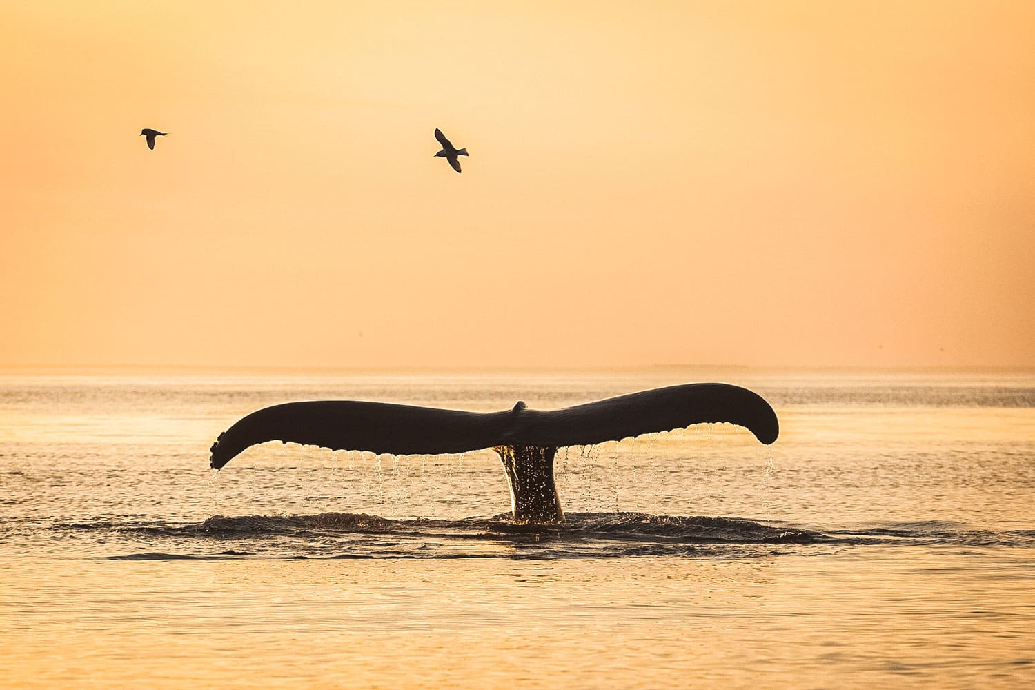
アークレイリ ホエール ウォッチング: オセアニアの驚異を発見しましょう
13.990 ISK
2 時間30分


簡単
274.990 ISK
Embark on an unforgettable journey through North Iceland’s breathtaking Diamond Circle from Akureyri. Discover the geothermal wonders of Lake Mývatn, with its bubbling mud pools, lava formations, and rich birdlife. Witness the sheer power of Dettifoss, Europe’s most powerful waterfall, and take in the serene beauty of Ásbyrgi Canyon, a horseshoe-shaped glacial valley steeped in legend. Visit Húsavík, the whale-watching capital of Iceland, where you can enjoy charming coastal scenery. Conclude the adventure at Goðafoss, the majestic “Waterfall of the Gods,” before returning to Akureyri.
Please note: Any extra activities not listed in this description may incur additional fees.
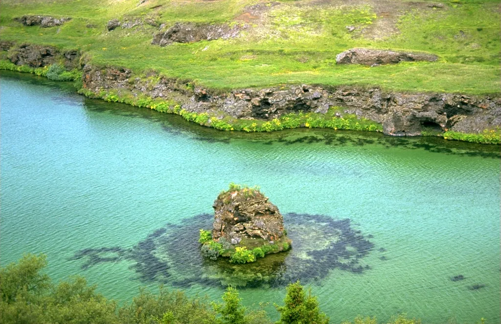
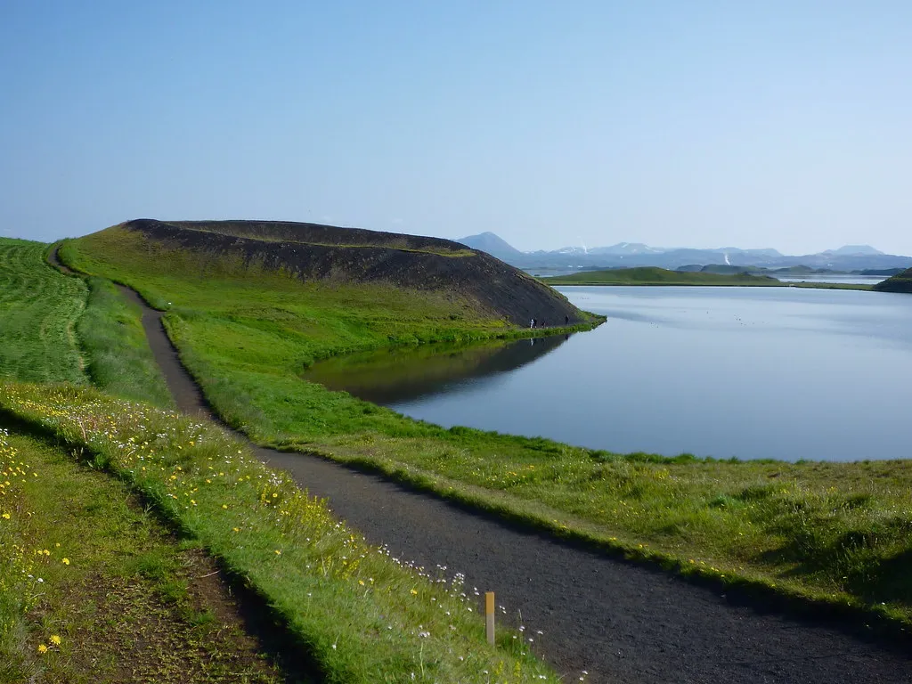
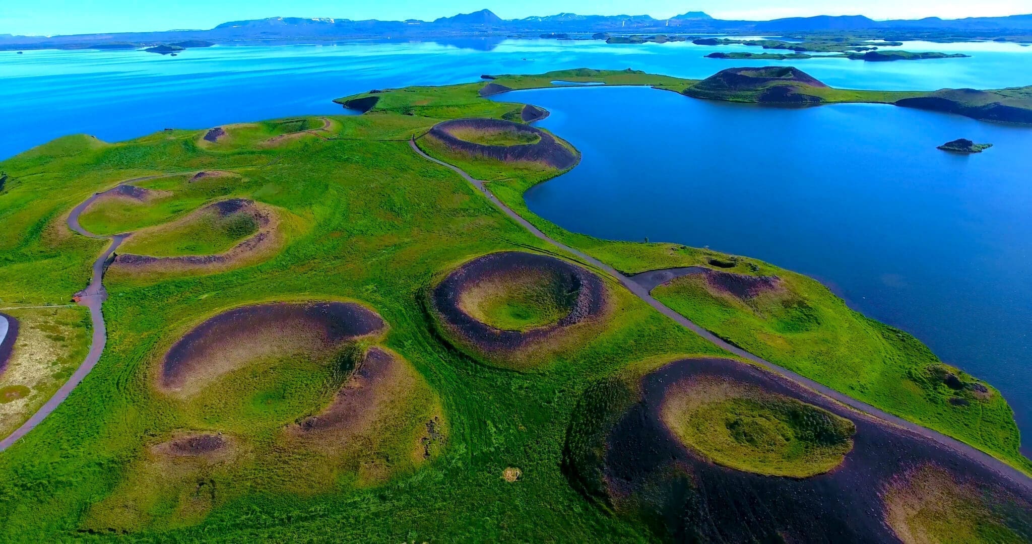
ミーヴァトンは、クラフラ火山からそれほど遠くない、アイスランド北部の火山活動が活発な地域にある浅い富栄養湖です。湖とその周囲の湿地には、水鳥、特にアヒルの活気に満ちた動物相が生息しています。この湖は 2300 年前の大規模な玄武岩質溶岩噴火によって形成され、周囲の景観は溶岩柱や根のない噴出孔 (偽クレーター) などの火山地形によって支配されています。流出するラクサー川は、ブラウントラウトやアトランティックサーモンの豊富な釣り場として知られています。.
湖の名前(アイスランド語のミー(「ユスリカ」)とヴァトン(「湖」);ユスリカの湖)は、夏に膨大な数のユスリカが見られることに由来しています。.
ミーヴァトンという名前は、湖だけでなく、周辺の居住地域全体に対しても使われることがある。 ラシャー川、ミーヴァトン湖、周辺の湿地は自然保護区(ミーヴァトン=ラシャー自然保護区)として保護されている。.
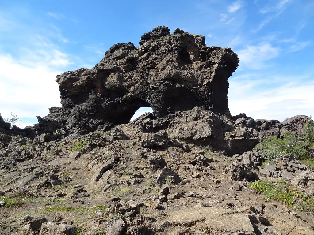
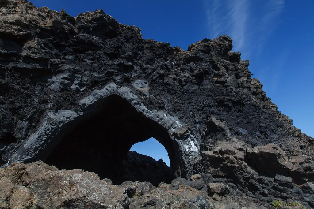
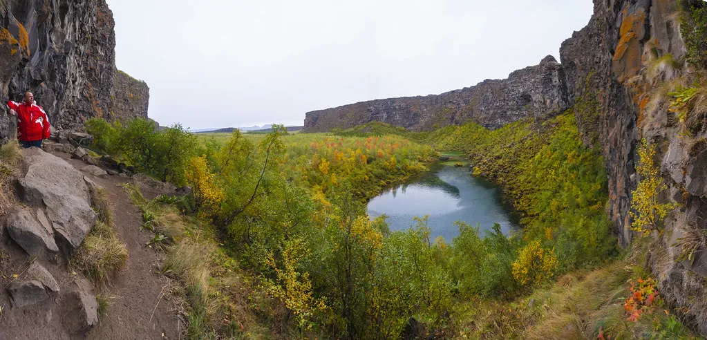
The Dimmuborgir (meaning dark cities, forts, or castles) Lava Field, located in the heart of the Mývatn Geothermal Area, is about 100 kilometers east of Akureyri.
The Dimmuborgir area, as the name suggests, is an unusually shaped lava field consisting of peculiar volcanic caves and rock formations. These dramatic structures are a favorite stop for tourists.
This natural phenomenon dates back some 2300 years to a massive eruption in a nearby crater. The lava seems to have flowed over a small lake that once existed; water below the lava was trapped and boiled, and the steam rose, forming lava pillars from drainpipes up to several meters in diameter. As the lava continued flowing toward the lower ground in the Mývatn Lake area, the top crust collapsed, leaving behind hollow pillars of solidified lava. The lake must have been at least 10 meters deep, as estimated by the tallest structures still standing.
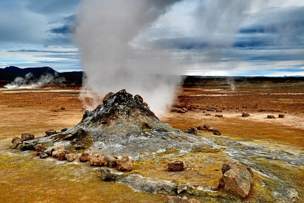
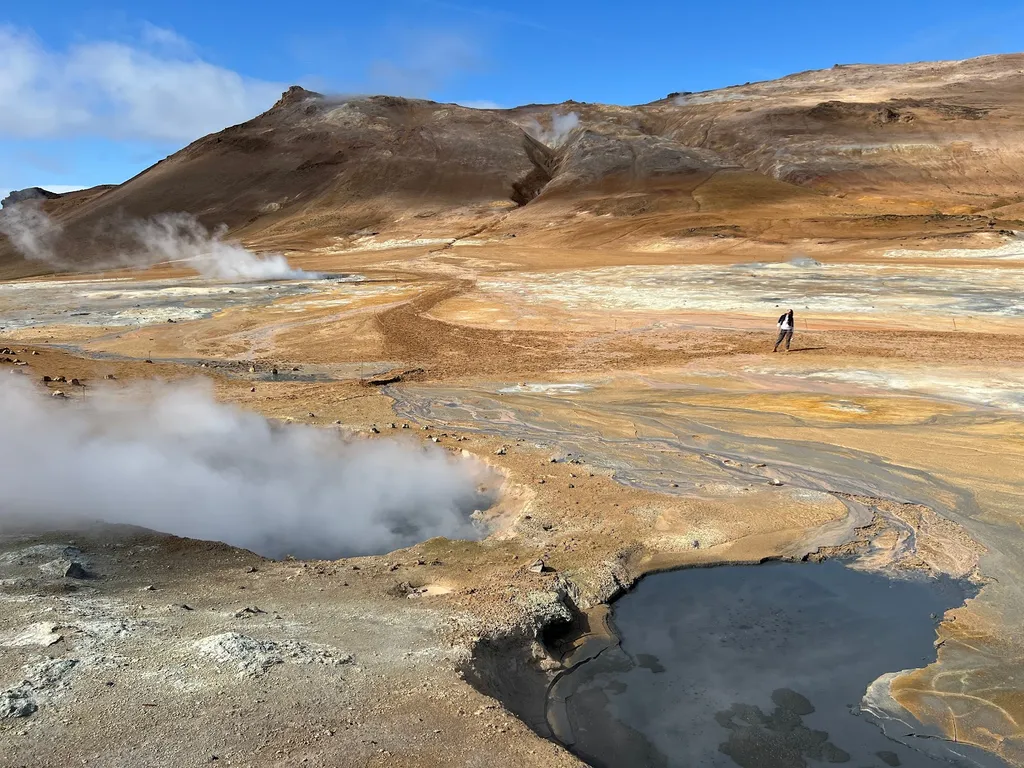
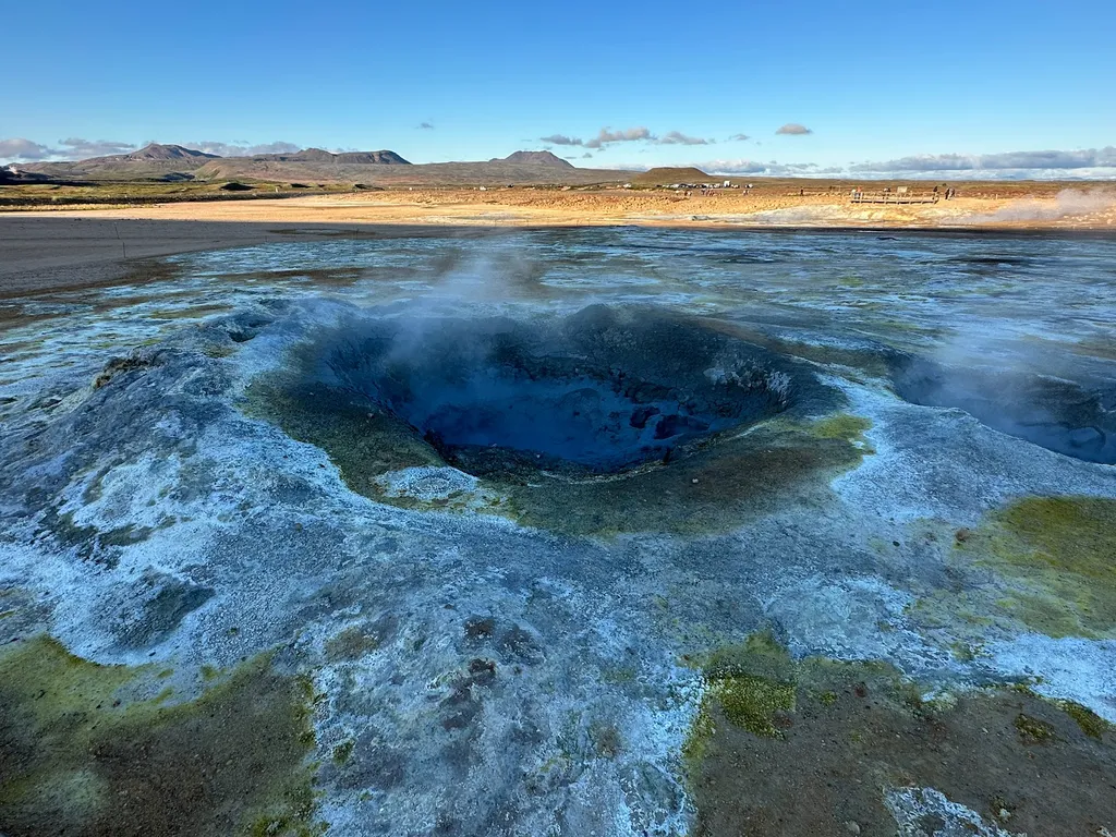
クヴェリール (Hverarond) またはナマフィヤル (Namafjall) とも呼ばれる、アイスランド北東部、ミヴァトン湖に近い地熱地帯である。 この異世界の風景は、泡立つ泥ピット、蒸気の噴気孔、鮮やかな黄色の硫黄堆積物によって特徴付けられる。.
風景の異世界の性質はすぐにフヴェリルを訪問者を襲う 地面はひび割れて不毛で、空気を満たす硫黄の刺激的な香りを放つ 泡立つ泥ピットとシューシューという噴気孔は、あなたが別の惑星に足を踏み入れるときに超現実的な雰囲気を作り出します。.
クヴェリルの最も印象的な特徴の 1 つは、岩だらけの地面にしがみついているのが見える明るい黄色の硫黄堆積物です。これらのカラフルな地層は、荒涼とした風景にポップな色を加え、周囲の黒い火山岩と鮮明に対照的です。.
フヴェリルには、地表下の地熱活動によって温められた温泉もいくつかあります。訪問者は、これらの水たまりから蒸気が立ち上るのを目にし、催眠術的でほとんど神秘的な効果を生み出します。.
クヴェリルを訪れることは、自然の生の力を垣間見ることができる本当にユニークな体験です。.
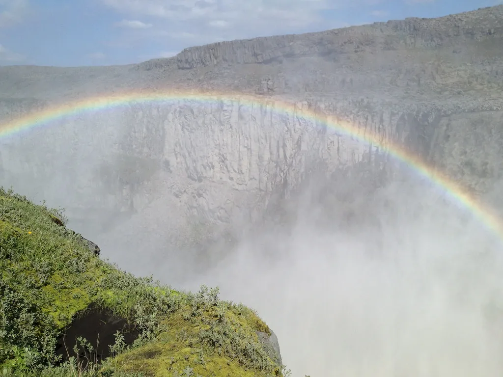
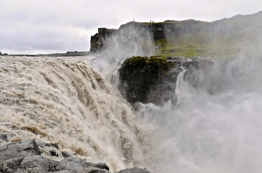
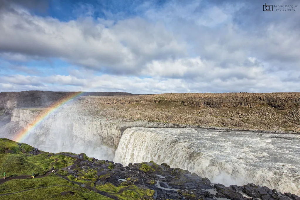
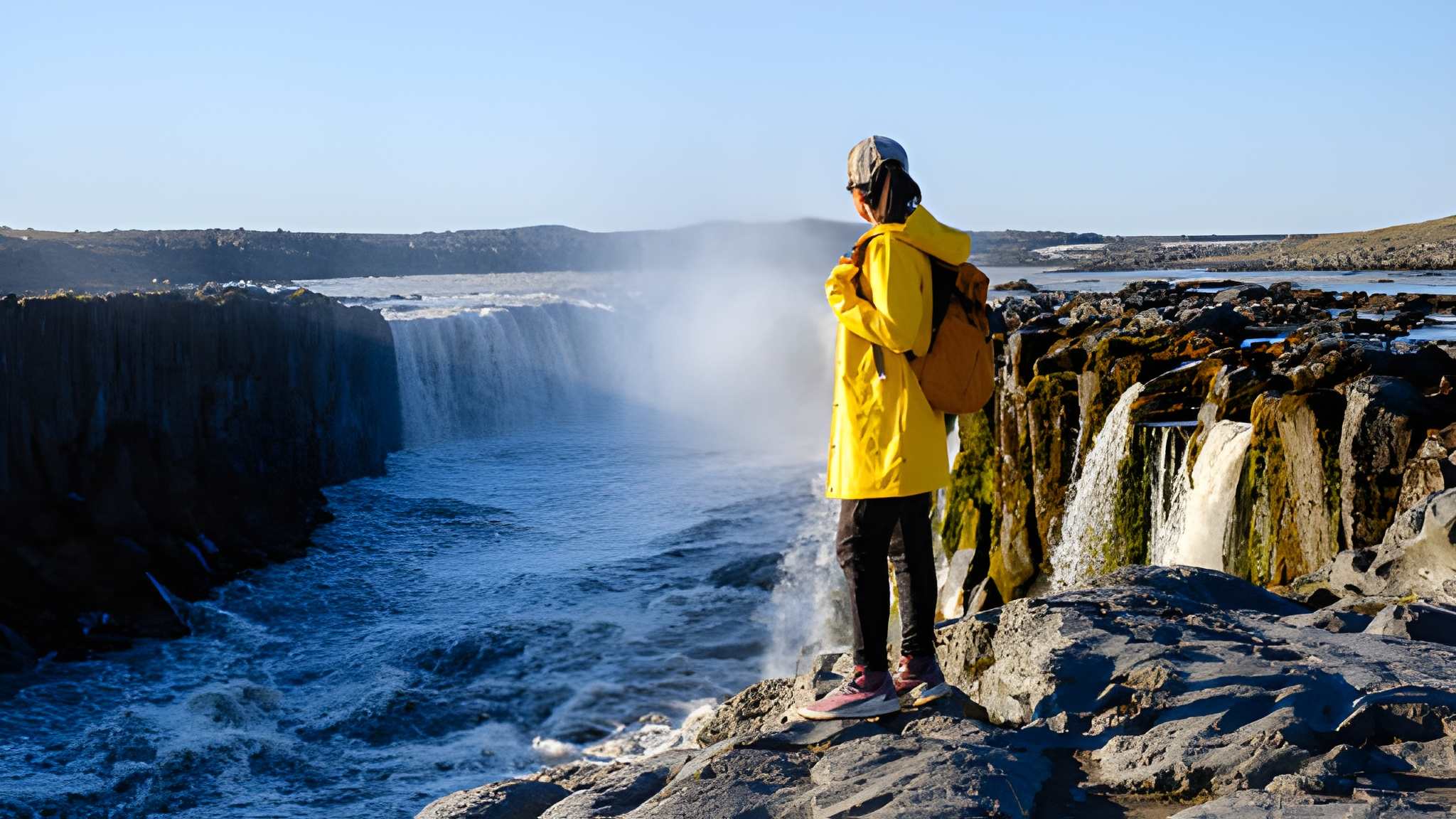
Dettifoss Waterfall, located in Jökulsárgljúfur Canyon, is south of Ásbyrgi Canyon in Northeast Iceland.
Seeing Dettifoss Waterfall, Europe’s most powerful cascade of water rushing over the falls, is an overwhelming experience. From the car park, there is an 800-meter path to the falls, an easy hike for most people.
Dettifoss Waterfall is in the Jökulsá á Fjöllum River that originates in Vatnajökull Glacier, the world’s largest glacier outside the Arctic. It runs through the Jökulsárgljúfur Canyon, thought to be carved out by several megafloods lasting only a few days, each separated by thousands of years. In 1973, the whole canyon was declared a national park, from its origins to its estuary. In 2008, it became a part of the newly established Vatnajökull National Park.
Dettifoss is a must-see destination for anyone visiting Iceland, offering a unique and unforgettable natural experience showcasing the raw power and beauty of the Icelandic landscape
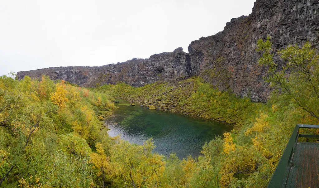
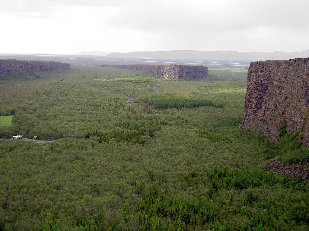
Ásbyrgi Canyon is regarded by many as the most beautiful place in Iceland.
This horseshoe-shaped canyon, measuring approximately 3.5 kilometers in length and up to 1 kilometer in width, is believed to have been formed by a catastrophic glacial flood caused by a volcanic eruption thousands of years ago.
Folklore says that Ásbyrgi was formed when Sleipnir, Norse God Óðinn’s eight-footed horse, put his hoof on the ground. Ásbyrgi, meaning the Shelter of Gods, is almost perfectly hoof-shaped.
The canyon is surrounded by cliffs up to 100 meters high, creating a unique and mesmerizing landscape. In the canyon’s center lies a lush green oasis, starkly contrasting the rugged and rocky terrain surrounding it.
One of the most spectacular features of Asbyrgi Canyon is the towering rock formations known as the “Church Floor” and the “Pillars of the Gods.” These natural formations result from volcanic activity and erosion over millions of years, creating a dramatic and otherworldly atmosphere.
Visitors to Asbyrgi Canyon can explore the network of hiking trails that wind through the canyon, offering breathtaking views of the surrounding landscape. The canyon is also home to diverse wildlife, including reindeer, Arctic foxes, and various bird species, making it a popular destination for nature enthusiasts and wildlife photographers.
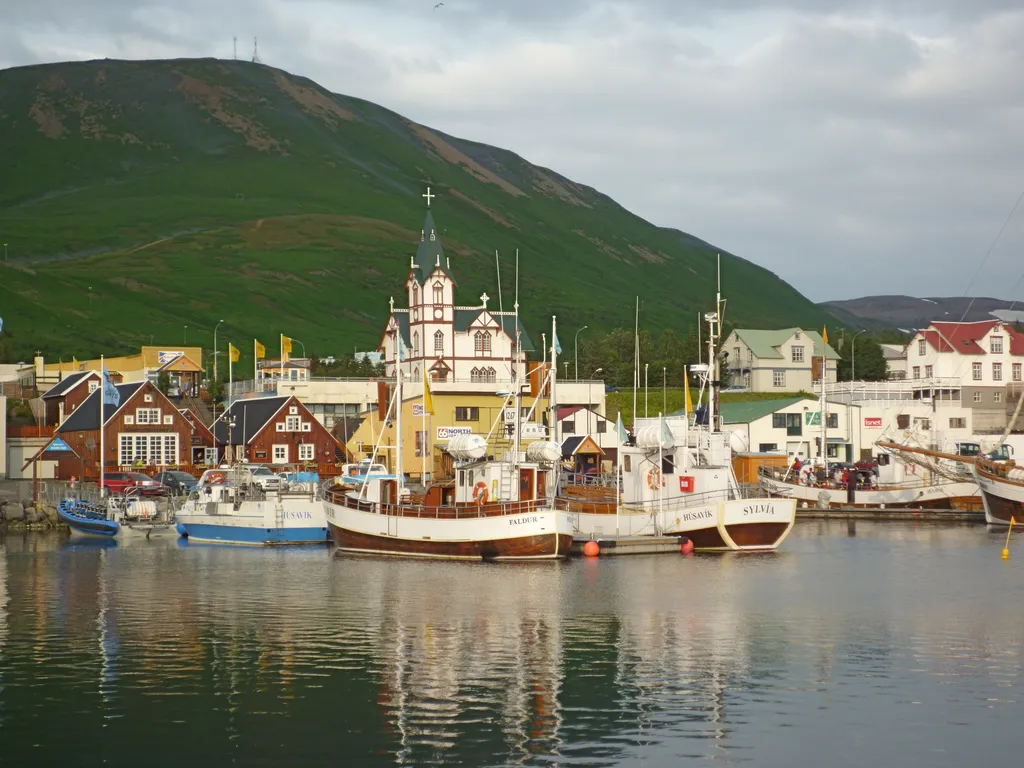
フーサヴィークは、アイスランド北海岸のノルズルジング自治体にある町で、スキャルファンディ湾に面しており、人口は 2,237 人です。町の最も有名なランドマークは、1907 年に建てられた木造教会フーサヴィークルキルキャです。.
収入は観光、漁業、小売業、小規模産業から得られている。フーサヴィークは最近まで、近くのミーヴァトン湖から採取されたシリカの輸出港であった。.
ランドナマボーク(「定住の書」)によると、フーサヴィークはアイスランドで初めて北欧人の男性が定住した場所である。 スウェーデンのヴァイキング、ガルザール・スヴァヴァルソンは、西暦870 年頃に1 冬滞在した。 870 年の春に島を離れたとき、冬の滞在の後、ナットファリという男性と男女2 人の奴隷を残し、ここに農場を設立した。 「家の湾」を意味する町の名前は、おそらくアイスランドで唯一の家であったと思われるガルザールの邸宅を指している。.
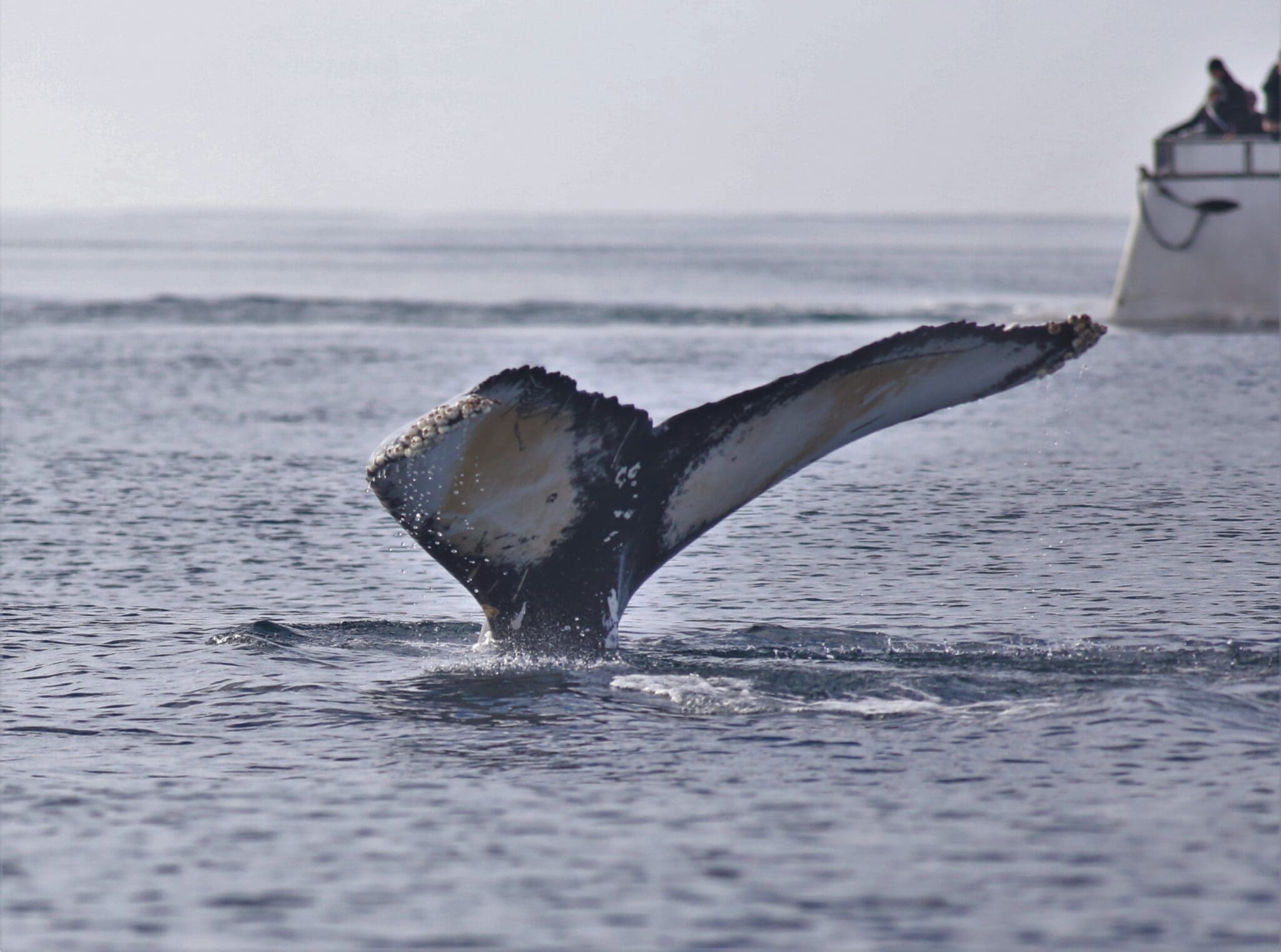
フーサヴィークはアイスランドのホエールウォッチングの中心地であり、夏の間、95% 以上の旅行で目撃されています。.
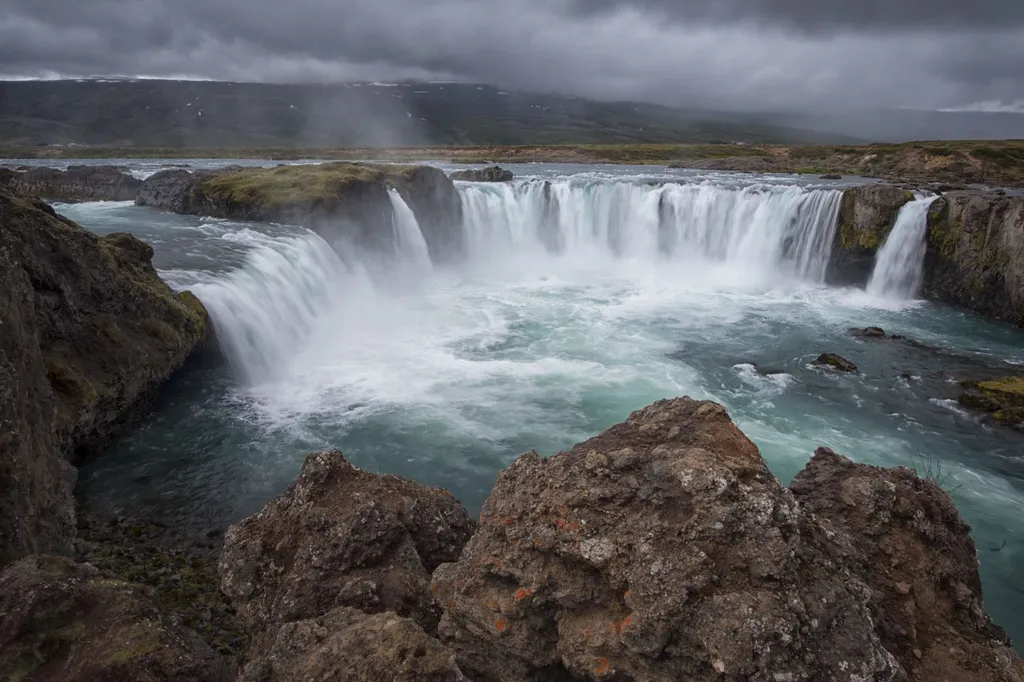
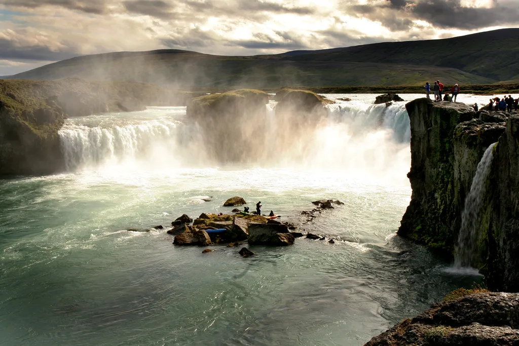
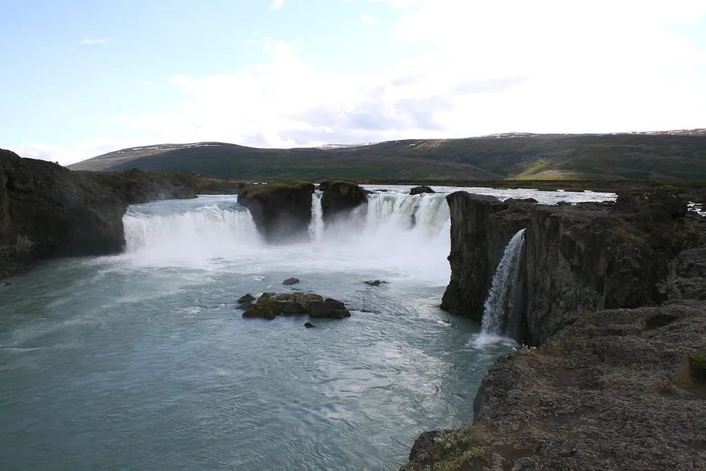
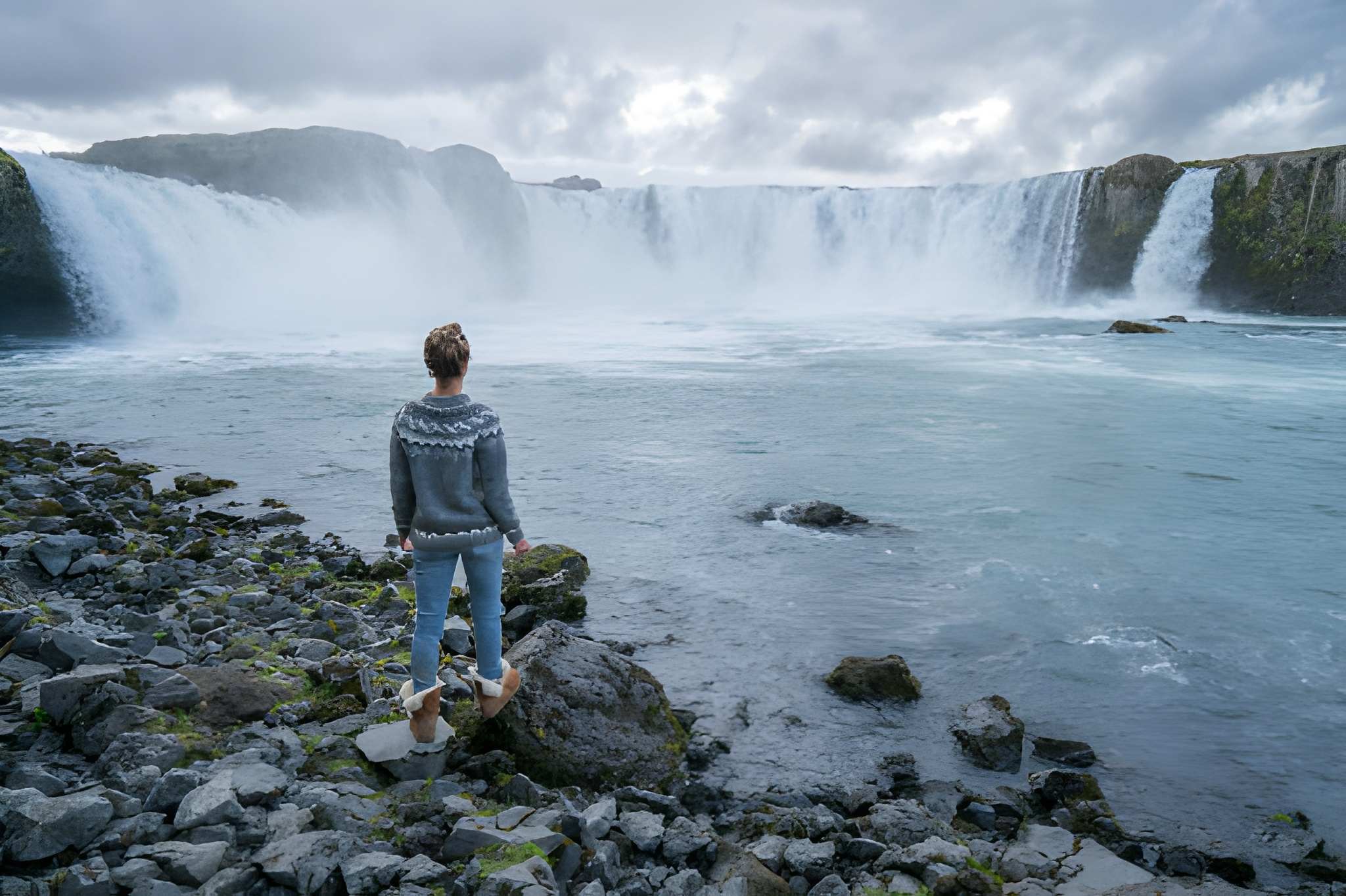
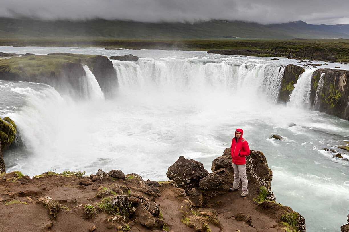
絵のように美しいゴザフォスは高さ12 メートル、幅30 メートル。 「ヴァトナヨークトル氷河」を源流とする強大なスクヤルファンダフリョート川に滝がある。.
ゴザフォスは「神の滝」を意味し、その名前は「神の滝」に由来しています アイスランド人の書、, 古いアイスランドの写本の 1 つにある、西暦 1000 年にアイスランドでキリスト教を国教とした法話者ソルゲイルについての物語。彼が新しい宗教に改宗し、帰国後、以前の宗教の北欧の神々の古い像を滝に投げ込んだため、ゴザフォスという名前が付けられました。.
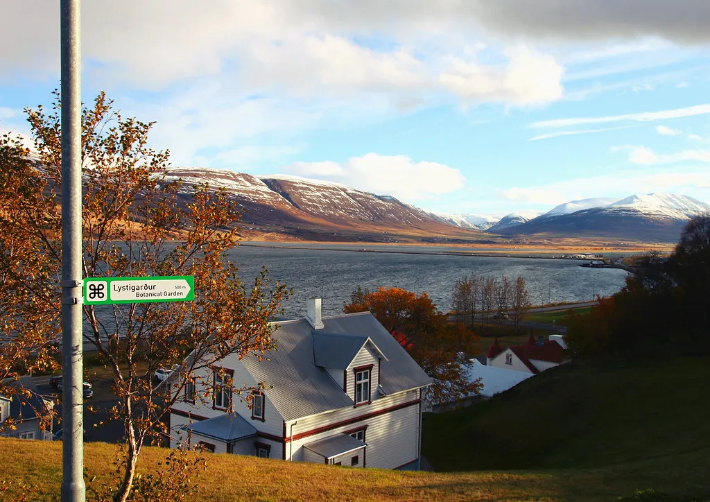
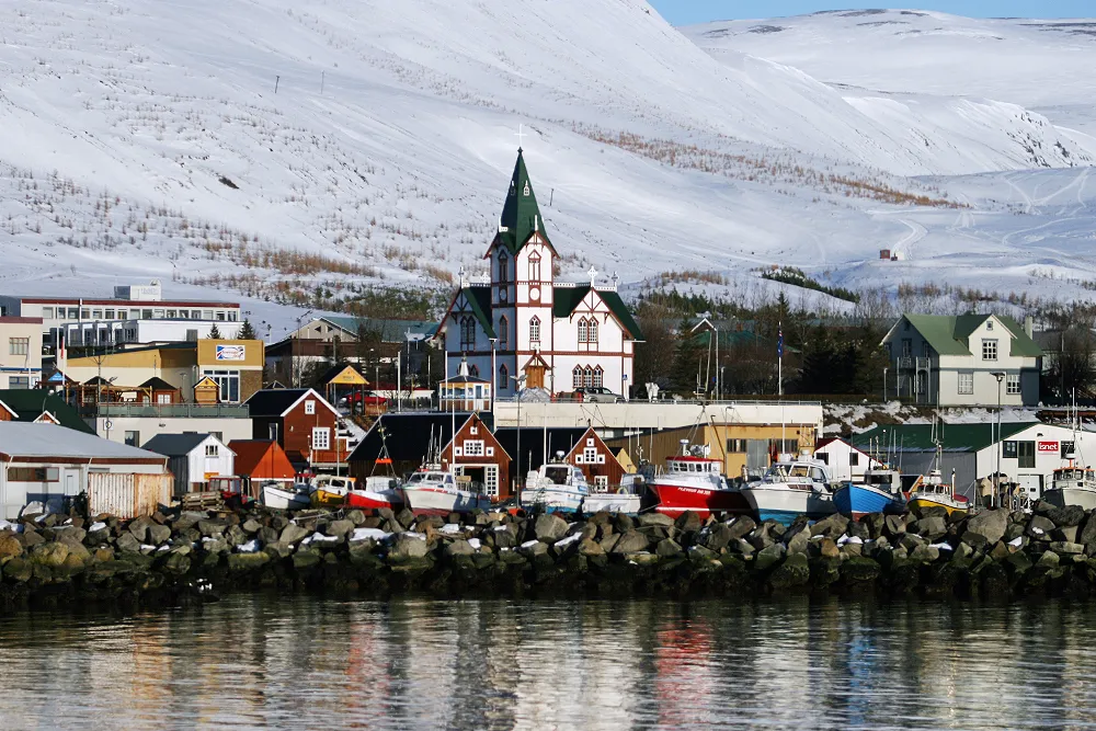
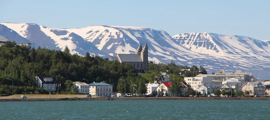
Akureyri is located at the bottom of Eyjafjörður Fjord in the heart of North Iceland. Known as the “Capital of the North,” it is the largest town outside the Capital Area. Sheltered by prominent mountains and located by the so-called “Pond,” as the innermost part of Eyjafjörður Fjord is called, many Icelanders regard Akureyri as the most beautiful town in Iceland.
Because the summer temperature in Akureyri is usually favorable, it is a trendy tourist destination among Icelanders. However, it often gets a lot of snow during the winter, but since Akureyri is the center for winter sports in Iceland, it’s welcomed. Only 5 km from the town center is Hlíðarfjall Mountain, a prime skiing area with excellent facilities.
Akureyri is the center of commerce and services in the region, and there are many attractions in the surrounding area, including historical sites, museums, a botanical garden, and natural wonders.

13.990 ISK
30.150 ISK
20.100 ISK
40.000 ISK
260.000 ISK
16.990 ISK
13.990 ISK

17.000 ISK
9.900 ISK
52.000 ISK