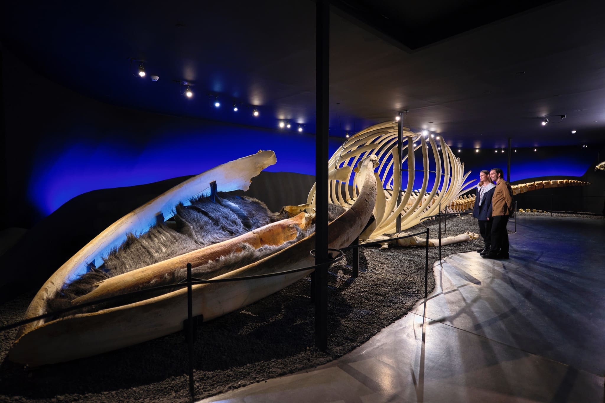
Húsavík Whale Museum Ticket
2,650 ISK
1 Stunde

Einfach
274.990 ISK
Embark on an unforgettable journey through North Iceland’s breathtaking Diamond Circle from Akureyri. Discover the geothermal wonders of Lake Mývatn, with its bubbling mud pools, lava formations, and rich birdlife. Witness the sheer power of Dettifoss, Europe’s most powerful waterfall, and take in the serene beauty of Ásbyrgi Canyon, a horseshoe-shaped glacial valley steeped in legend. Visit Húsavík, the whale-watching capital of Iceland, where you can enjoy charming coastal scenery. Conclude the adventure at Goðafoss, the majestic “Waterfall of the Gods,” before returning to Akureyri.
Please note: Any extra activities not listed in this description may incur additional fees.
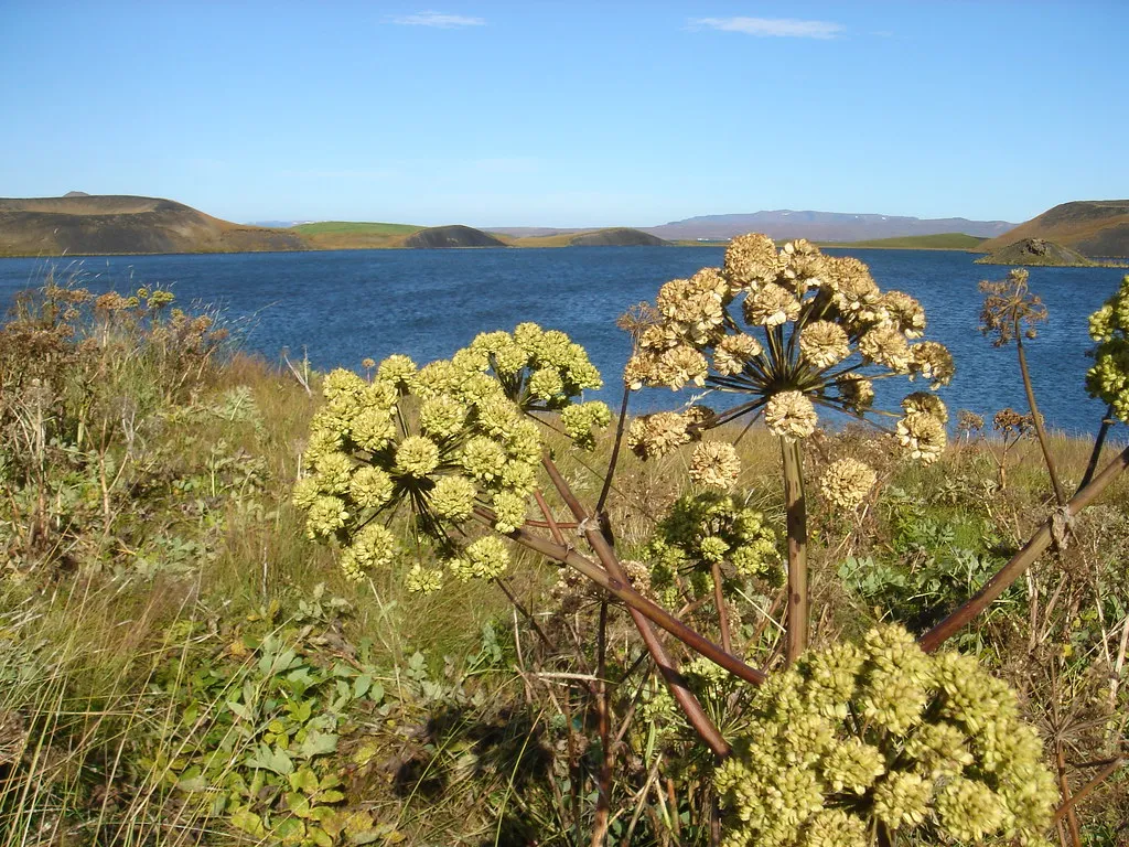
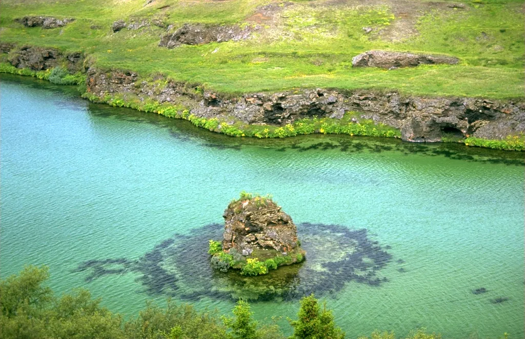
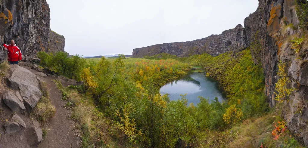
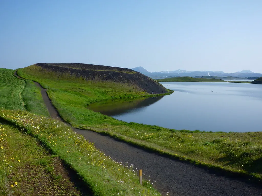
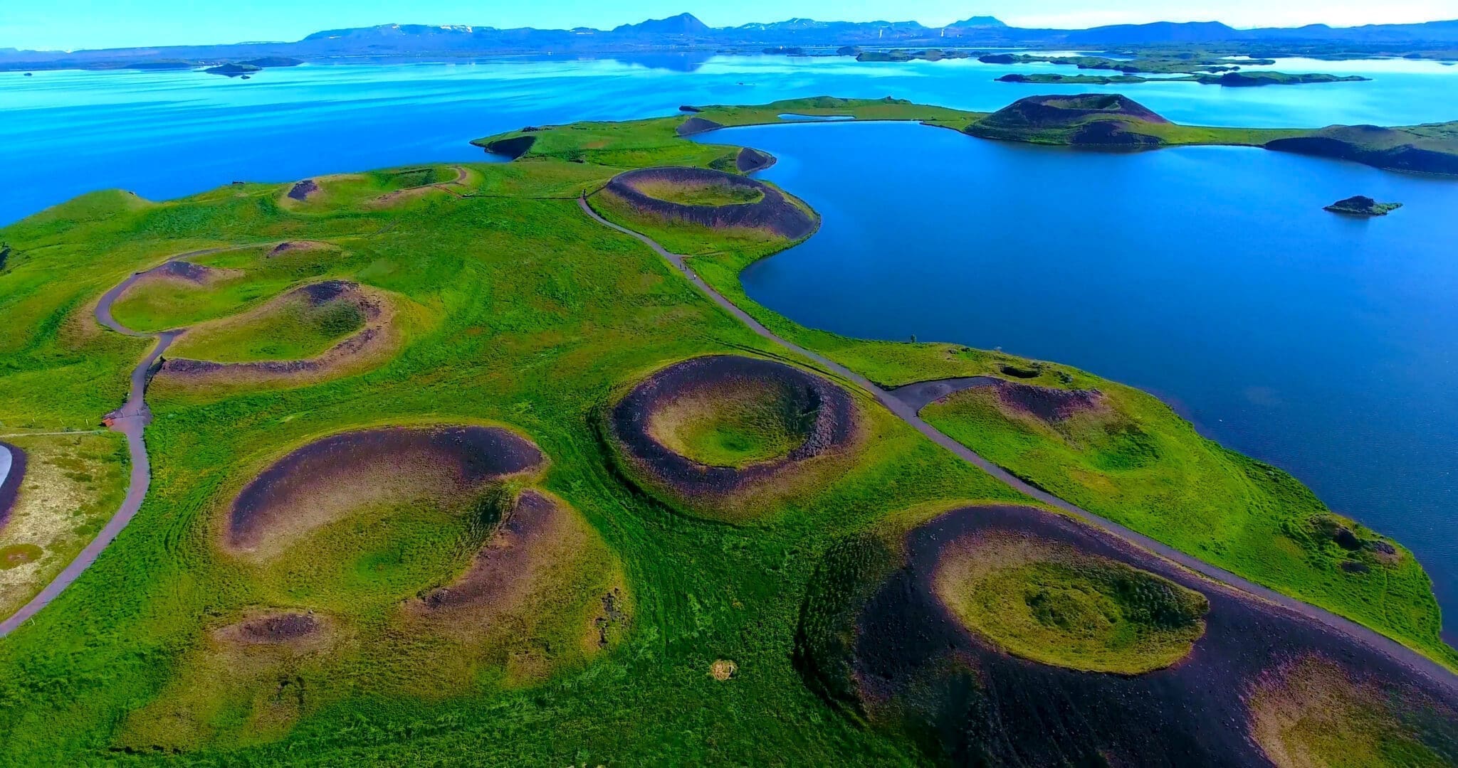
Mauvatn ist ein flacher eutropher See in einem Gebiet mit aktivem Vulkanismus im Norden Islands, unweit des Vulkans Krafla, Der See und die umliegenden Feuchtgebiete weisen eine lebendige Fauna von Wasservögeln, insbesondere Enten, auf, der See entstand vor 2300 Jahren durch einen großen basaltischen Lavausbruch, und die umgebende Landschaft wird von vulkanischen Landformen dominiert, darunter Lavasäulen und wurzellose Quellen (Pseudokrater).Der ausströmende Fluss Laxá ist bekannt für seinen reichen Fischfang auf Bachforellen und Atlantischen Lachs.
Der Name des Sees (Isländisch mauur (“midge”) und vatn (“see”); der See der Mücken) rührt von der enormen Anzahl an Mücken her, die dort im Sommer zu finden sind.
Der Name Mauvatn wird manchmal nicht nur für den See, sondern auch für das gesamte umliegende bewohnte Gebiet verwendet. Der Fluss Laxá, der Maucaun-See und die umliegenden Feuchtgebiete sind als Naturschutzgebiet geschützt (Naturschutzgebiet Mauaucatn-Laxá).
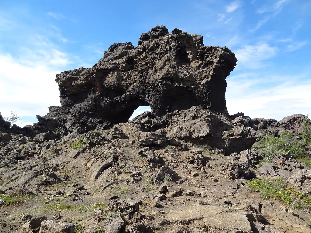
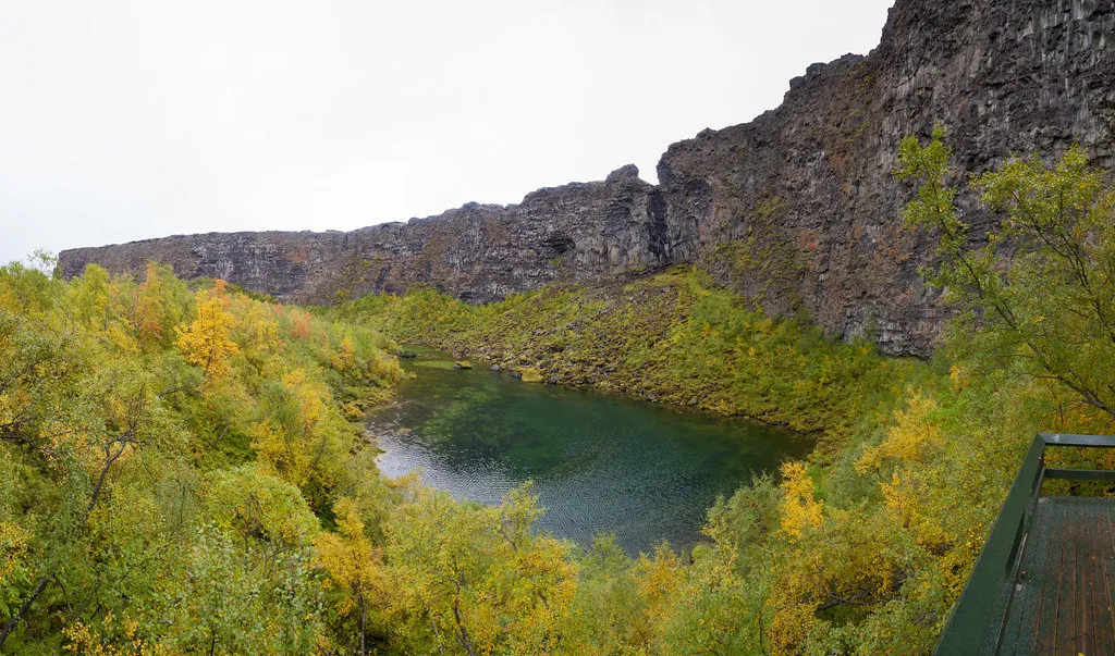
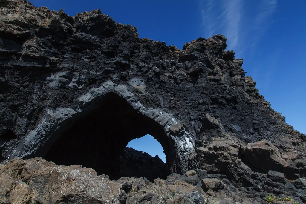
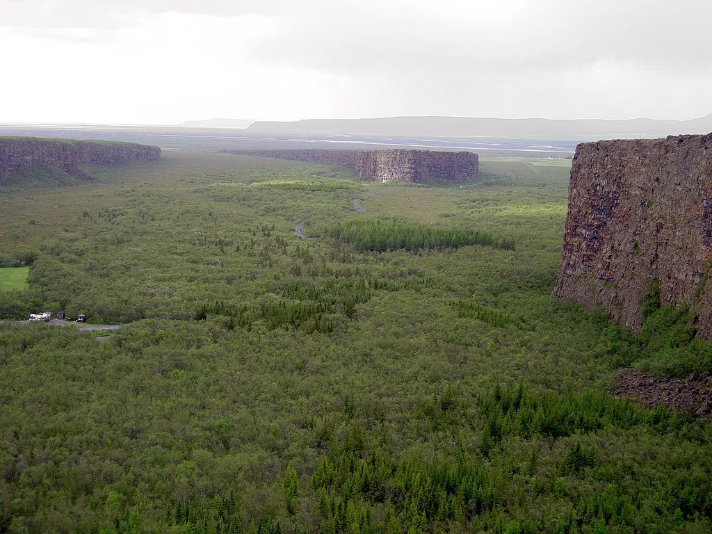
The Dimmuborgir (meaning dark cities, forts, or castles) Lava Field, located in the heart of the Mývatn Geothermal Area, is about 100 kilometers east of Akureyri.
The Dimmuborgir area, as the name suggests, is an unusually shaped lava field consisting of peculiar volcanic caves and rock formations. These dramatic structures are a favorite stop for tourists.
This natural phenomenon dates back some 2300 years to a massive eruption in a nearby crater. The lava seems to have flowed over a small lake that once existed; water below the lava was trapped and boiled, and the steam rose, forming lava pillars from drainpipes up to several meters in diameter. As the lava continued flowing toward the lower ground in the Mývatn Lake area, the top crust collapsed, leaving behind hollow pillars of solidified lava. The lake must have been at least 10 meters deep, as estimated by the tallest structures still standing.
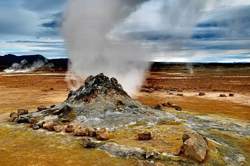
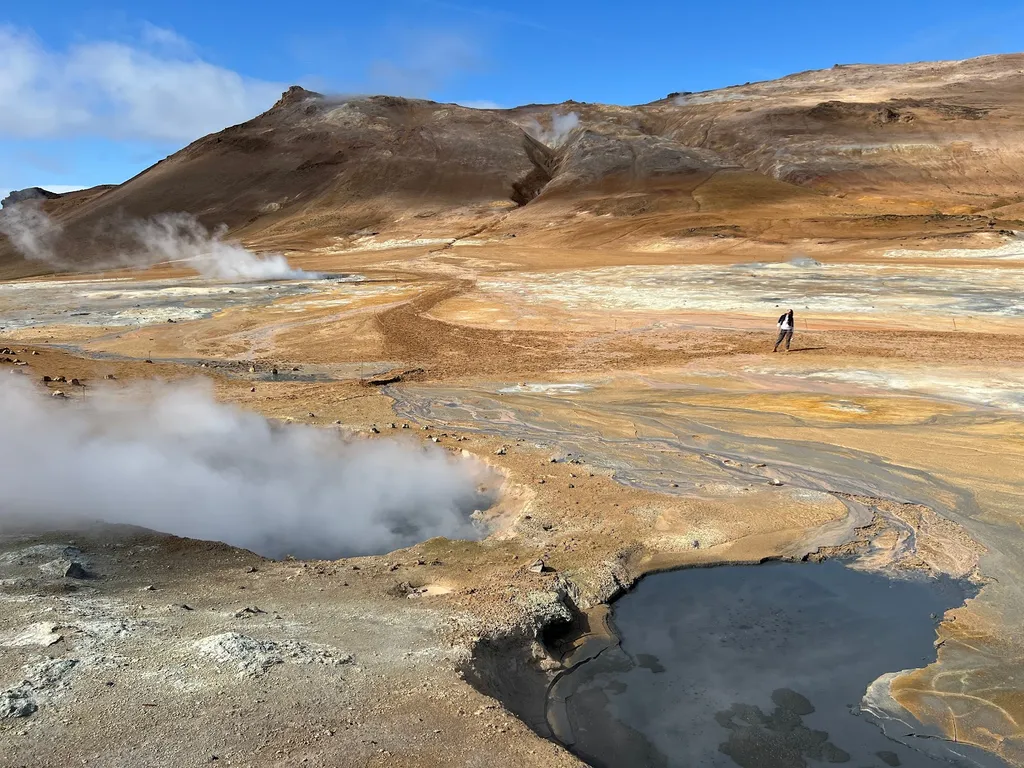
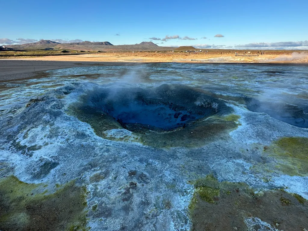
Hverir, auch bekannt als Hverarond oder Namafjall, ist ein Geothermiegebiet im Nordosten Islands in der Nähe des Myvatn-Sees. Diese jenseitige Landschaft ist durch sprudelnde Schlammgruben, dampfende Fumarolen und leuchtend gelbe Schwefelablagerungen gekennzeichnet.
Die jenseitige Natur der Landschaft trifft die Besucher von Hverir sofort Der Boden ist rissig und karg, wobei ein stechender Schwefelgeruch verströmt wird, der die Luft füllt Die sprudelnden Schlammgruben und zischenden Fumarolen erzeugen eine surreale Atmosphäre, wenn man auf einen anderen Planeten tritt.
Eines der auffälligsten Merkmale von Hverir sind die leuchtend gelben Schwefelablagerungen, die sich am felsigen Boden festklammern. Diese farbenfrohen Formationen verleihen der ansonsten trostlosen Landschaft einen Farbtupfer und kontrastieren die umliegenden schwarzen Vulkangesteine stark.
In Hverir befinden sich auch mehrere heiße Quellen, die durch die geothermische Aktivität unter der Oberfläche erhitzt werden. Besucher können sehen, wie Dampf aus diesen Wasserbecken aufsteigt und so einen hypnotischen und fast mystischen Effekt erzeugt.
Der Besuch von Hverir ist ein wirklich einzigartiges Erlebnis, das einen Einblick in die rohe Kraft der Natur bietet.
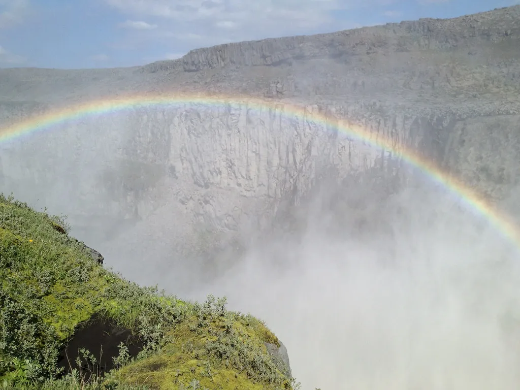
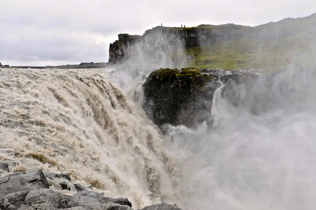
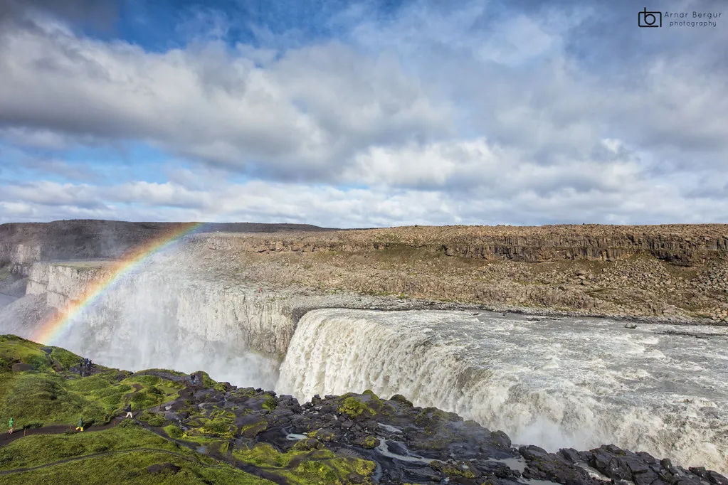
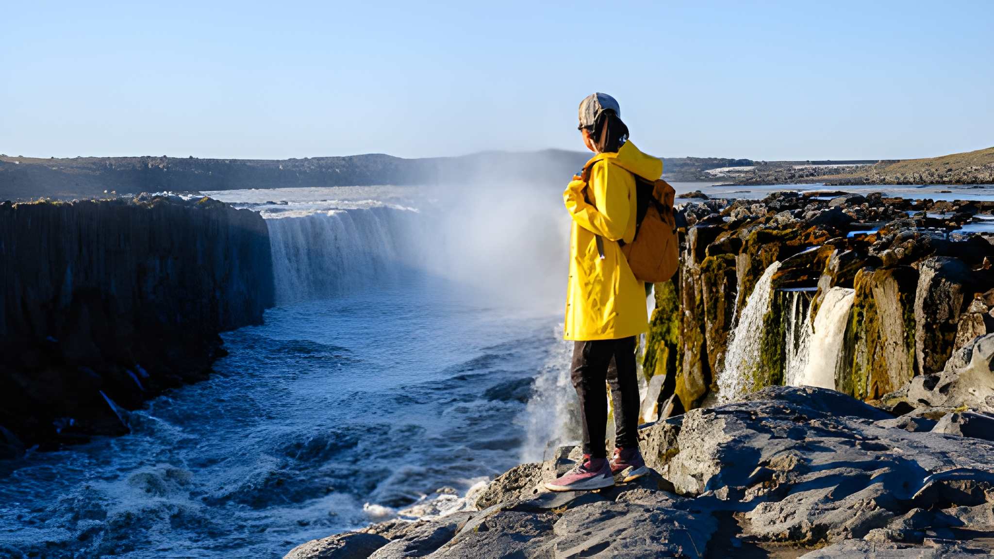
Dettifoss Waterfall, located in Jökulsárgljúfur Canyon, is south of Ásbyrgi Canyon in Northeast Iceland.
Seeing Dettifoss Waterfall, Europe’s most powerful cascade of water rushing over the falls, is an overwhelming experience. From the car park, there is an 800-meter path to the falls, an easy hike for most people.
Dettifoss Waterfall is in the Jökulsá á Fjöllum River that originates in Vatnajökull Glacier, the world’s largest glacier outside the Arctic. It runs through the Jökulsárgljúfur Canyon, thought to be carved out by several megafloods lasting only a few days, each separated by thousands of years. In 1973, the whole canyon was declared a national park, from its origins to its estuary. In 2008, it became a part of the newly established Vatnajökull National Park.
Dettifoss is a must-see destination for anyone visiting Iceland, offering a unique and unforgettable natural experience showcasing the raw power and beauty of the Icelandic landscape
Ásbyrgi Canyon is regarded by many as the most beautiful place in Iceland.
This horseshoe-shaped canyon, measuring approximately 3.5 kilometers in length and up to 1 kilometer in width, is believed to have been formed by a catastrophic glacial flood caused by a volcanic eruption thousands of years ago.
Folklore says that Ásbyrgi was formed when Sleipnir, Norse God Óðinn’s eight-footed horse, put his hoof on the ground. Ásbyrgi, meaning the Shelter of Gods, is almost perfectly hoof-shaped.
The canyon is surrounded by cliffs up to 100 meters high, creating a unique and mesmerizing landscape. In the canyon’s center lies a lush green oasis, starkly contrasting the rugged and rocky terrain surrounding it.
One of the most spectacular features of Asbyrgi Canyon is the towering rock formations known as the “Church Floor” and the “Pillars of the Gods.” These natural formations result from volcanic activity and erosion over millions of years, creating a dramatic and otherworldly atmosphere.
Visitors to Asbyrgi Canyon can explore the network of hiking trails that wind through the canyon, offering breathtaking views of the surrounding landscape. The canyon is also home to diverse wildlife, including reindeer, Arctic foxes, and various bird species, making it a popular destination for nature enthusiasts and wildlife photographers.
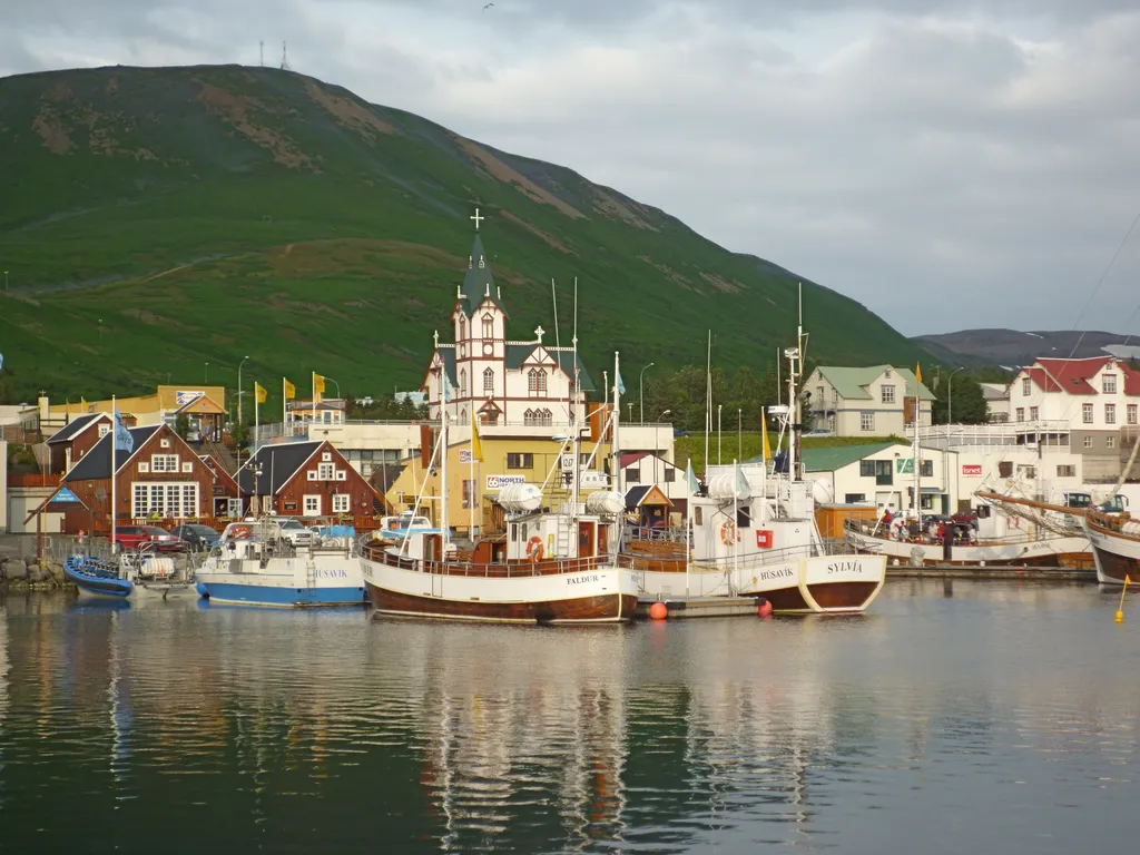
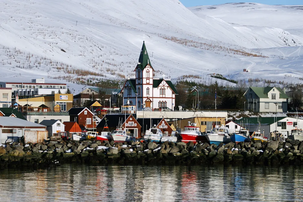
Húsavík ist eine Stadt in der Gemeinde NorPGur.ing an der Nordküste Islands, am Ufer der Bucht von Skjálfandi, sie hat 2237 Einwohner, das bekannteste Wahrzeichen des Ortes ist die 1907 erbaute Holzkirche Húsavíkurkirkja.
Die Einnahmen stammen aus Tourismus, Fischerei, Einzelhandel und Kleinindustrie. Bis vor Kurzem war Húsavík der Exporthafen für Kieselsäure, die aus dem nahegelegenen Mauvatn-See gewonnen wurde.
Laut Landnámabók (“Buch der Besiedlung”) war Húsavík der erste Ort in Island, der von einem Nordmänner besiedelt wurde. Der schwedische Wikinger GarPMar Svavarsson blieb dort um 870 n. Chr. einen Winter, als er die Insel im Frühjahr 870 verließ, hinterließ er nach einem Winteraufenthalt einen Mann namens Nattfari und zwei Sklaven, einen Mann und eine Frau, und sie gründeten hier eine Farm. Der Name der Stadt bedeutet “Häuserbucht”und bezieht sich wahrscheinlich auf GarPGars Gehöft, das möglicherweise das einzige Haus in Island war.
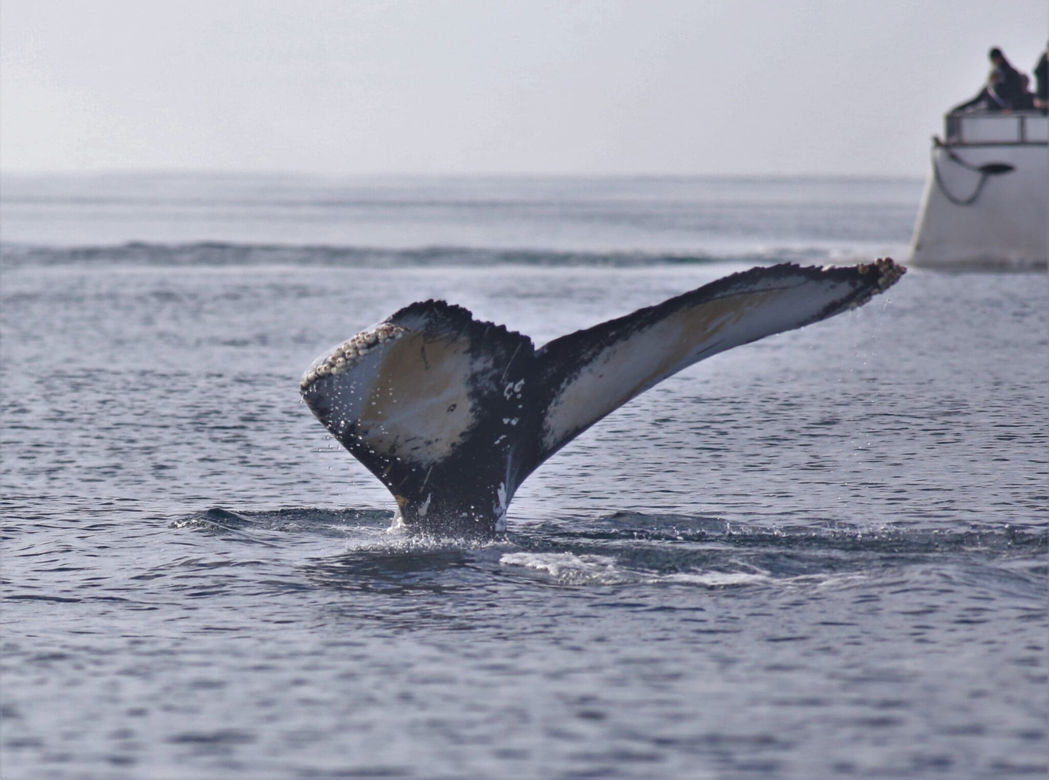
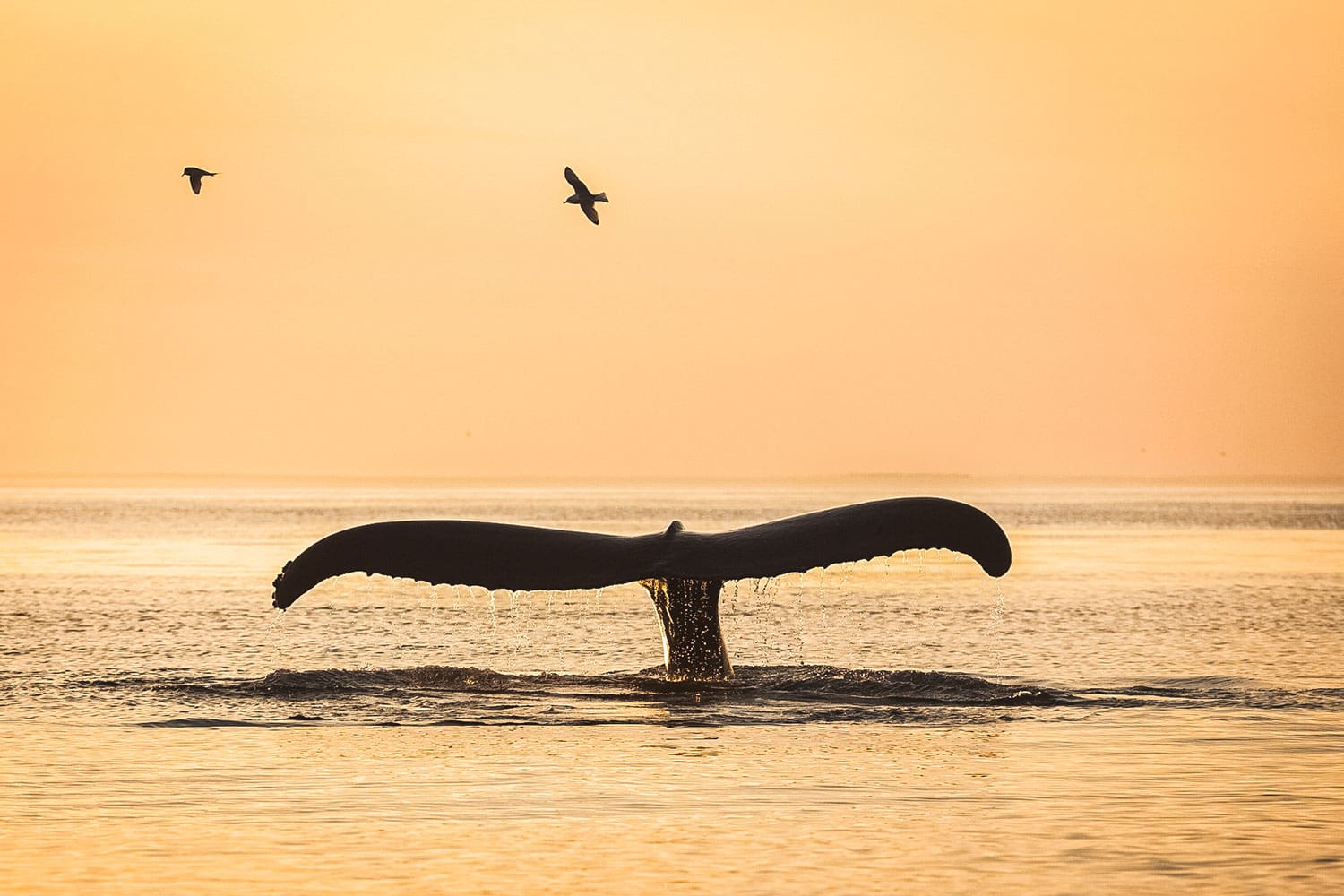
Húsavík ist Islands Hauptstadt der Walbeobachtung und wurde im Sommer auf über 951 TP3 T-Fahrten gesichtet.
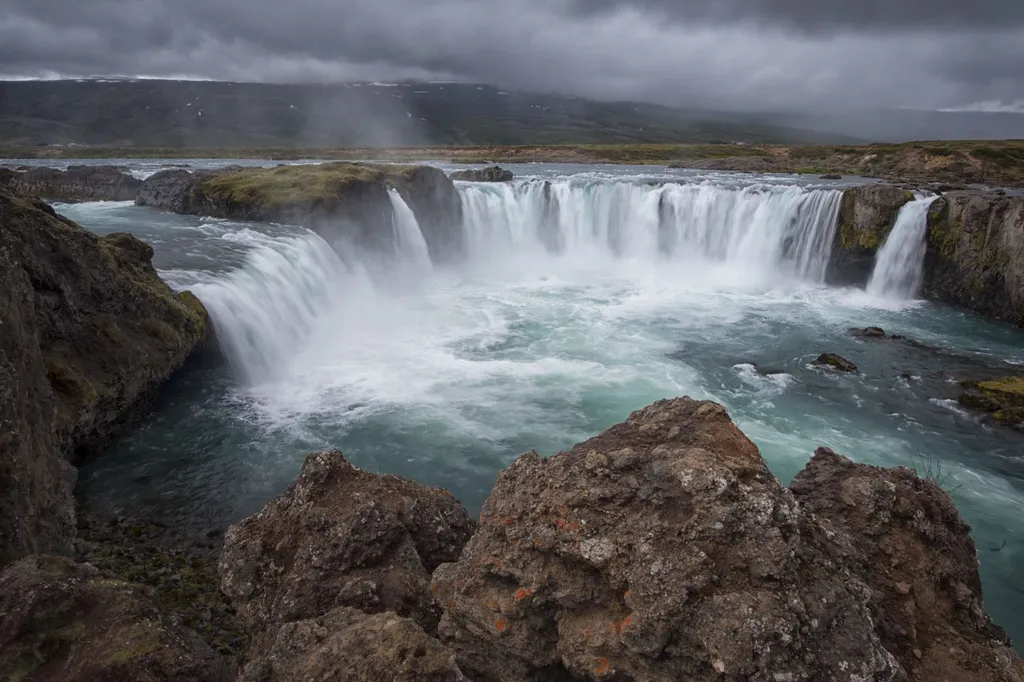
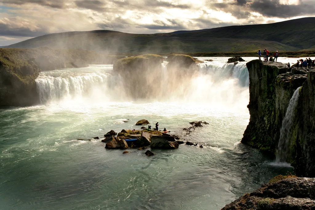
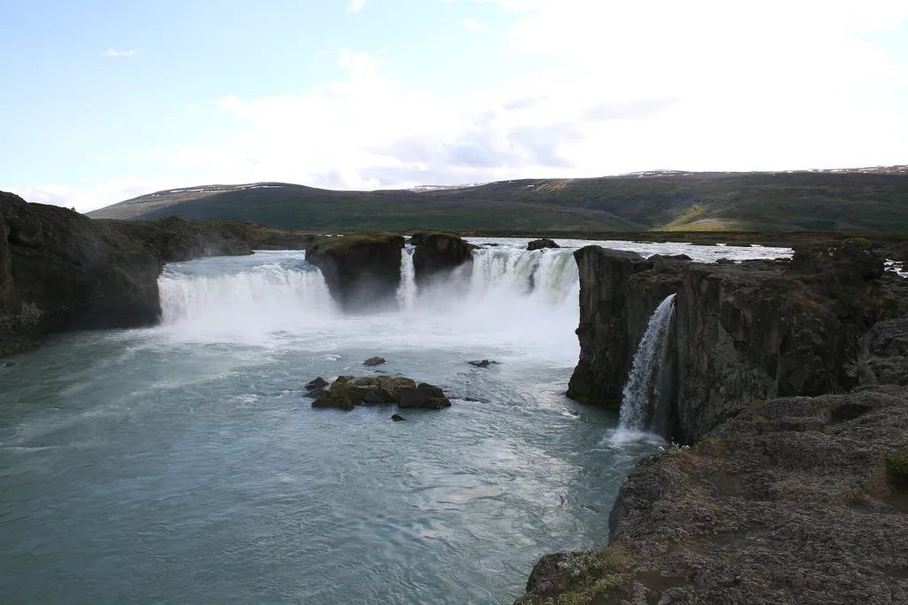
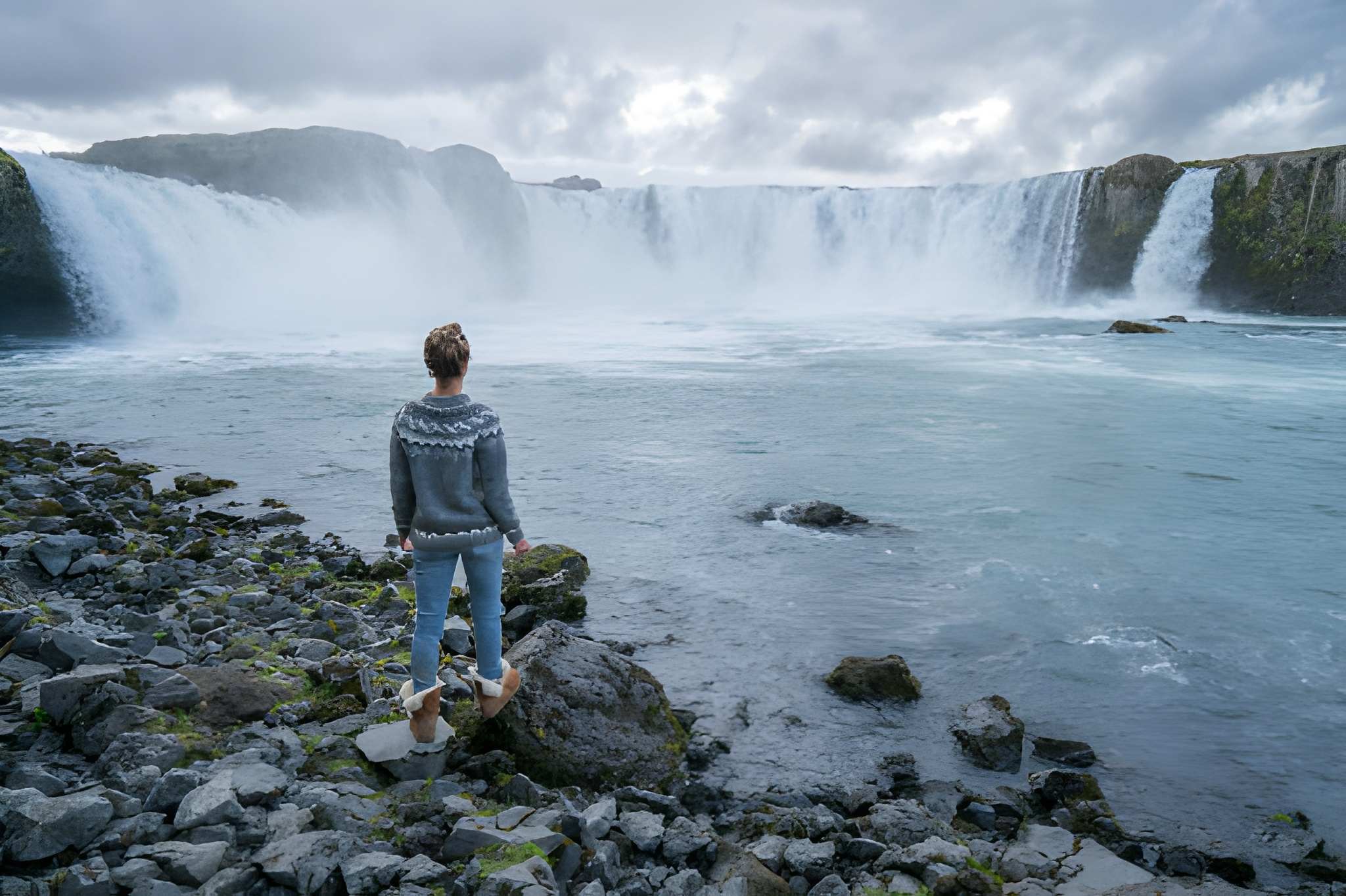
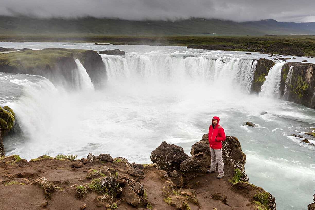
Der malerische GoPMafoss ist 12 Meter hoch und 30 Meter breit, der Wasserfall befindet sich im mächtigen Fluss Skjálfandafljót, der im Vatnajökull-Gletscher entspringt.
GoPMafoss bedeutet “Wasserfall der Götter”und hat seinen Namen von „Wasserfall der Götter” Das Buch der Isländer, die, Eine Erzählung in einem der alten isländischen Manuskripte über 1000 n. Chr. den Gesetzesredner 'Recht', der das Christentum zur offiziellen Religion in Island machte, nachdem er zur neuen Religion konvertiert war und bei seiner Ankunft in der Heimat seine alten Statuen der nordischen Götter seiner früheren Religion in den Wasserfall warf, daher der Name Go1afoss.
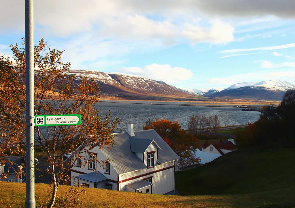
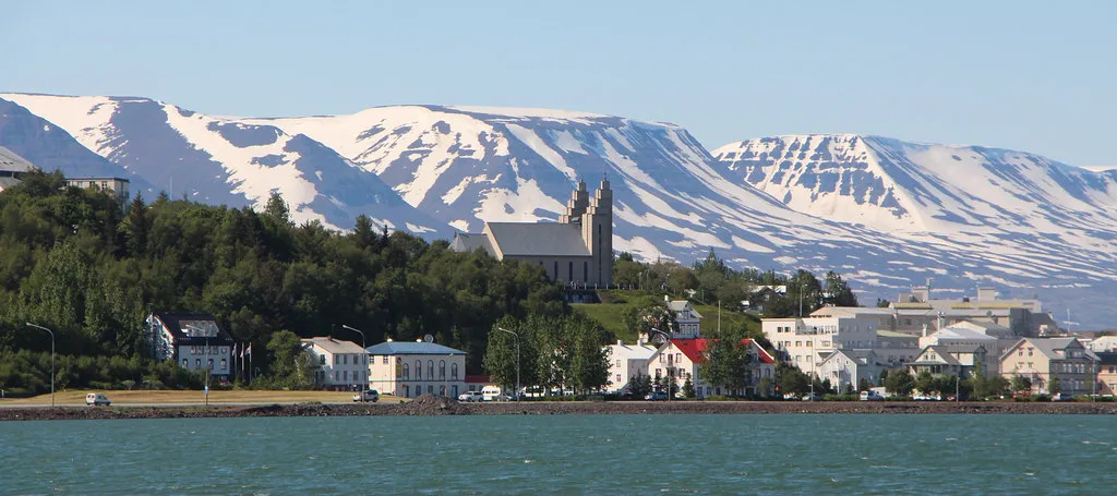
Akureyri is located at the bottom of Eyjafjörður Fjord in the heart of North Iceland. Known as the “Capital of the North,” it is the largest town outside the Capital Area. Sheltered by prominent mountains and located by the so-called “Pond,” as the innermost part of Eyjafjörður Fjord is called, many Icelanders regard Akureyri as the most beautiful town in Iceland.
Because the summer temperature in Akureyri is usually favorable, it is a trendy tourist destination among Icelanders. However, it often gets a lot of snow during the winter, but since Akureyri is the center for winter sports in Iceland, it’s welcomed. Only 5 km from the town center is Hlíðarfjall Mountain, a prime skiing area with excellent facilities.
Akureyri is the center of commerce and services in the region, and there are many attractions in the surrounding area, including historical sites, museums, a botanical garden, and natural wonders.

2,650 ISK
5.900 ISK
360.063 ISK
13.490 ISK
30.150 ISK
20.100 ISK
40.000 ISK
260.000 ISK
16.990 ISK
13.990 ISK
Reisetipps, neue Guides und ein Heads-up, wenn die Polarlichter-Prognose gut aussieht Kein Spam.