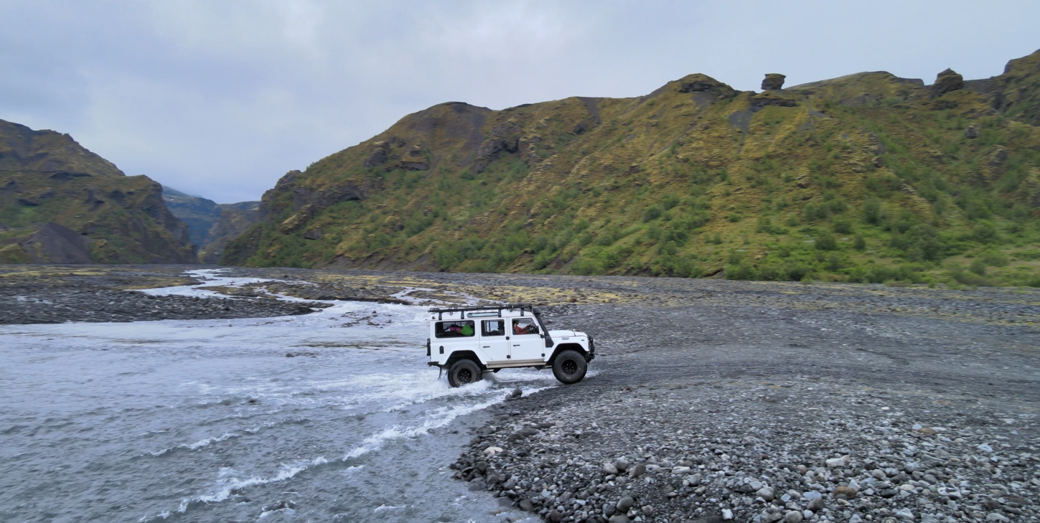
Private Thorsmork Valley Day Tour by Super Jeep from Reykjavik
275.000 冰岛克朗
10个小时


中等
84.052 冰岛克朗
踏上 epic 4-day self-guided hiking adventure on the 劳加维古尔步道, taking you from the colorful rhyolite mountains of 兰德曼纳劳加尔 to the lush valley of 回火, sleeping in tents. This journey offers an impressive diversity of landscapes, starting with the vibrant 熔岩场 of Landmannalaugar and ascending towards 赫拉芬廷努斯克, known for its black obsidian deposits and snow-covered landscapes even in summer.
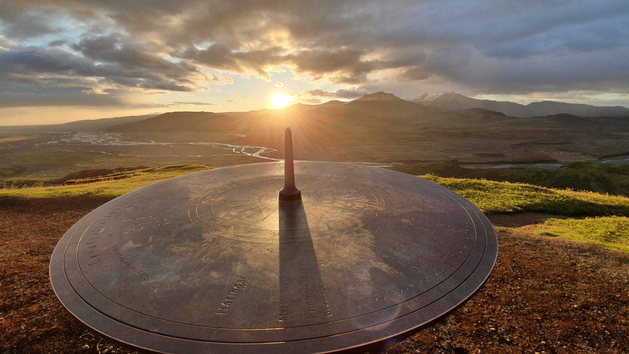
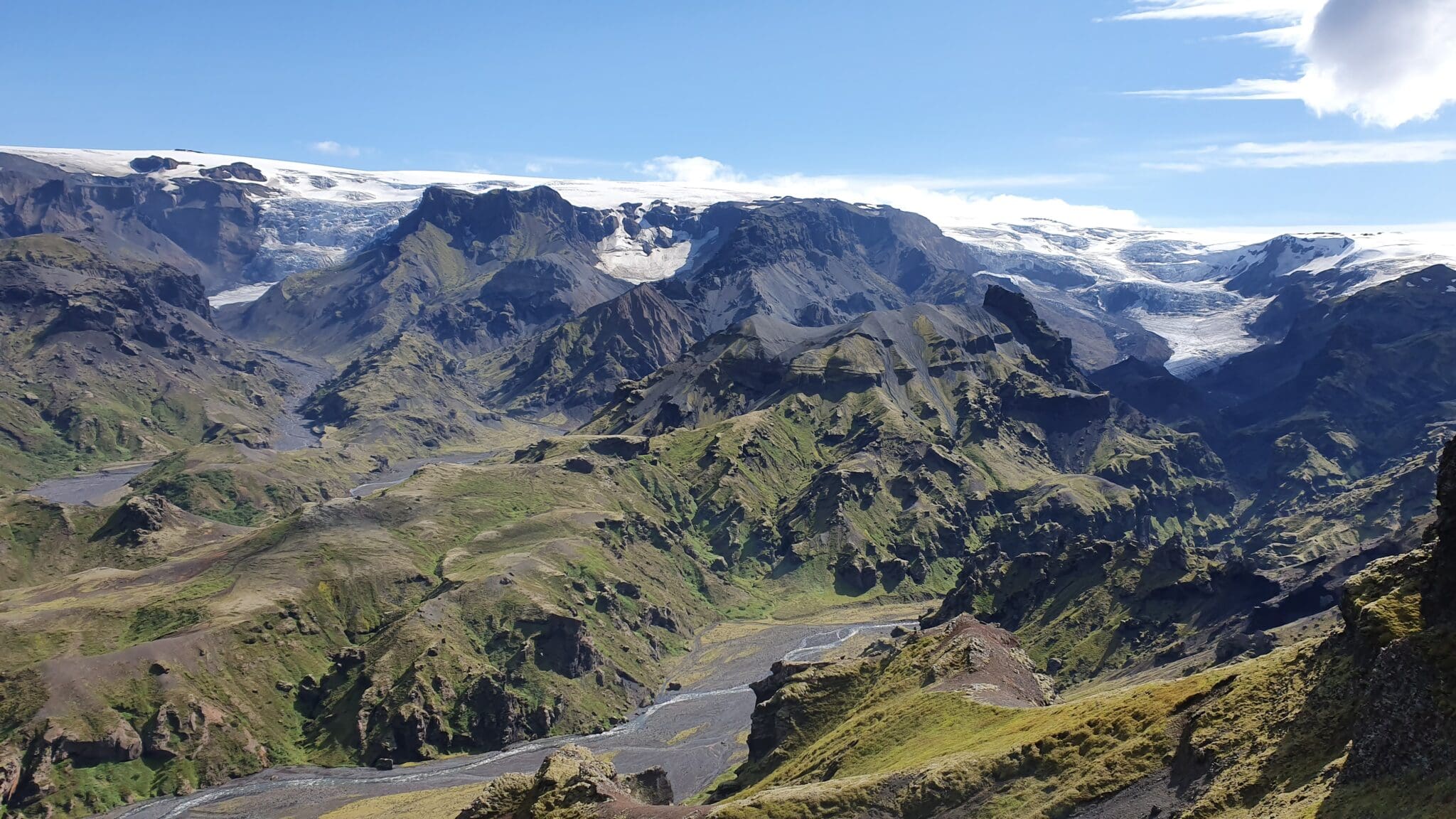
The route continues descending into the Jökultungur valley, with its stunning mountain formations and colorful sediments, to the serene lake 阿尔夫塔瓦特恩, perfect for camping and enjoying the tranquility. We proceed through the 马里菲尔桑杜尔沙漠, passing by the solitary Mount Hattafell and the dramatic gorge of the Markarfljót river, to the Emstrur campsite, with views of the 米达尔舍库尔 並 艾贾菲亚拉冰盖 glaciers. The journey culminates in the green valley of 回火, a natural paradise with dense vegetation and dreamlike landscapes, providing the perfect ending to this unforgettable trek.
Don’t miss the opportunity to experience this unique trekking adventure in Iceland. Each day on the Laugavegur trail is filled with surprises and natural beauty, guaranteeing unforgettable memories and a deep connection with nature. Discover why this hike is one of the most spectacular in the world!
07:00 am早餐后从雷克雅未克出发(接机路线从06:30 am开始),前往冰岛高地,今天将是一个相对平静的一天,因为我们前往Landmannalaugar露营地,抵达后我们将搭起帐篷,有时间轻松地进行第一次徒步旅行,以适应地形,享受我们最初的徒步旅行体验。.
距离: 11公里
上升: 402米
血统: 380米
持续时间: 4-5个小时
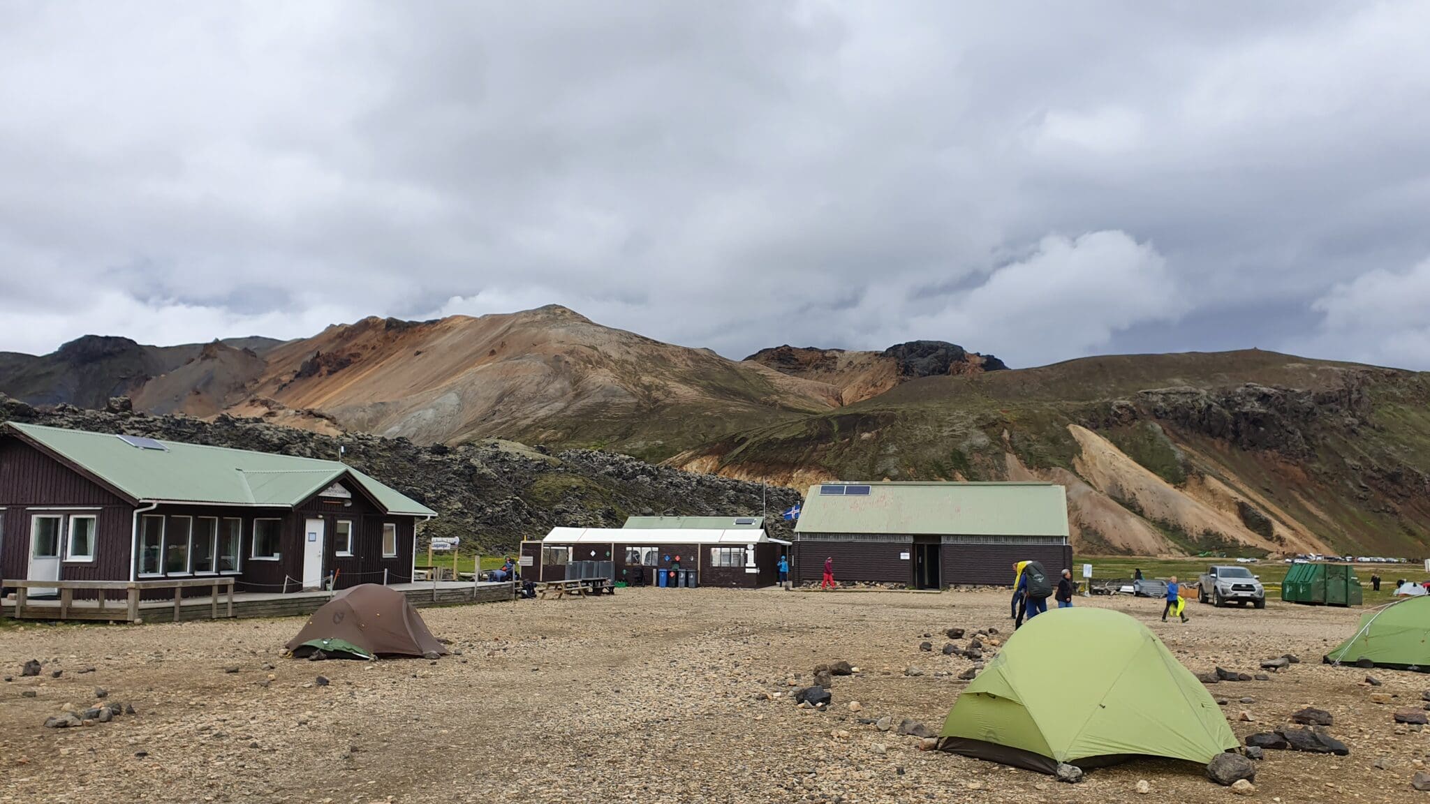
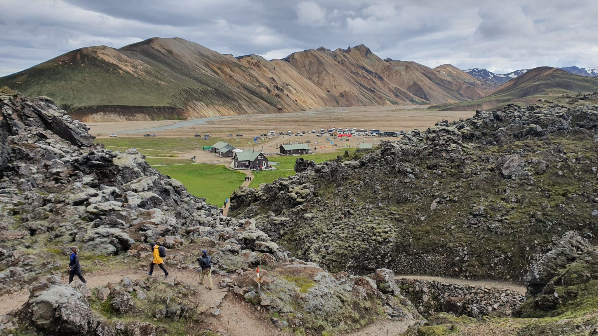
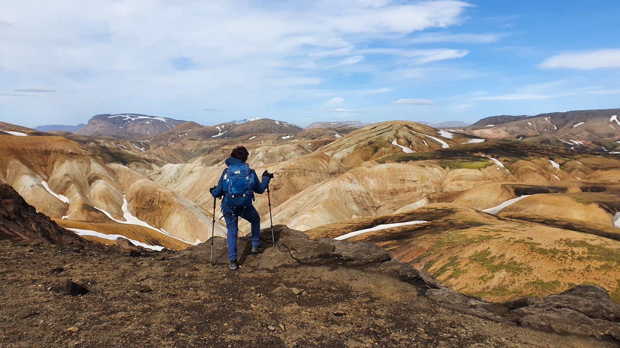
兰德曼纳劳加尔
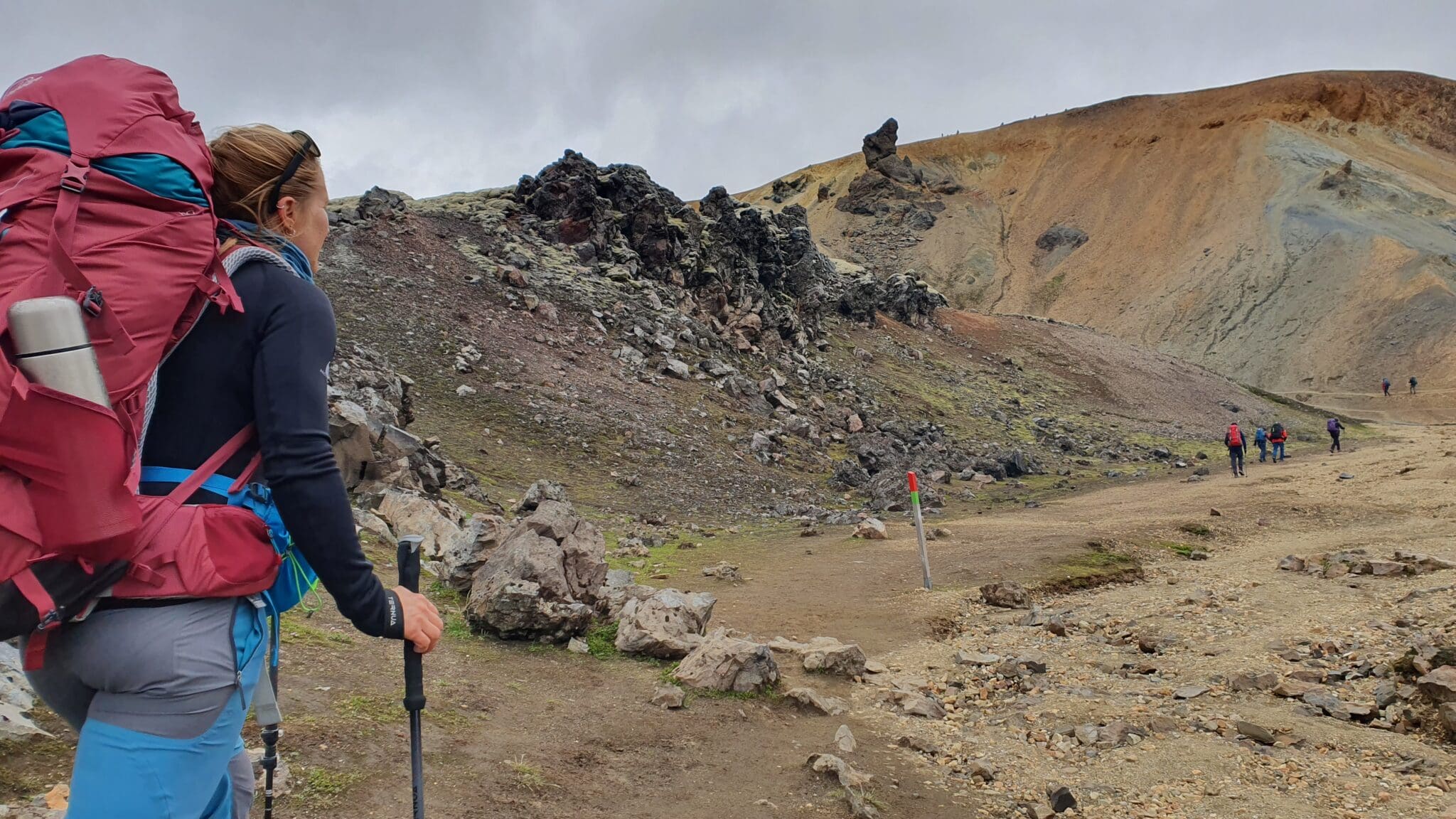
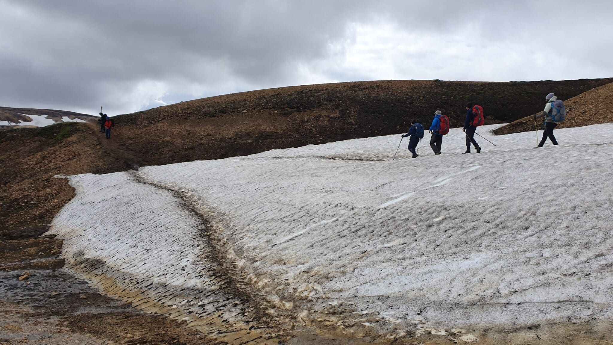
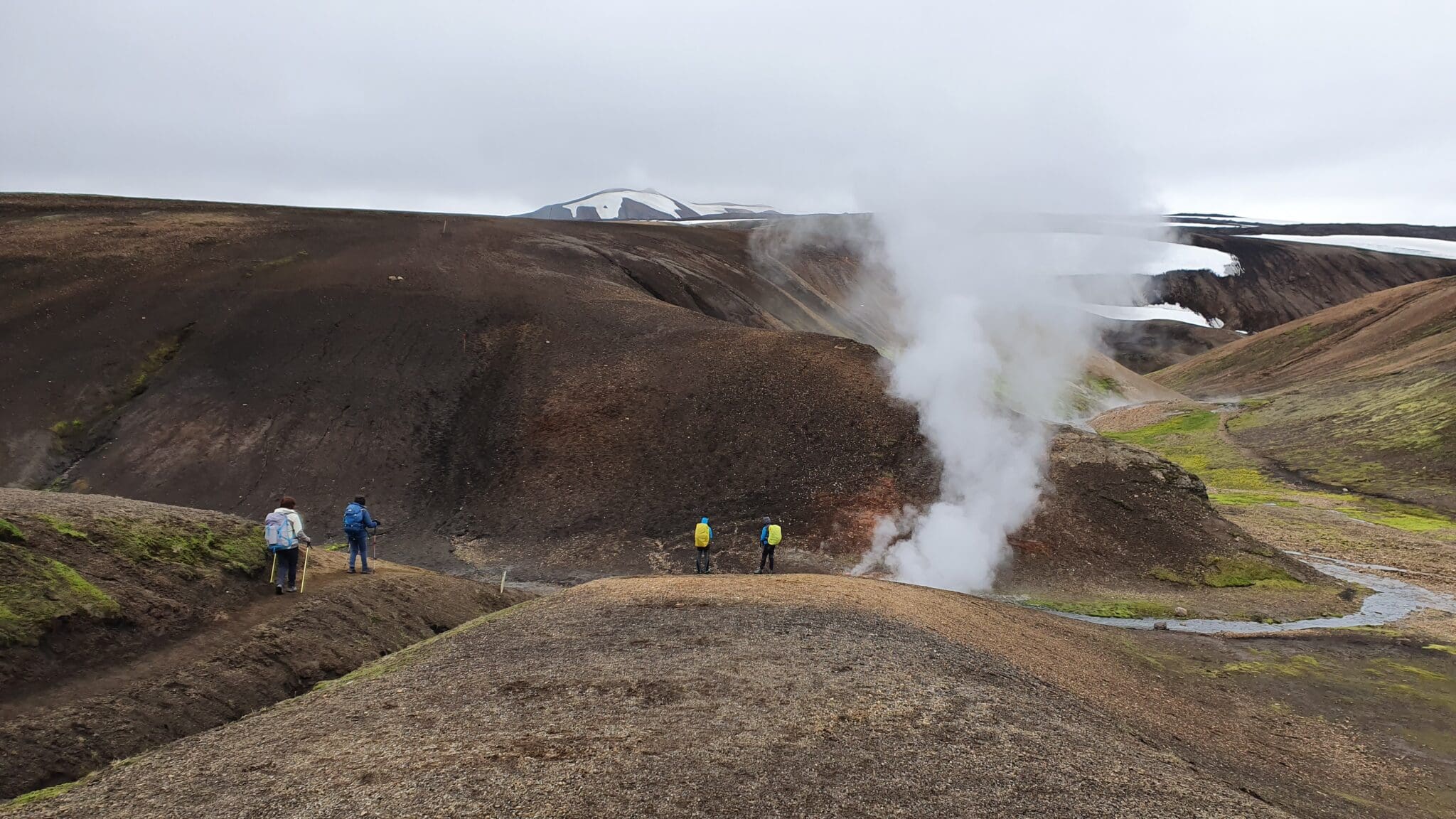
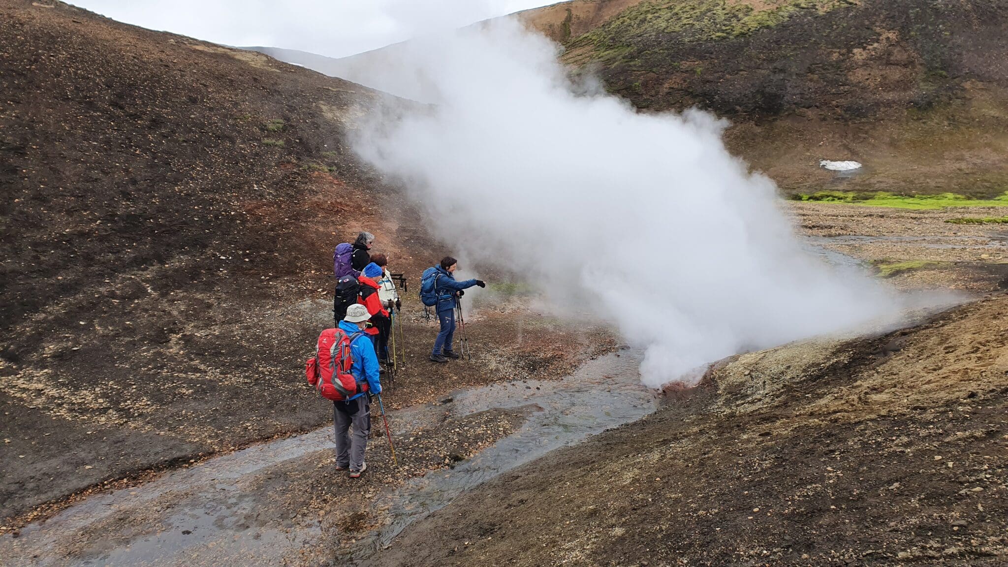
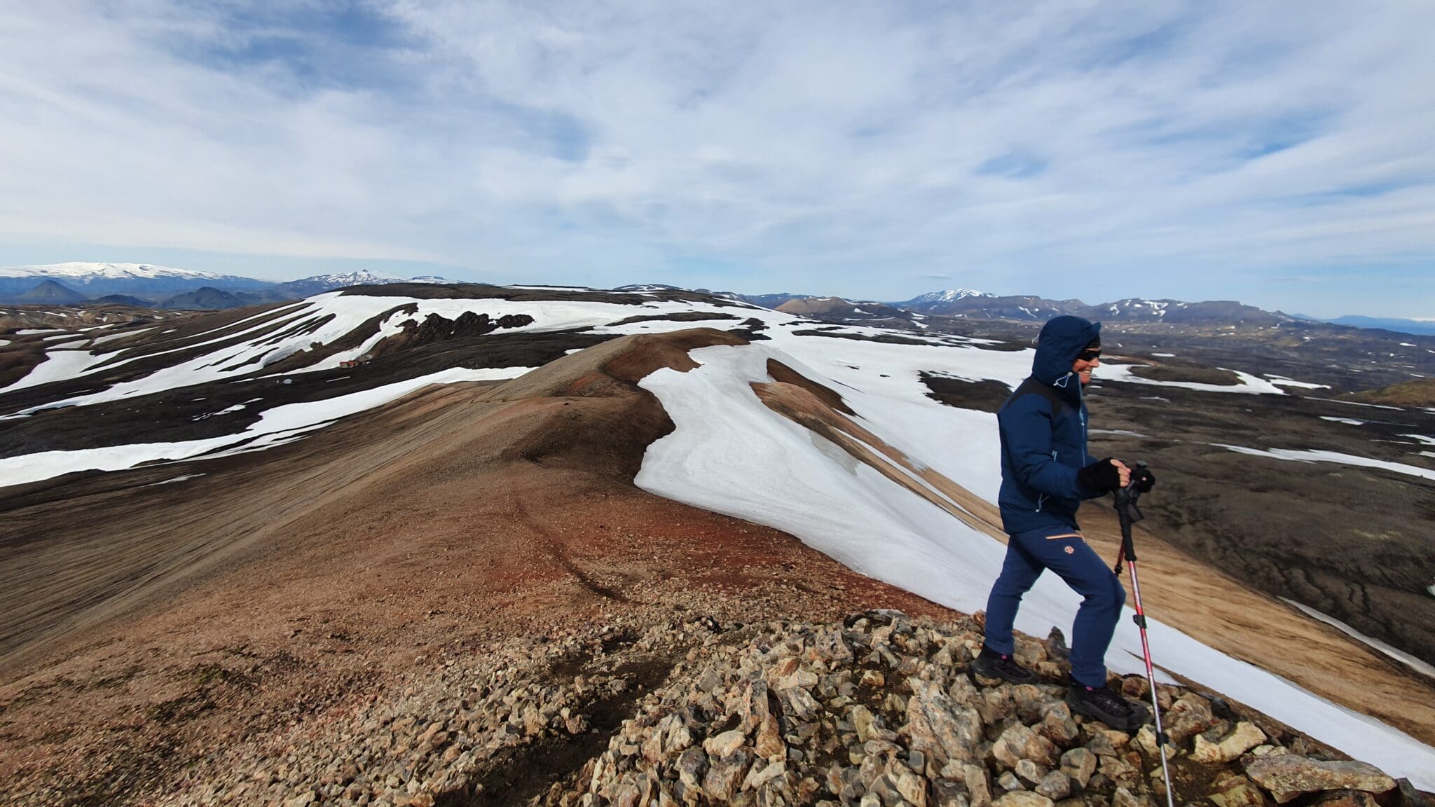
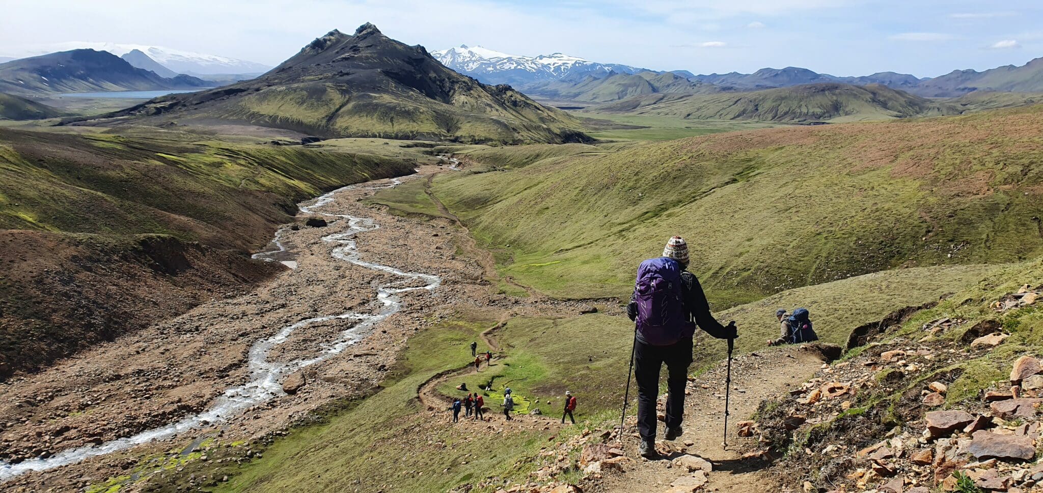
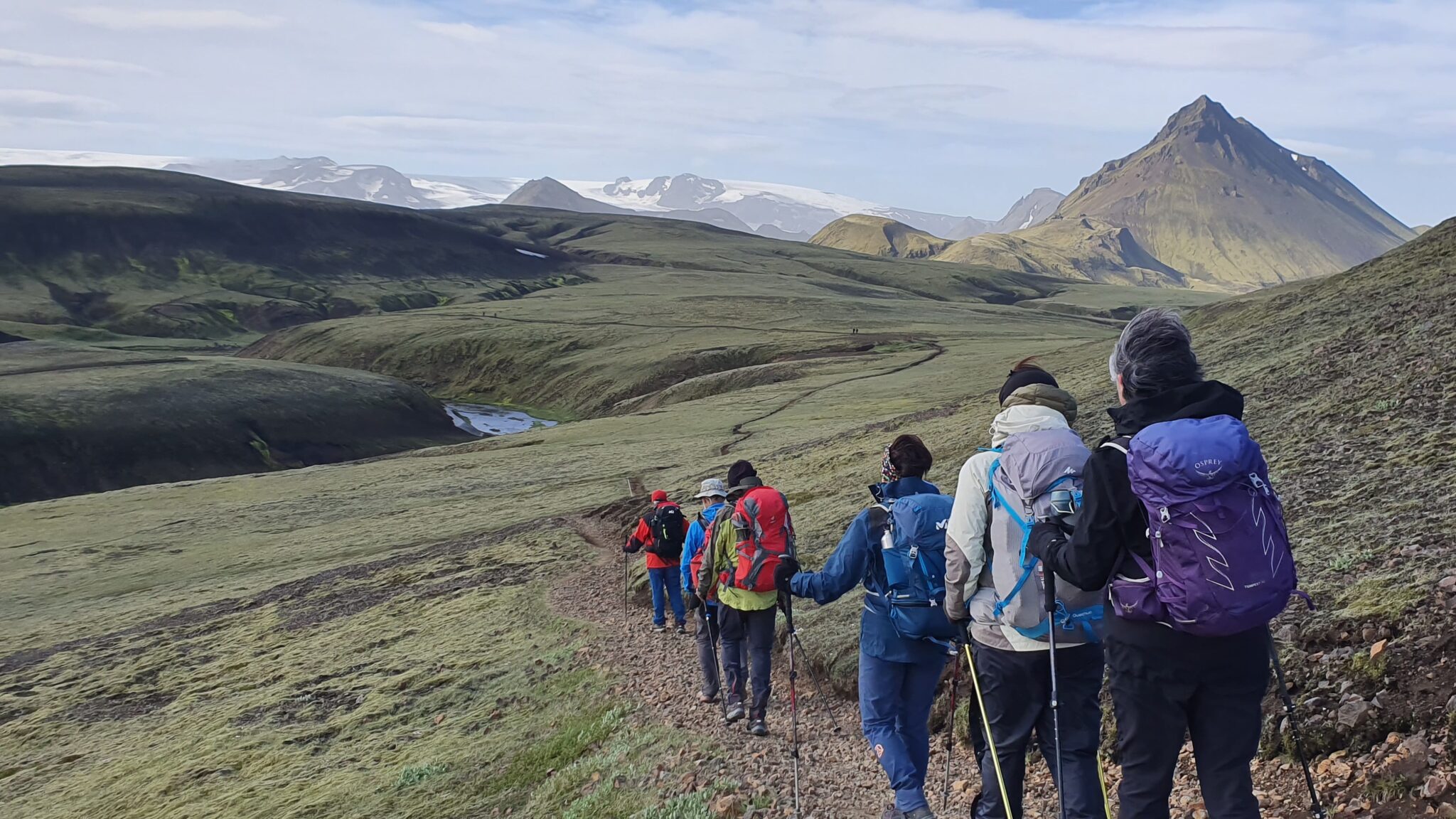
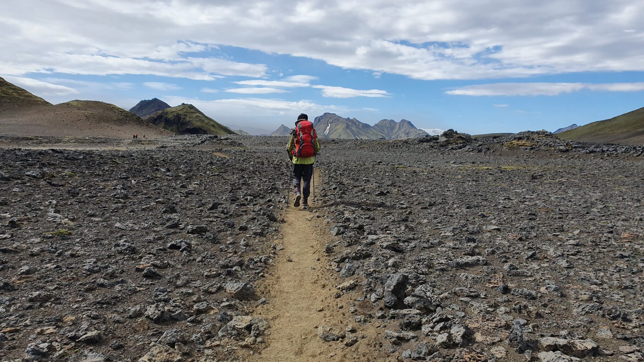
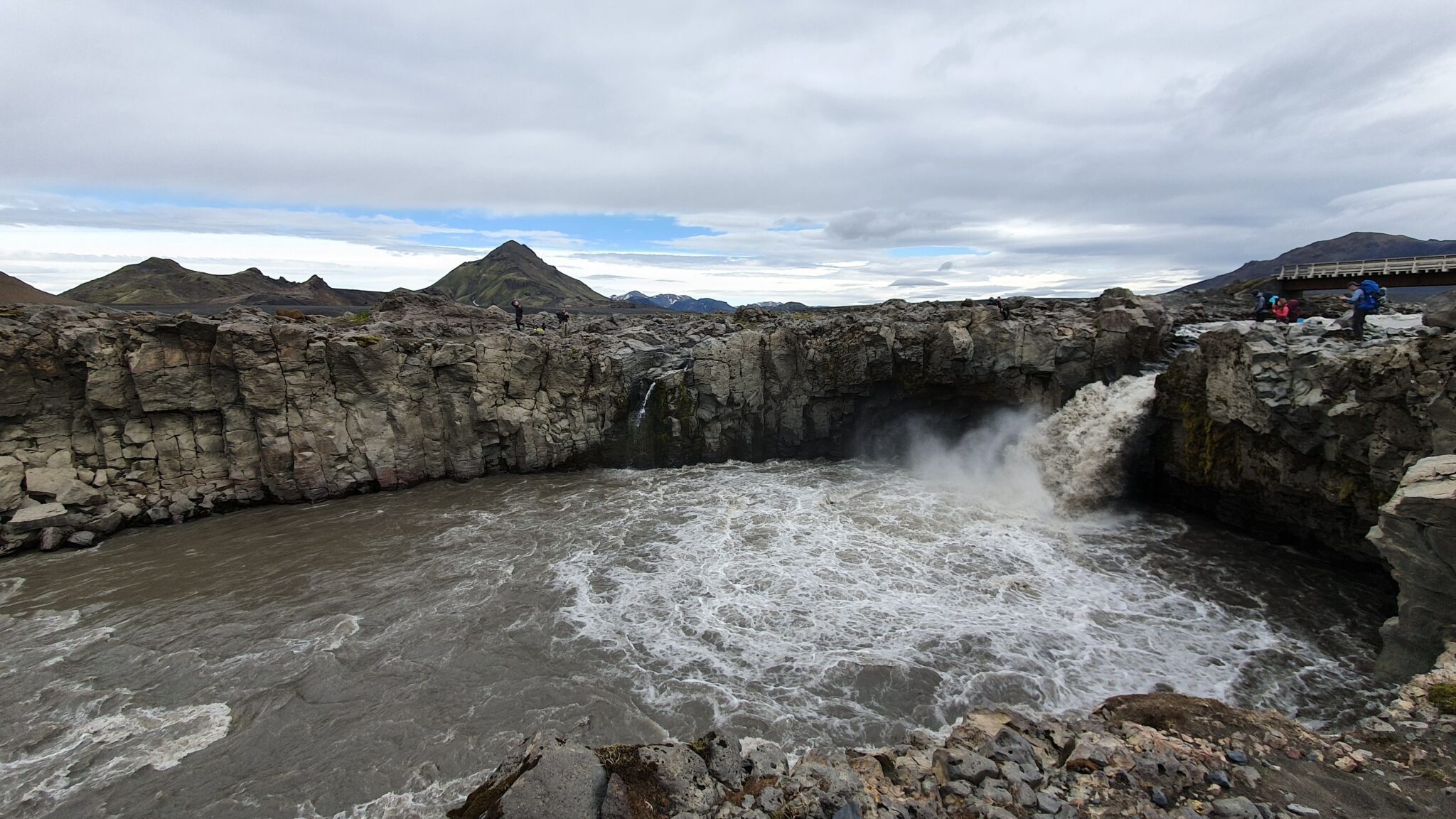
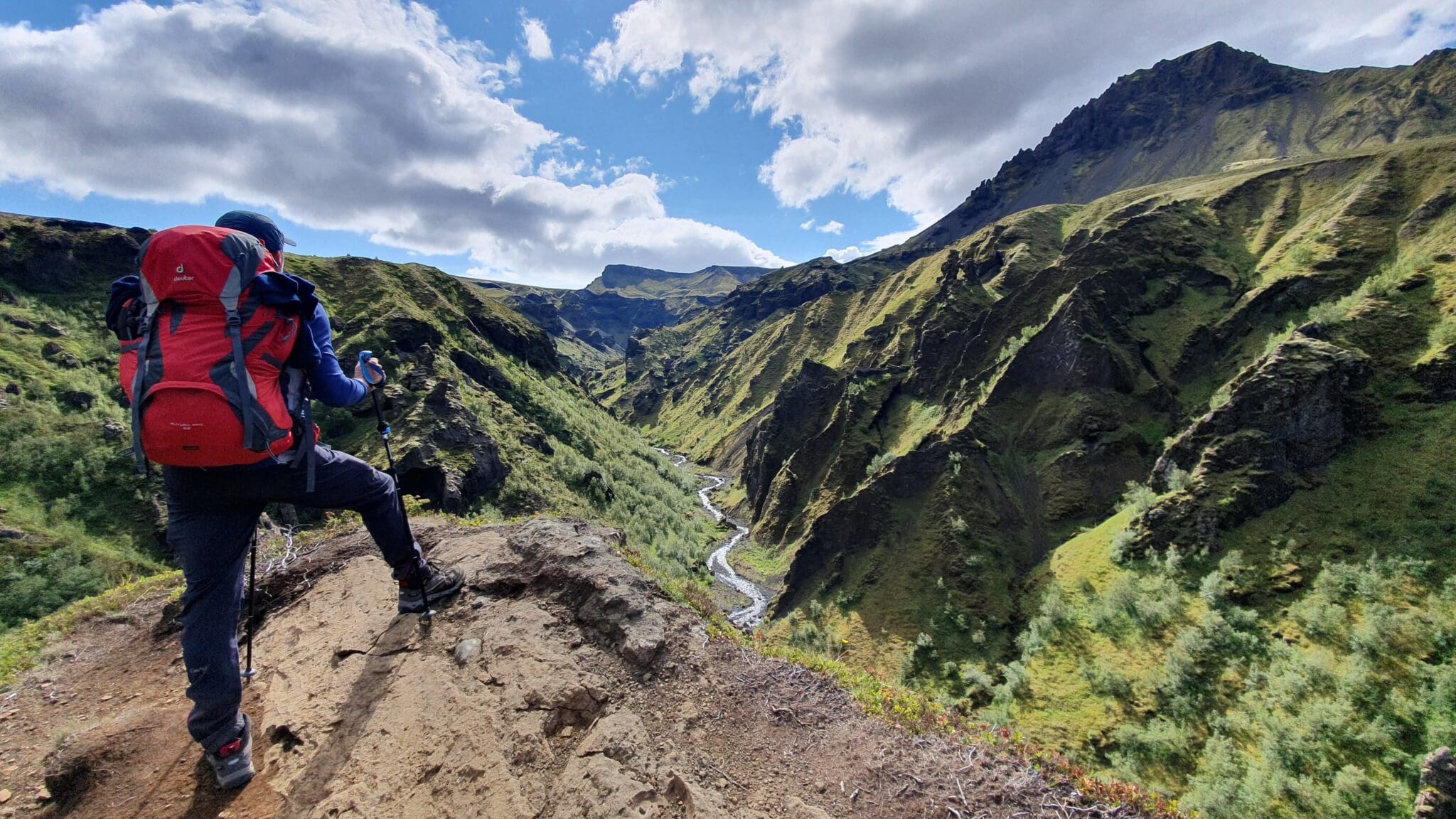
真正的冒险开始了!在吃完早点早餐并收拾帐篷后,我们将开始徒步旅行,今天,我们将走最远的距离,徒步穿过Laugahraun熔岩场,向Stórihver的地热区上升。这一段可以欣赏到山谷的全景,在晴朗的日子里,您可以看到周围的冰川。.
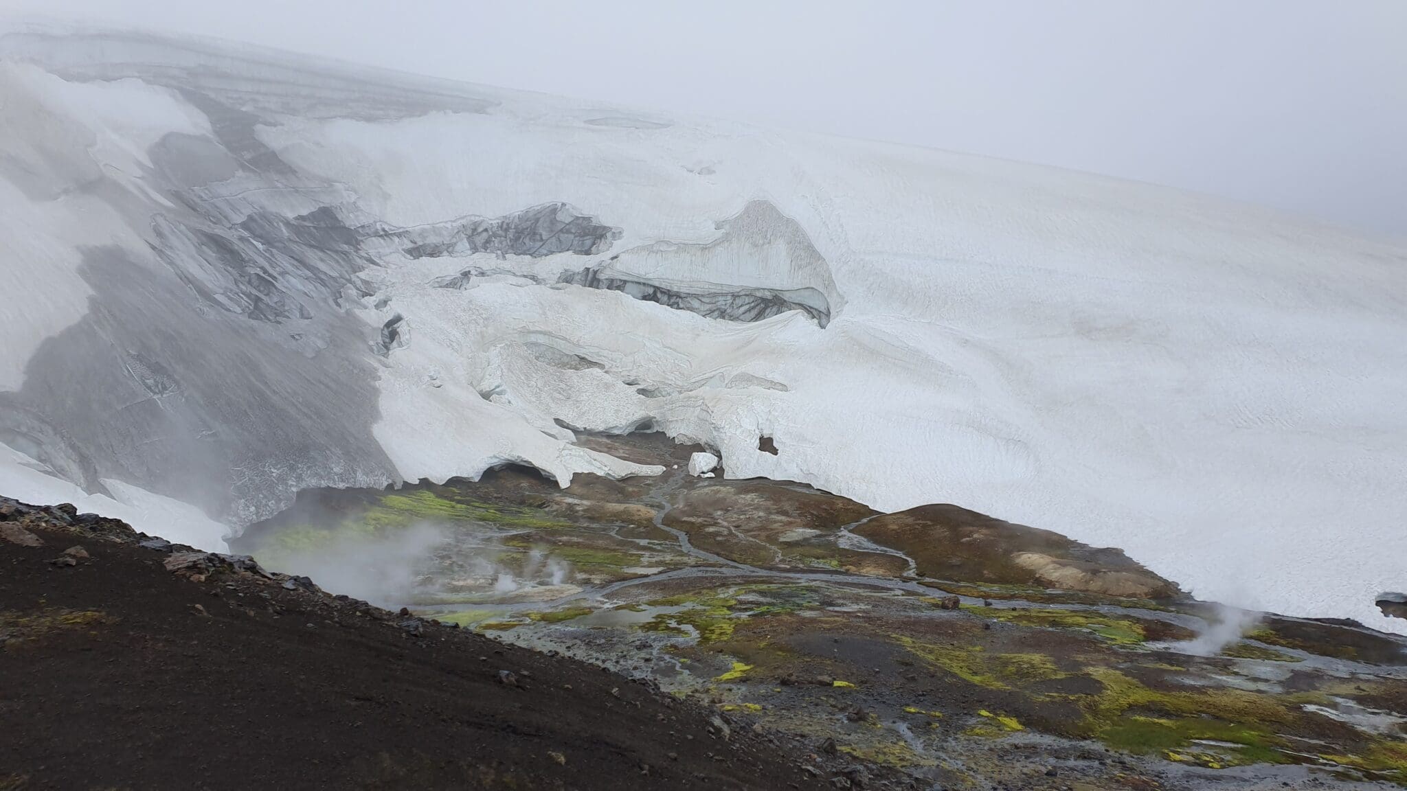
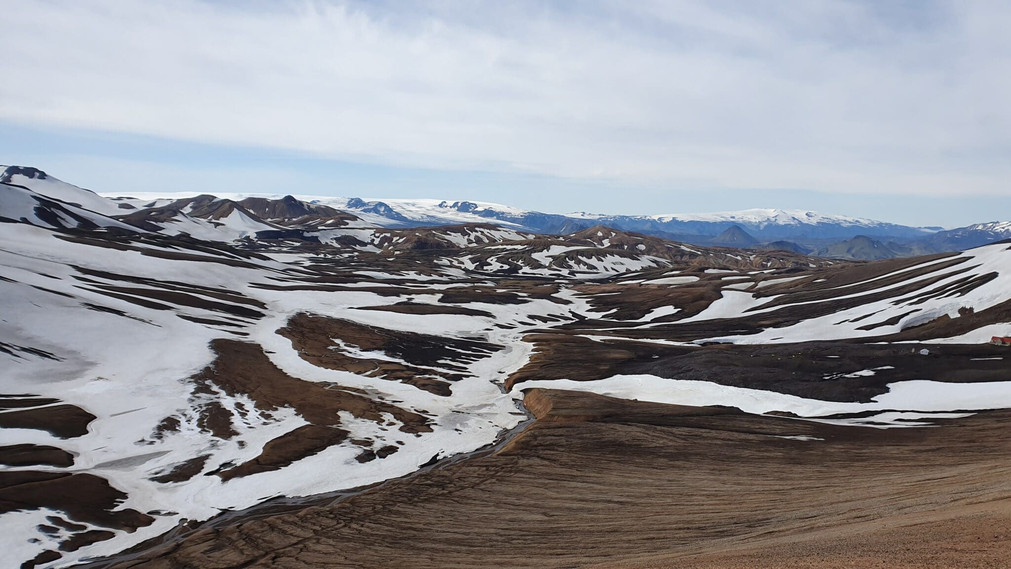
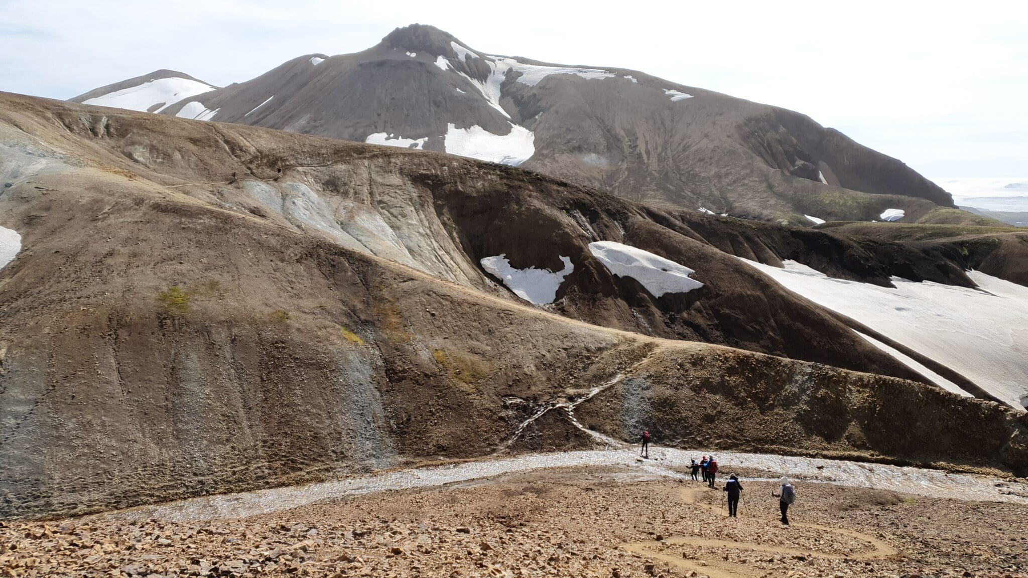
赫拉芬廷努斯克
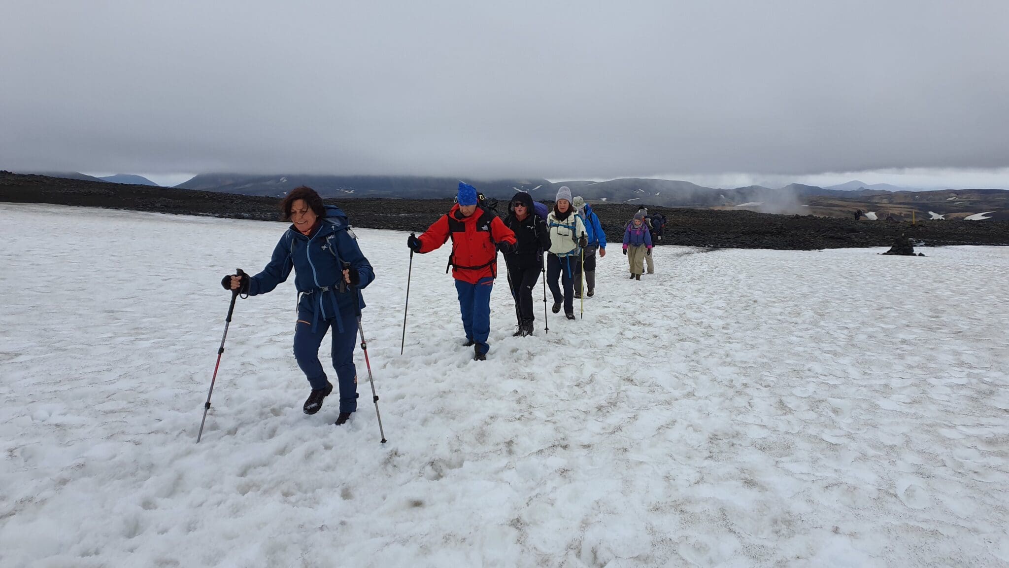
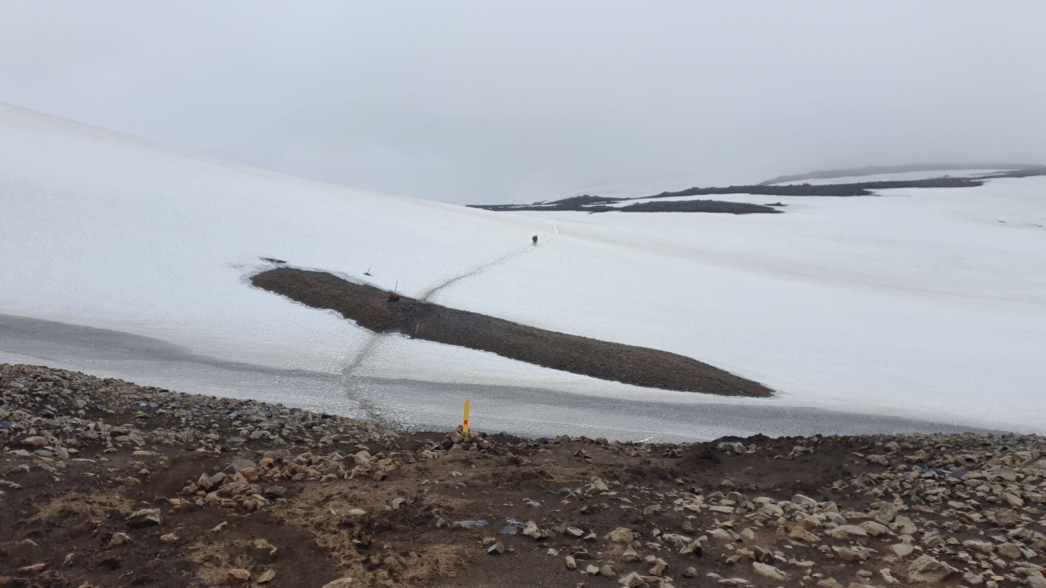
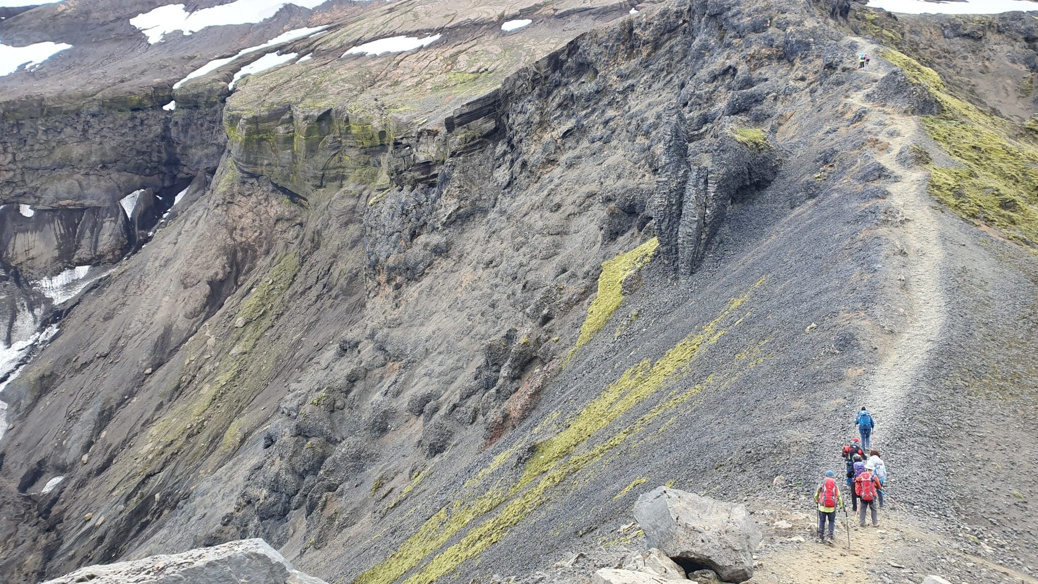
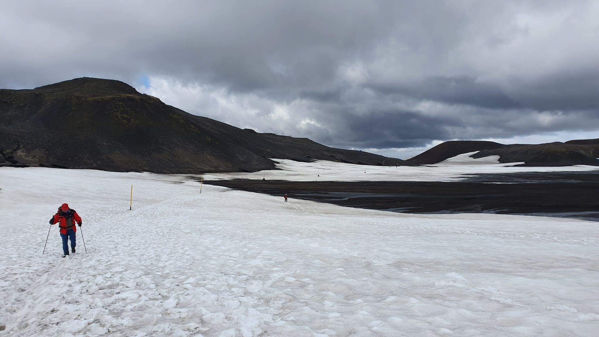
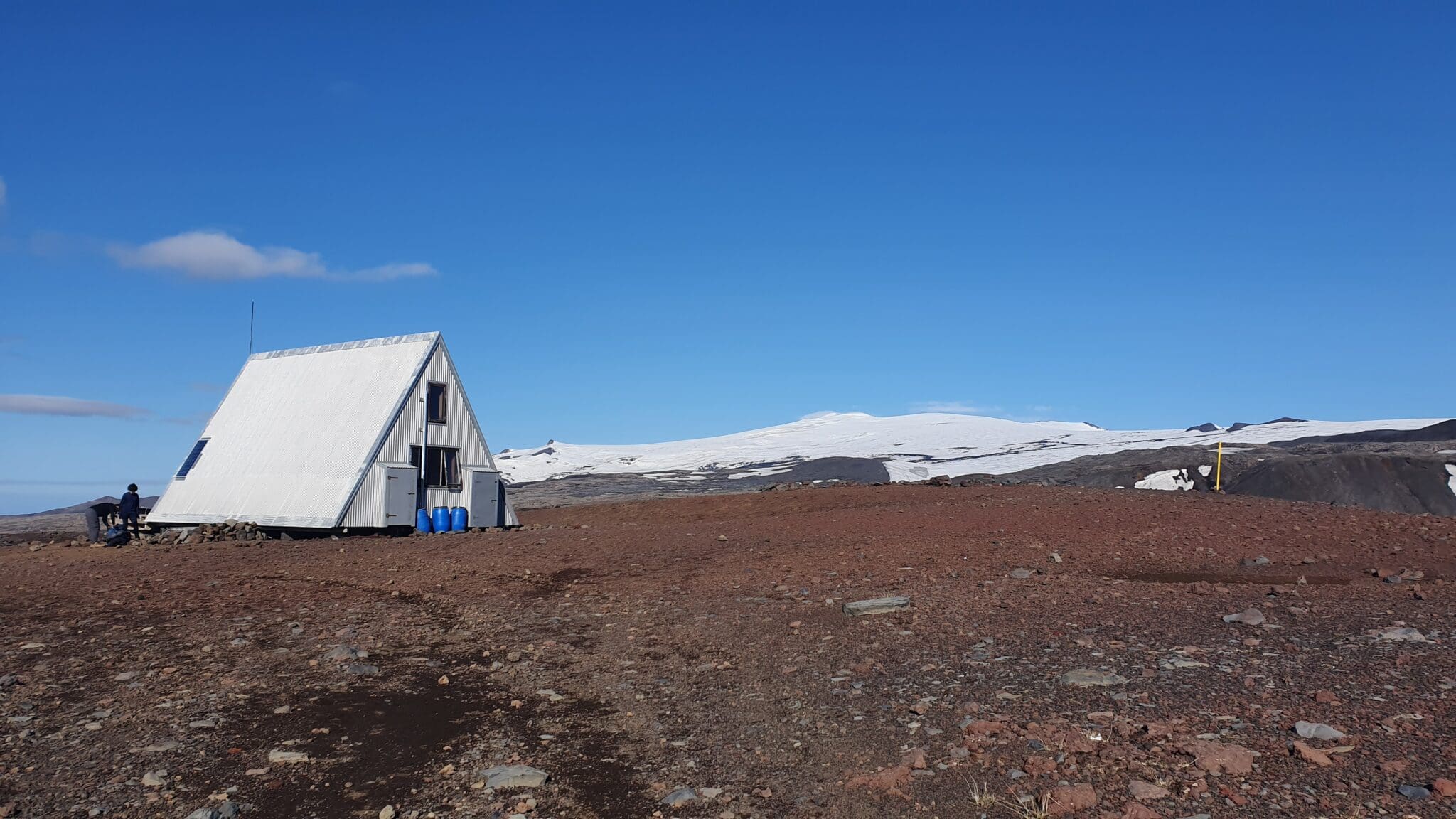
升(ascend),景观变化极大,我们将到达赫拉芬廷努斯克(Hrafntinnusker),这里以令人印象深刻的黑色黑曜石沉积而闻名,赫拉芬廷努斯克还设有Höskuldsskáli山间小屋,但我们会继续我们的路线,在这个地区,雪和冰层即使在夏季也能保留下来,创造出近乎超现实的景观。.
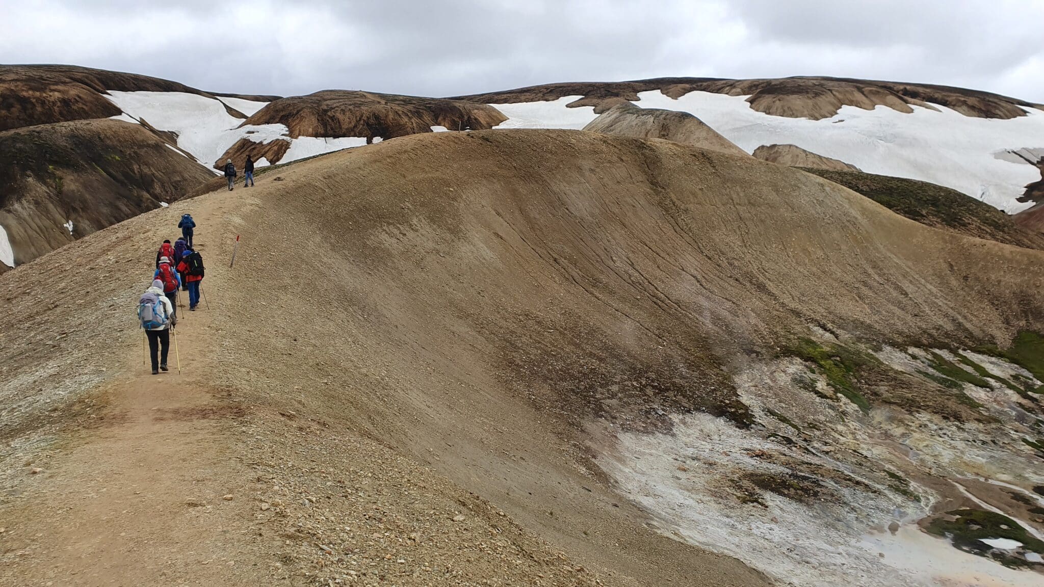
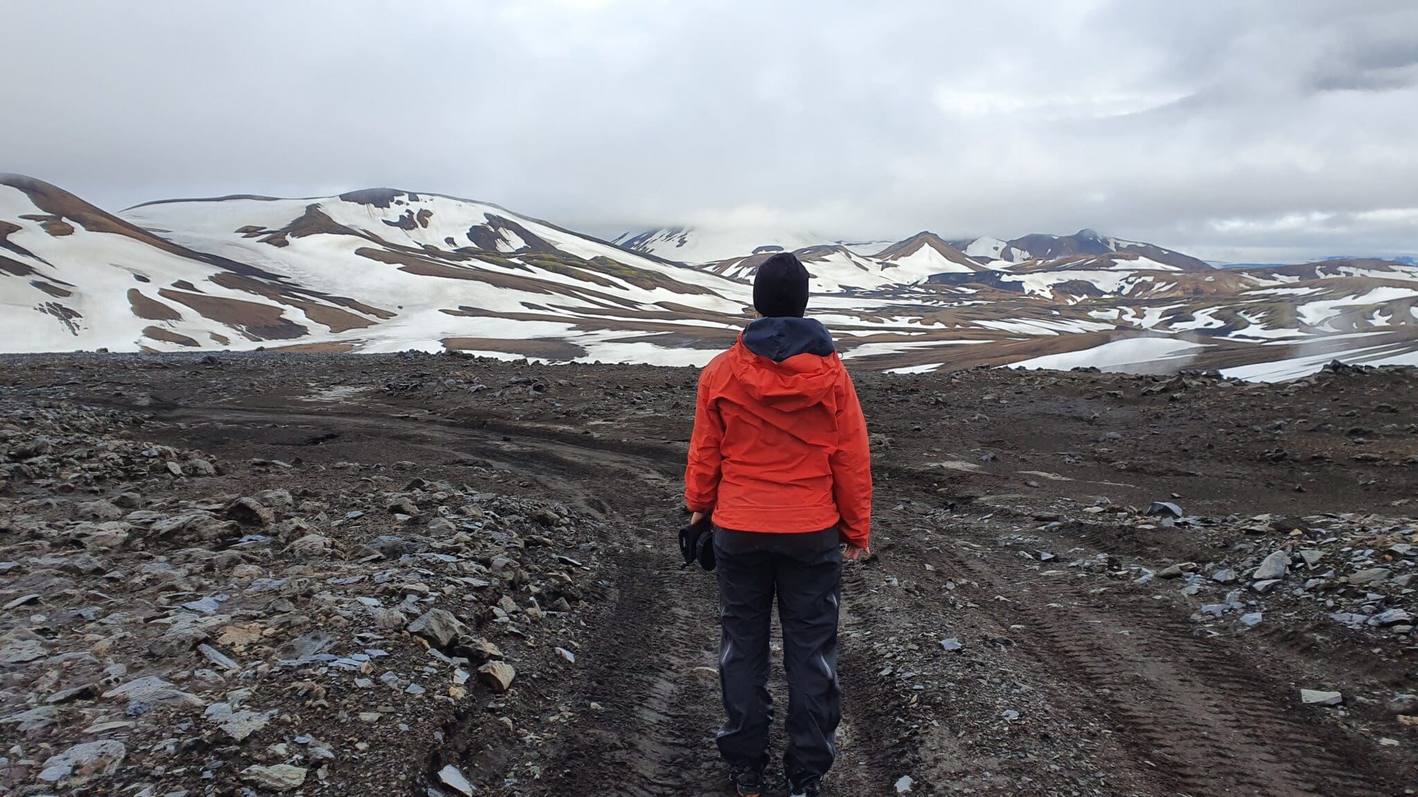
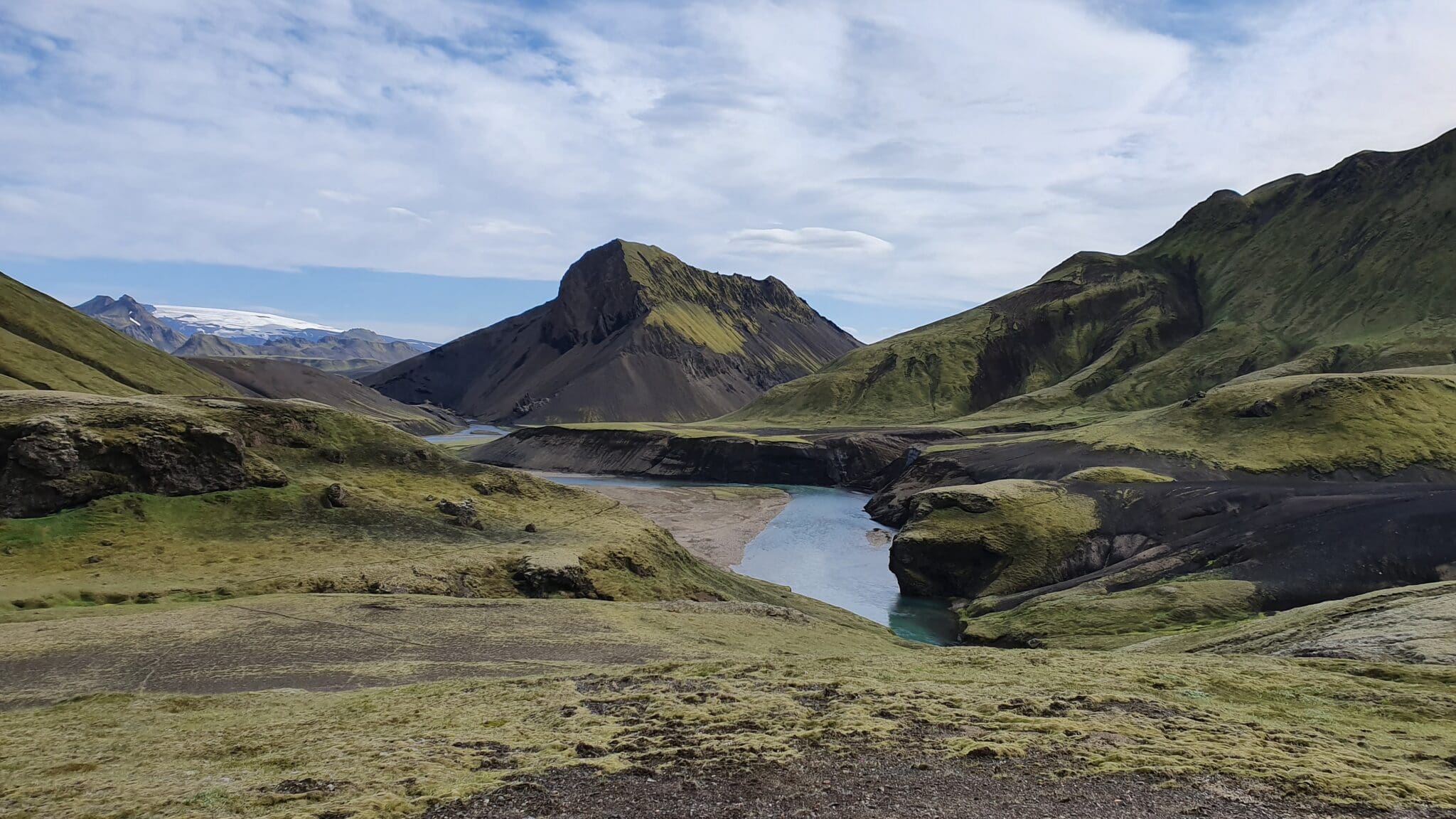
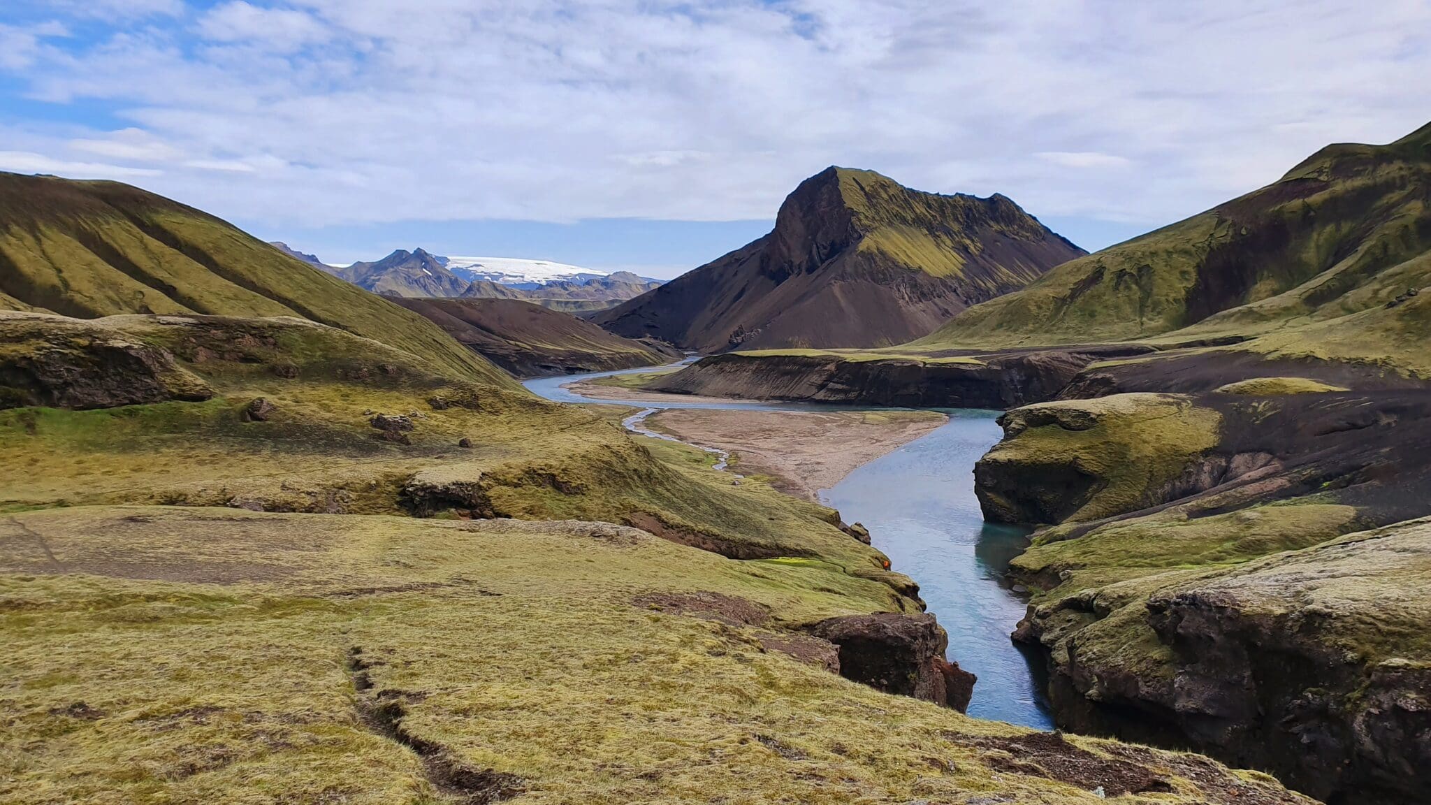
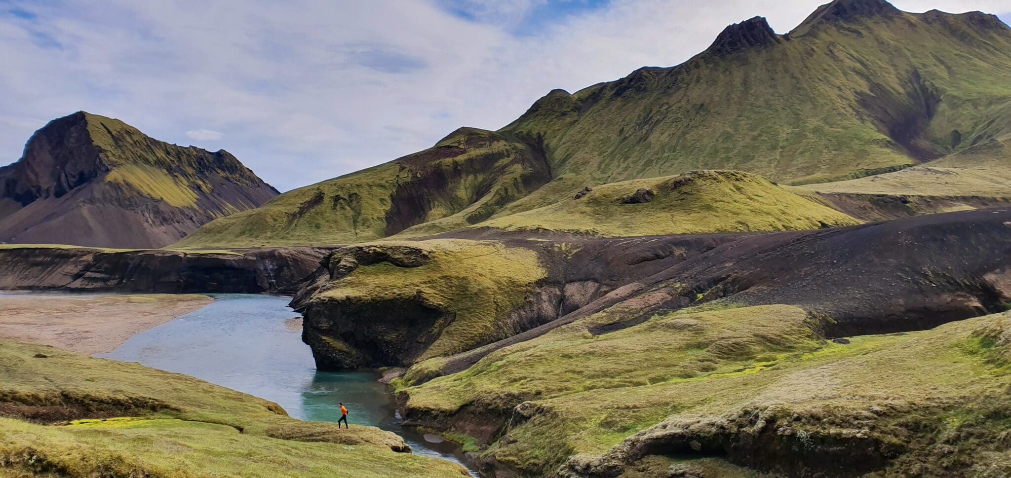
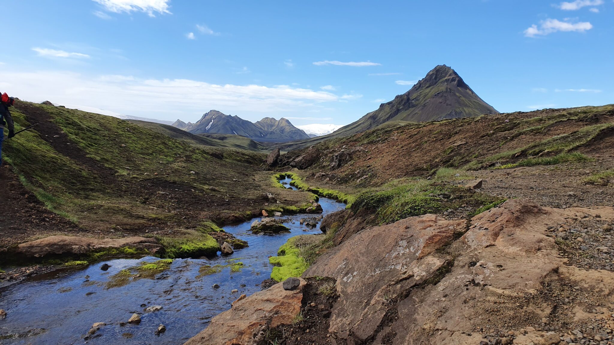
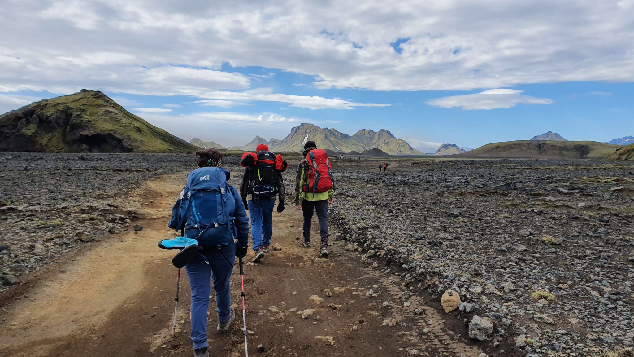
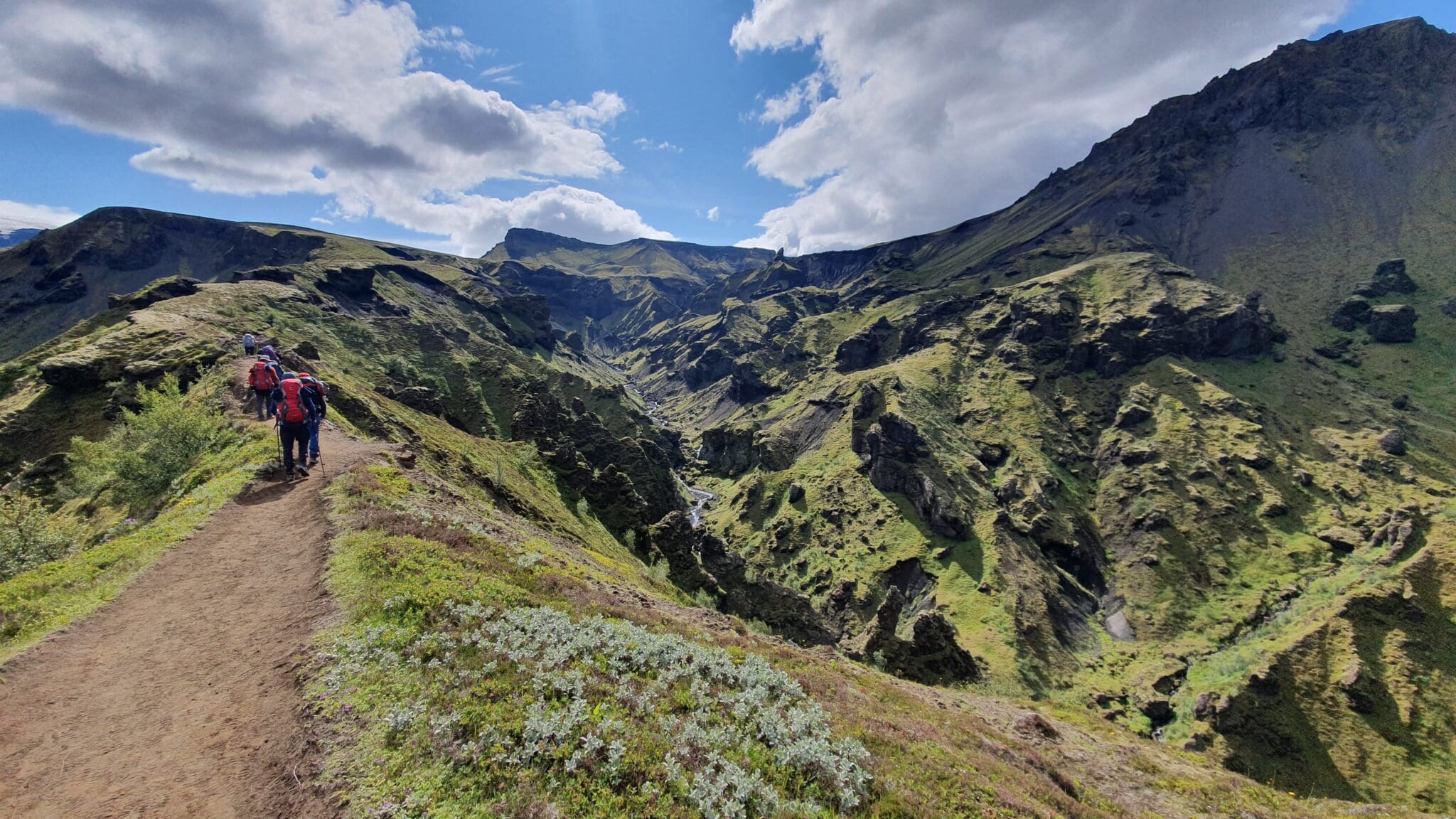
约库通古尔
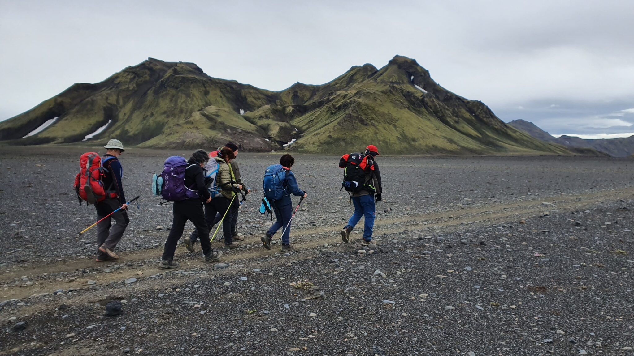
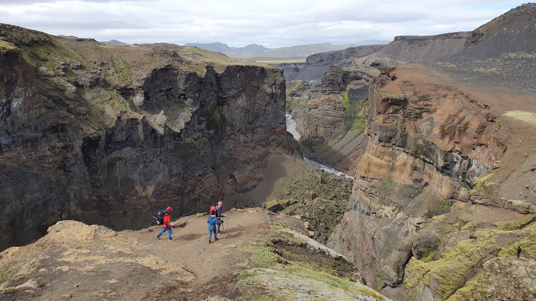
Hrafntinnusker到阿尔夫塔瓦特恩的步道开始下降到约库尔通古尔山谷,这里以美丽的山地地层和色彩缤纷的沉积物而闻名,在这里,你会发现溪流和小湖泊,植物群随着下降而变化,有更多的植被和野花。.
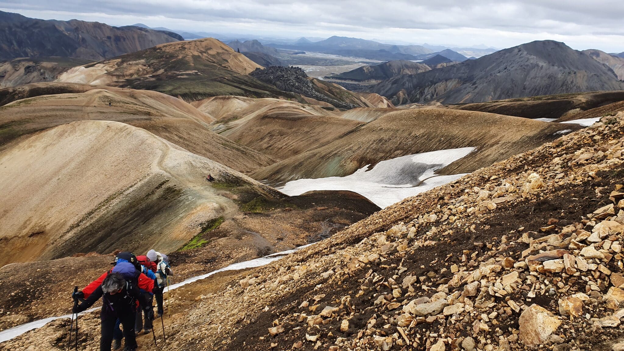
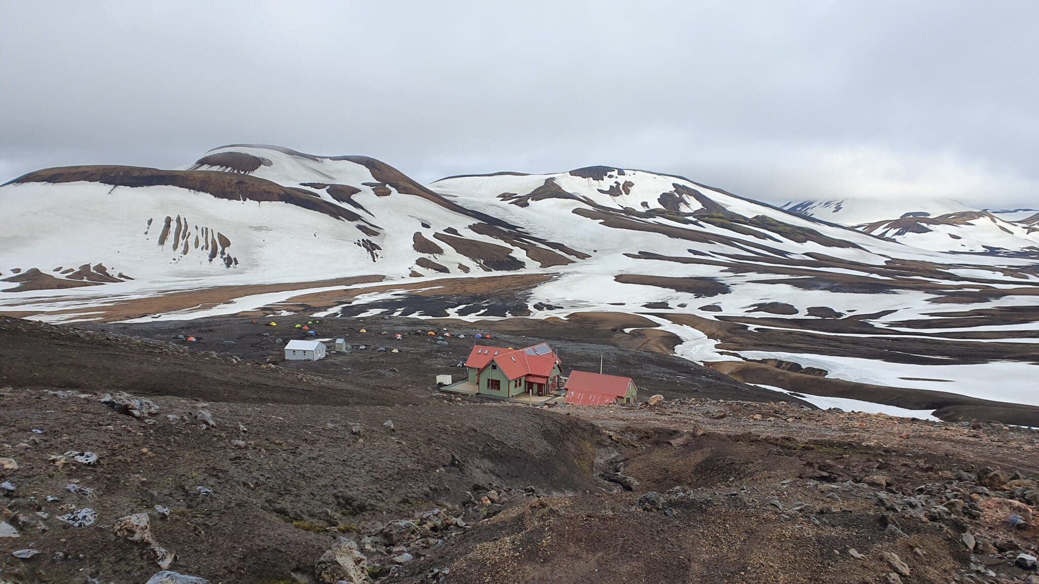
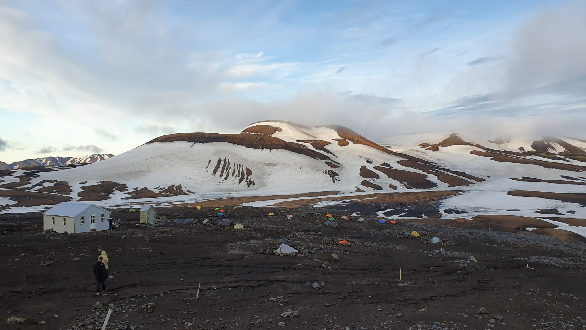
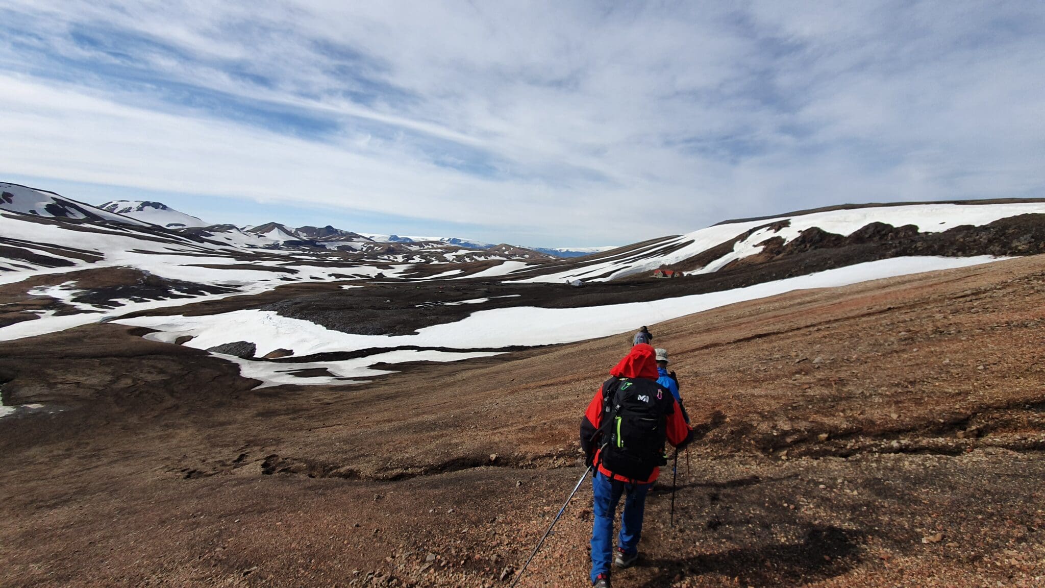
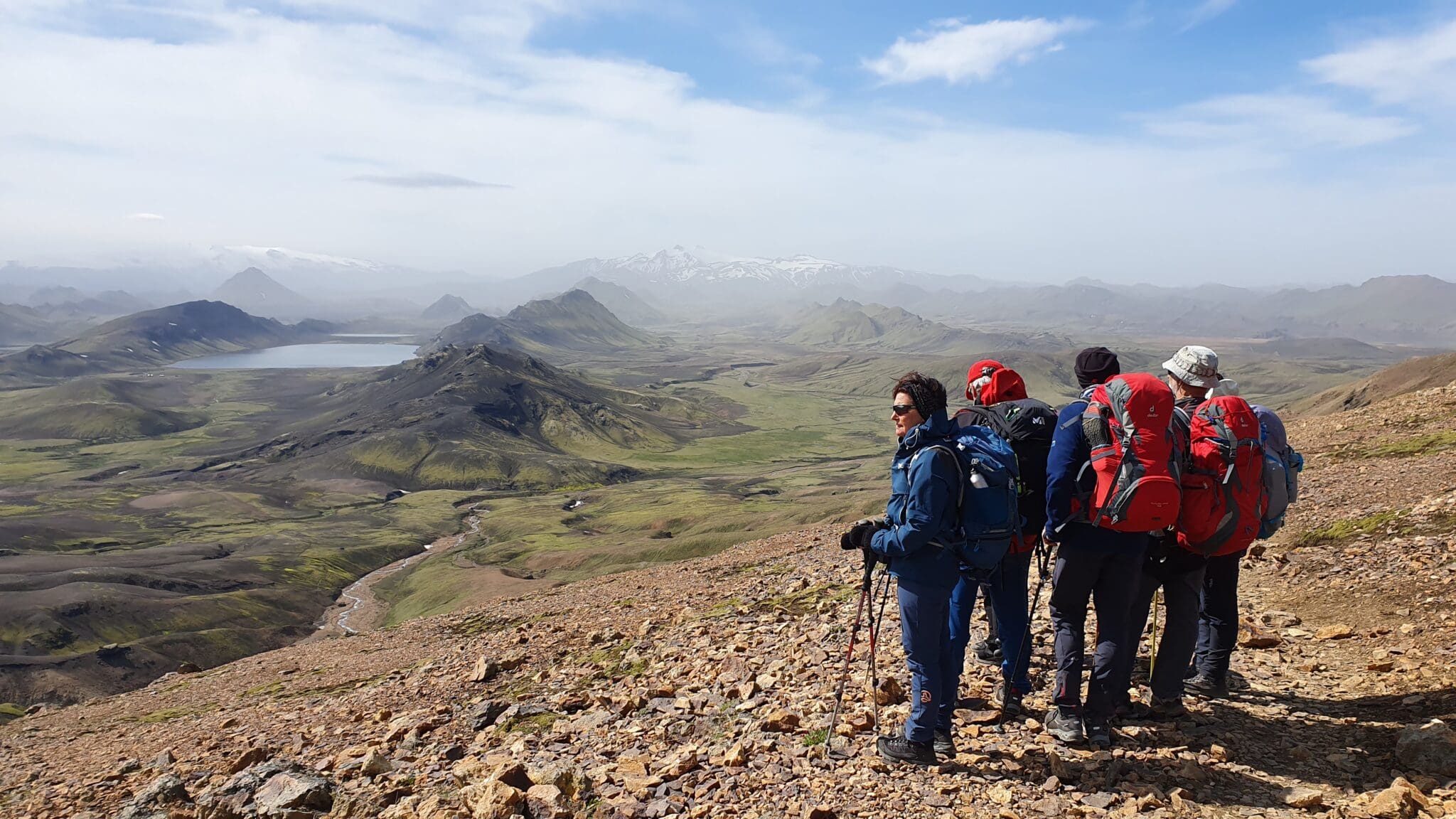
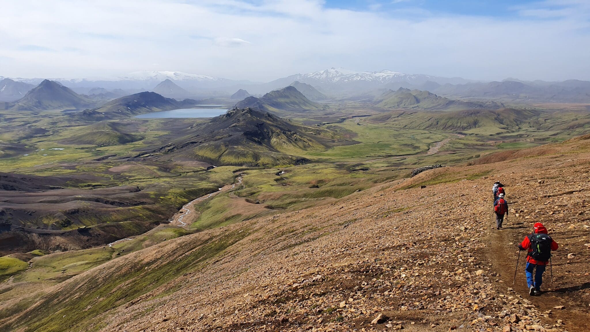
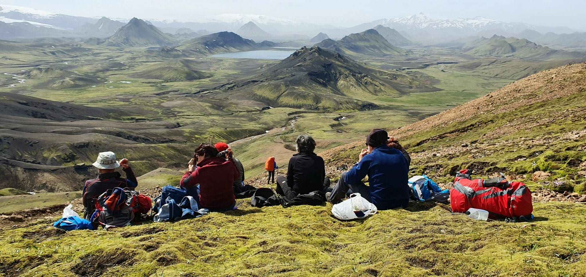
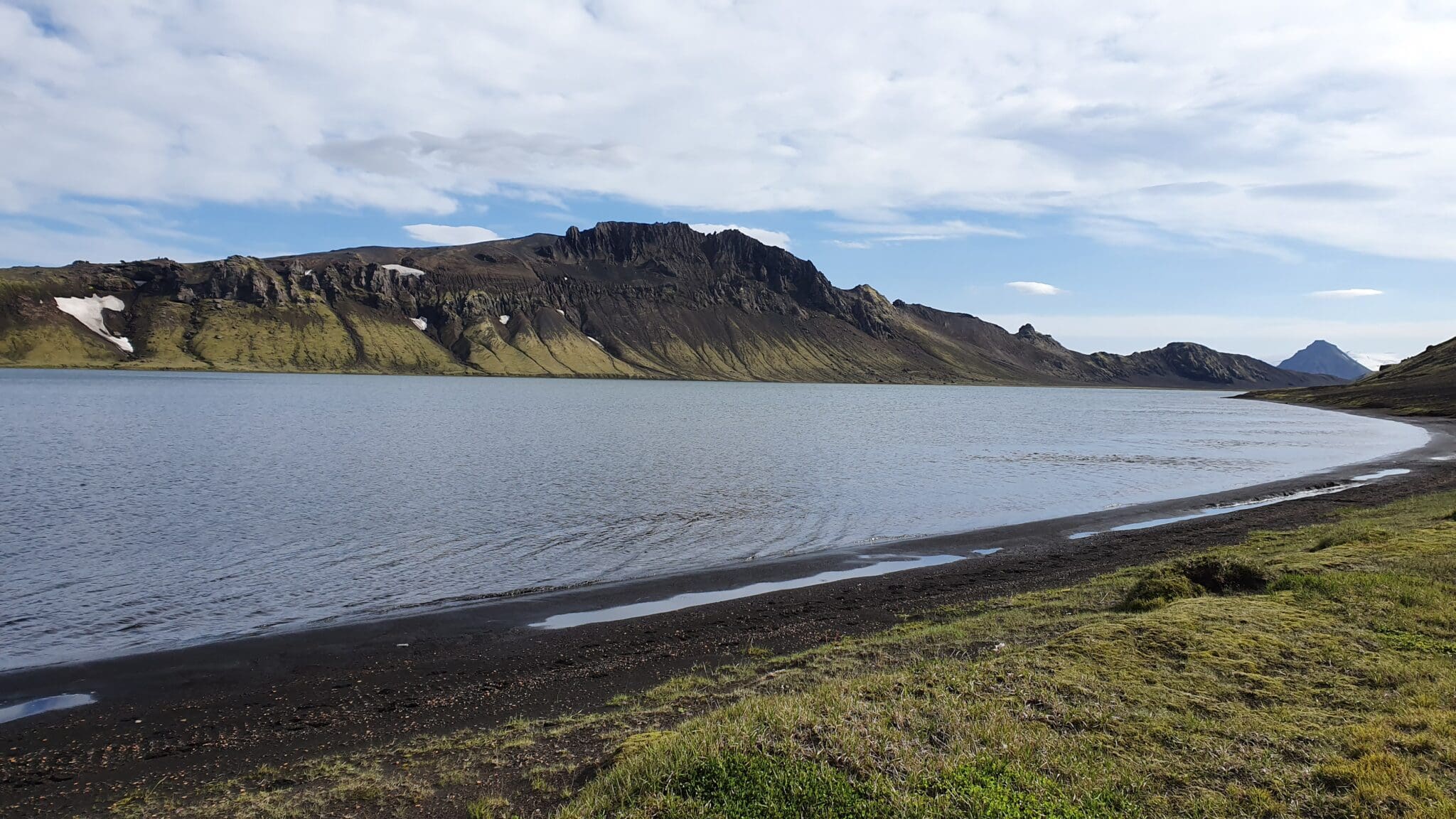
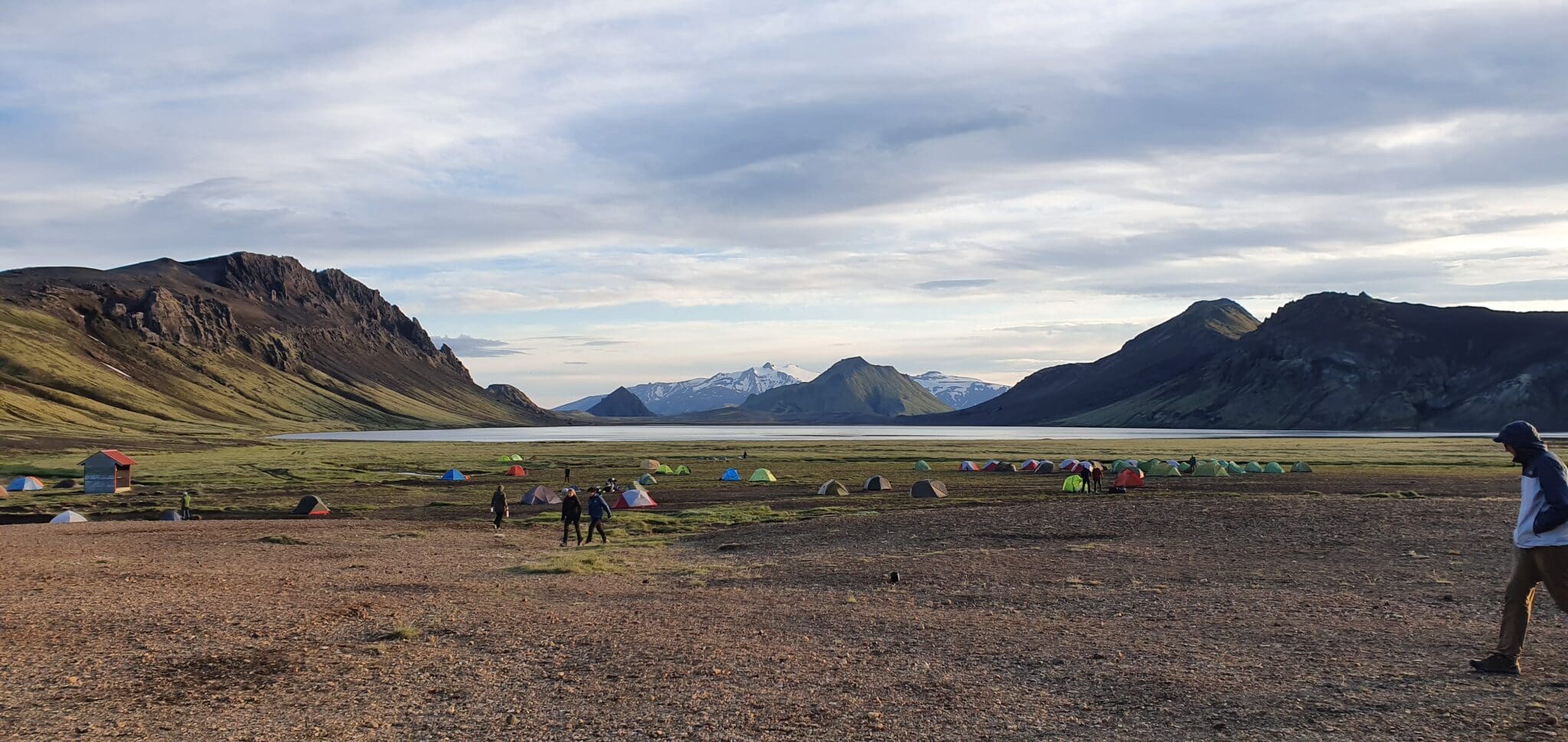
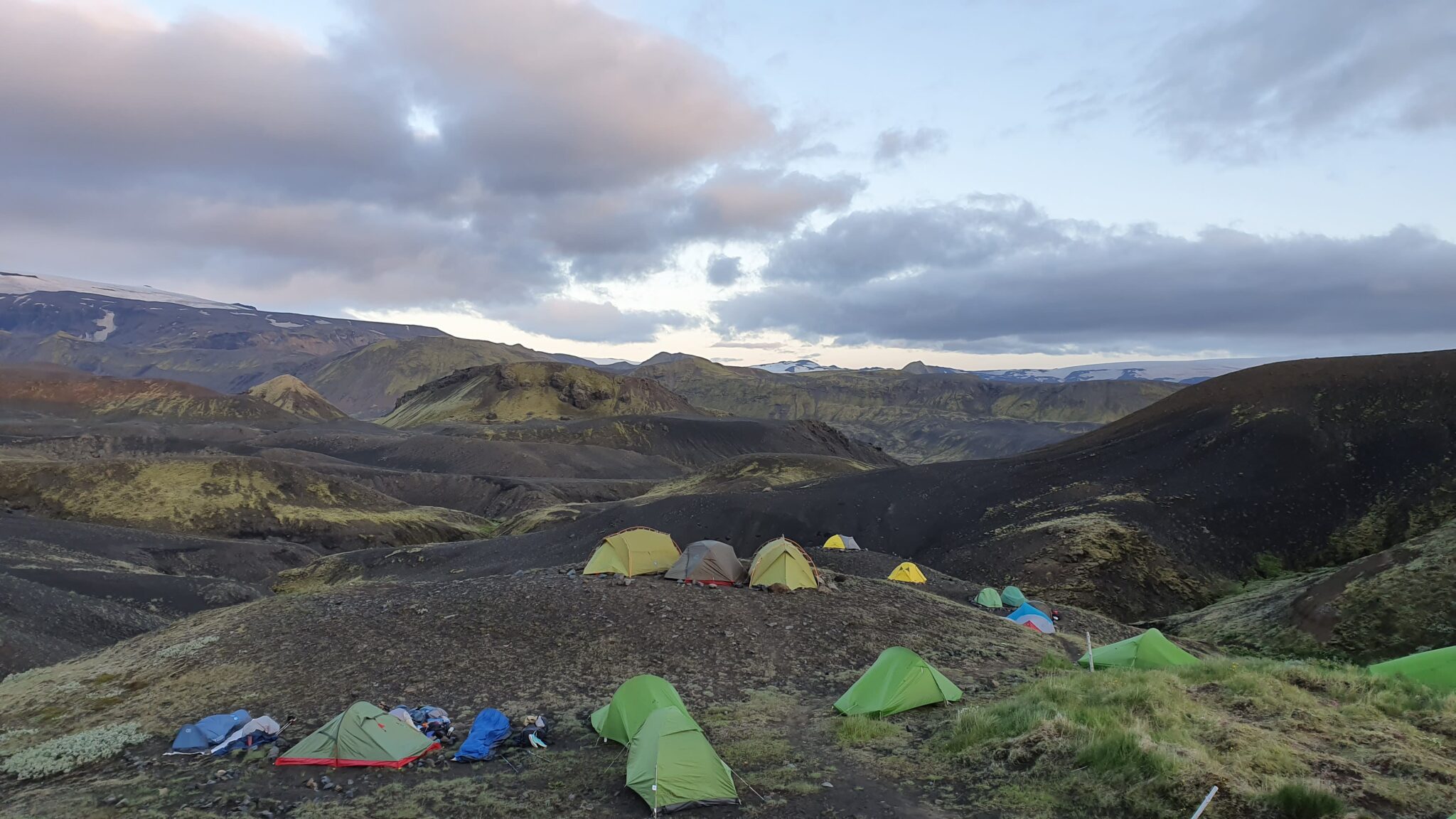
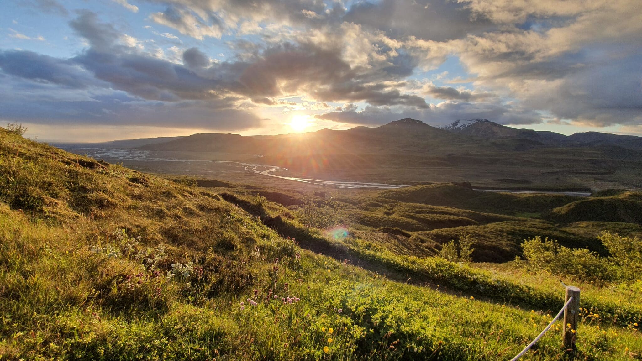
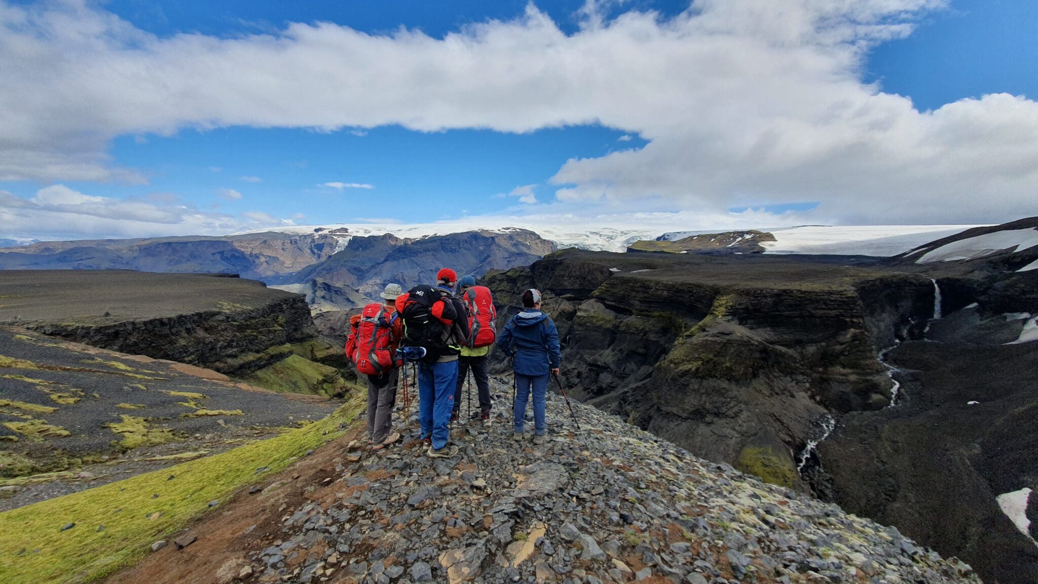
阿尔夫塔瓦特恩
Lake allftavatn结束的路段,四周群山环绕,风景宁静, álftavatn,意为“天鹅湖”是徒步后我们会露营放松的地方, 背景是群山的湖景是路线的亮点之一。.
距离:24公里
上升:629米
血统:692米
持续时间:8-9小时
阿尔夫塔瓦特恩
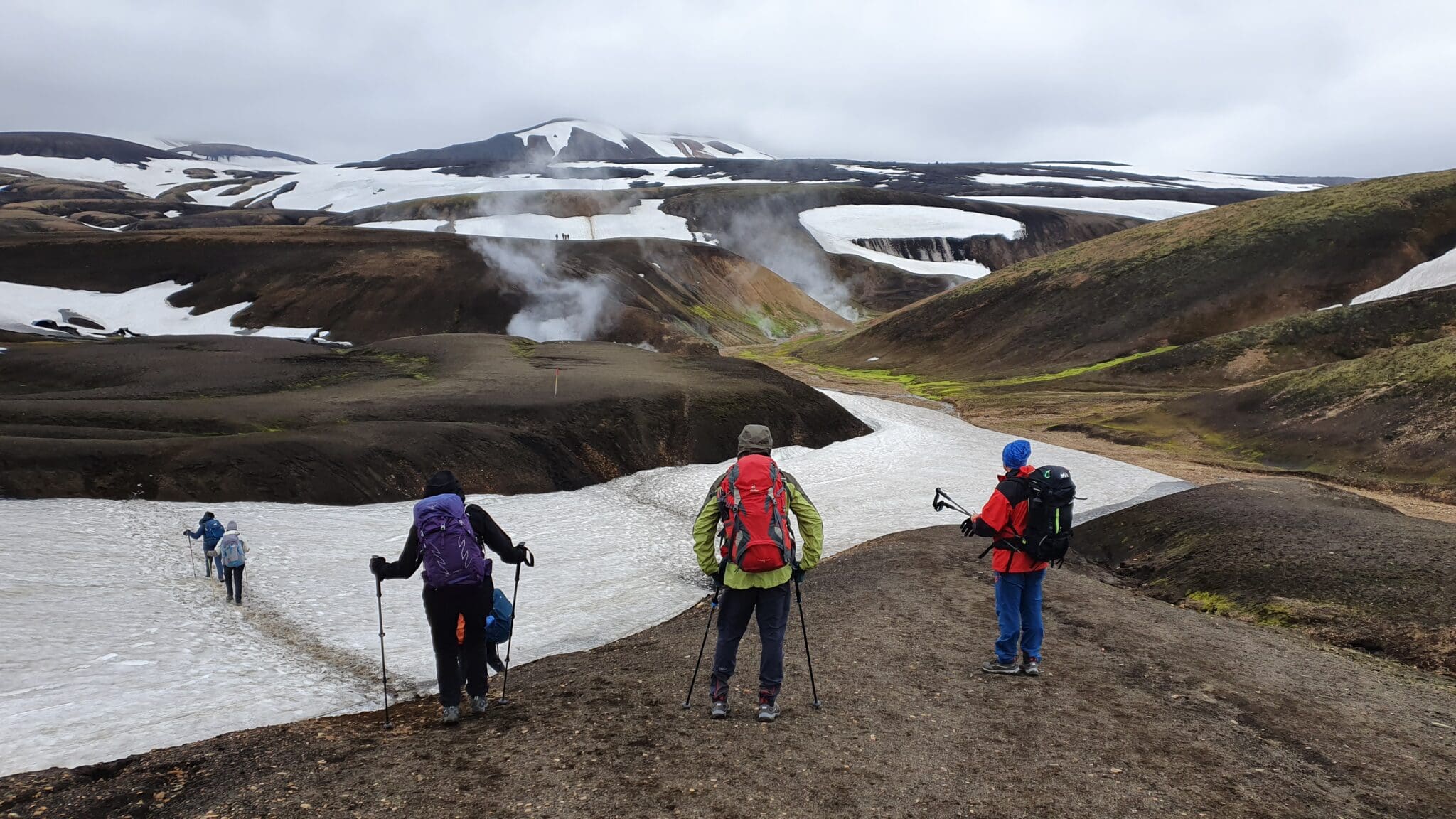
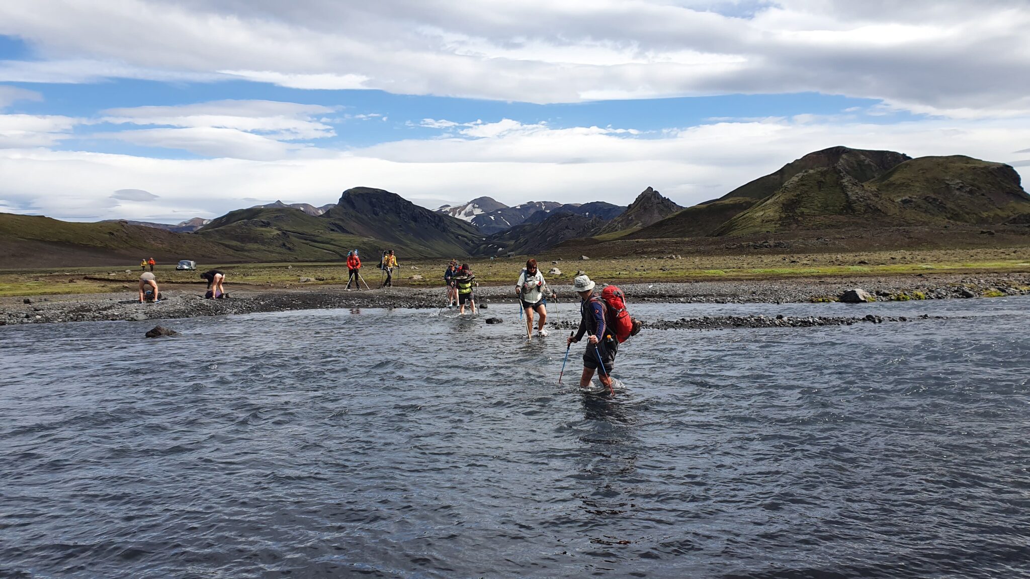
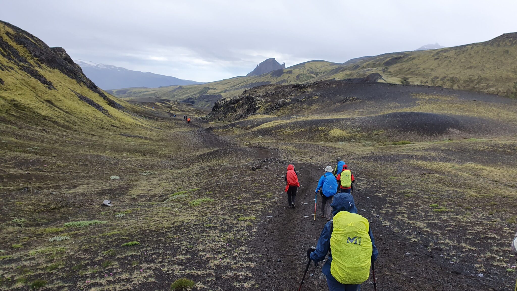
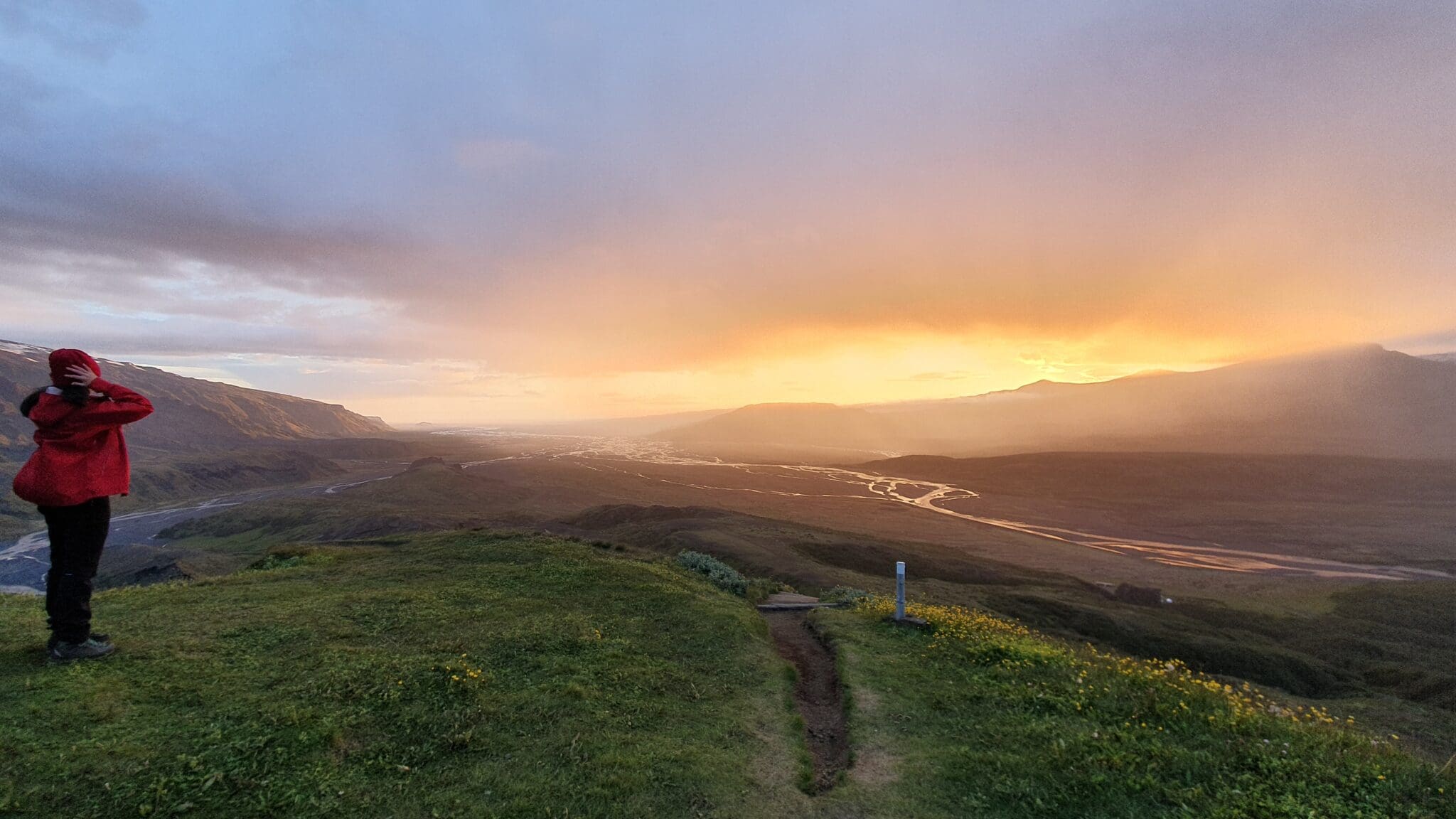
(Alftavatn)到埃姆斯特鲁尔(Emstrur)的徒步旅行始于阿尔夫塔瓦特湖(Lake allftavatn)美丽的环境,周围环绕着山脉和绿色的草地,这个地方非常适合在开始徒步旅行之前享受宁静的日出。.
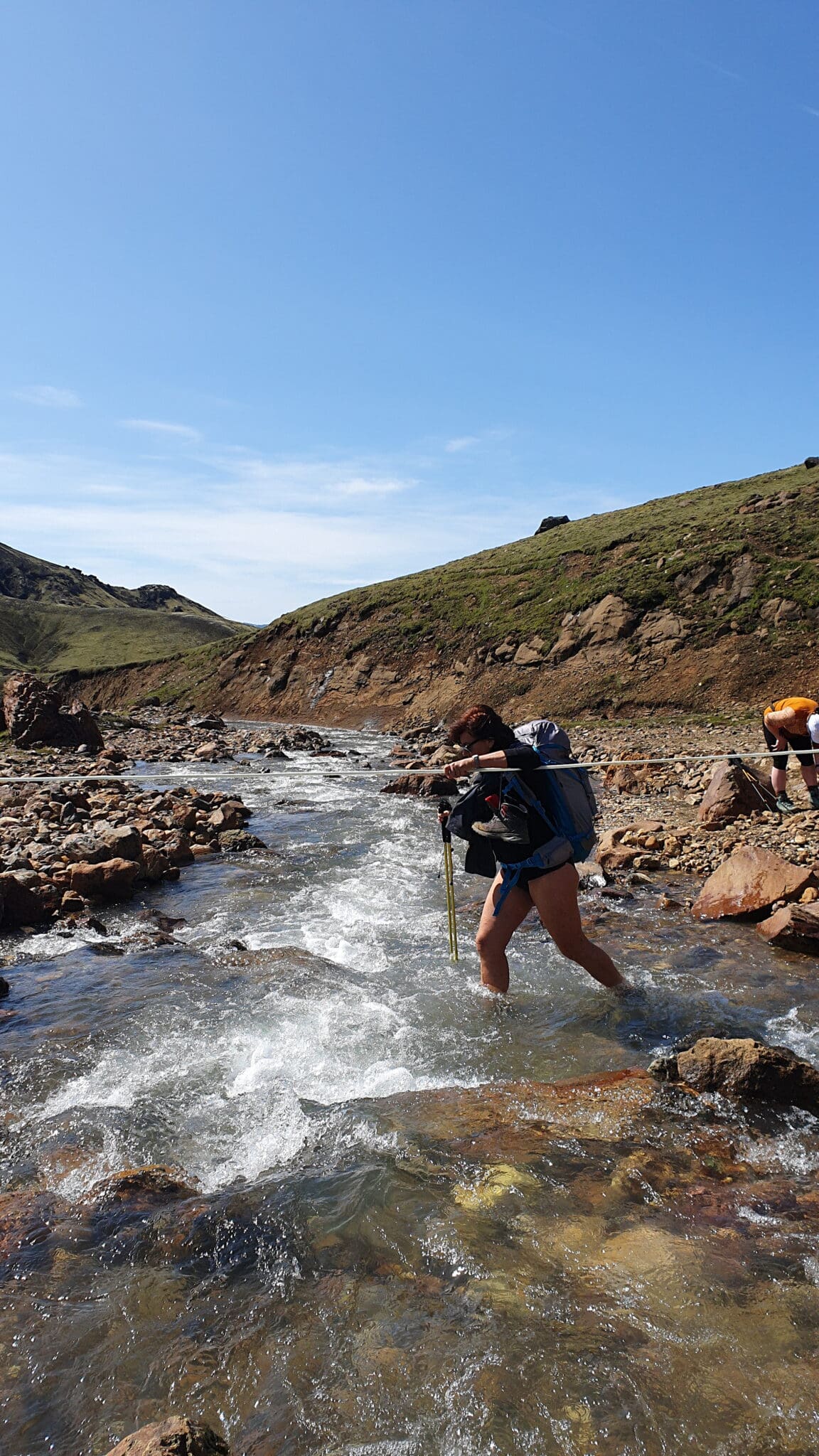
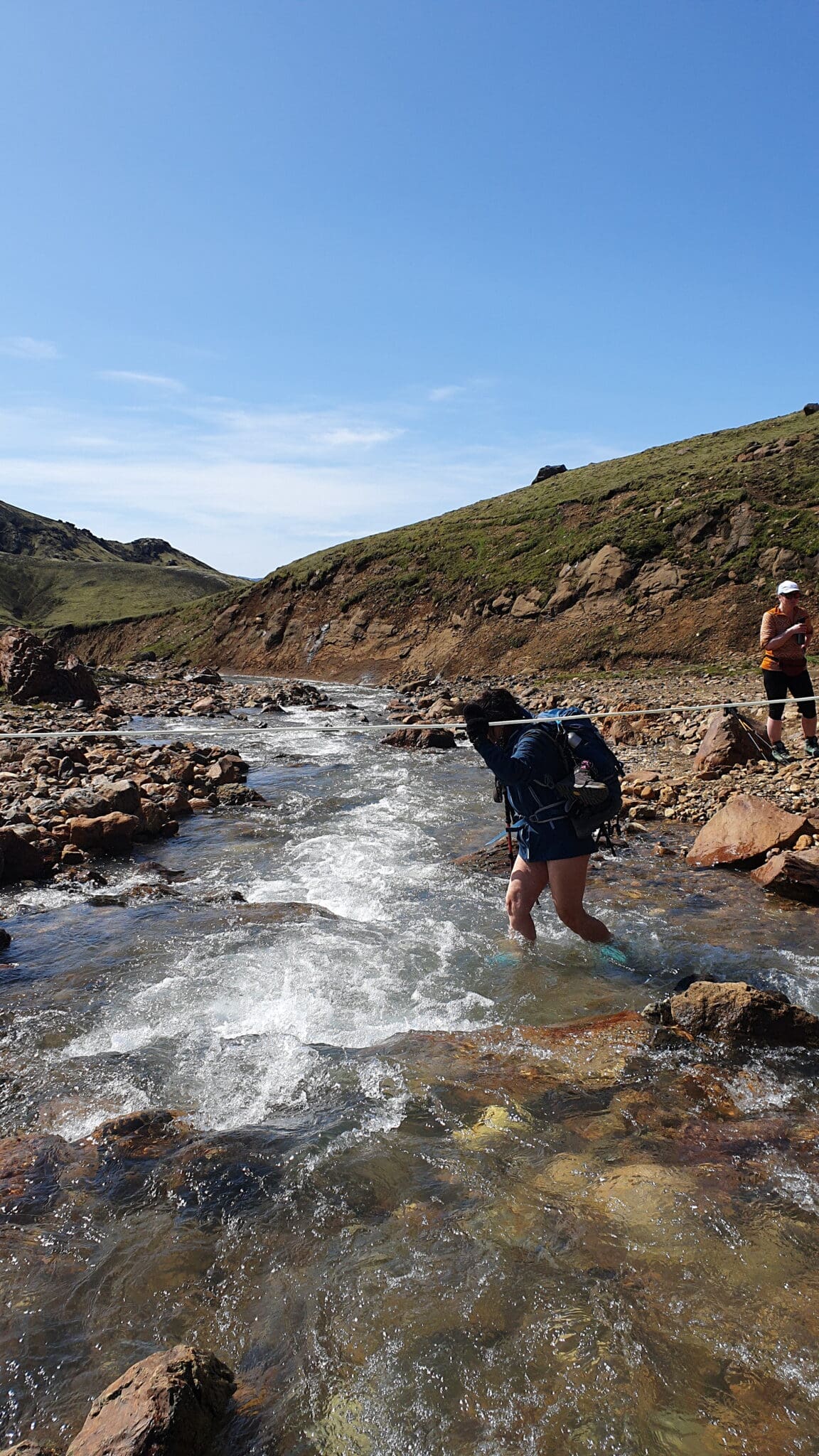
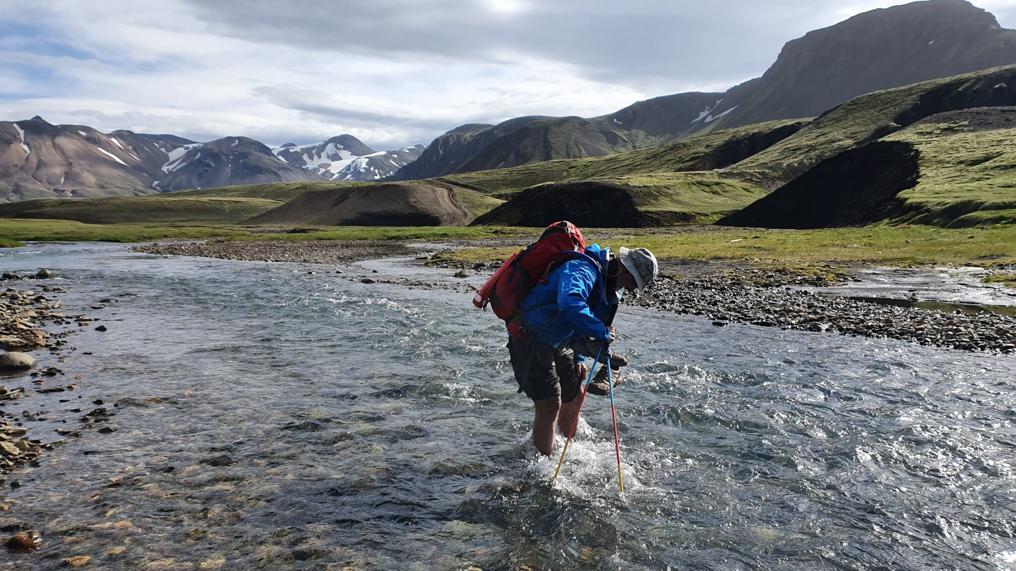
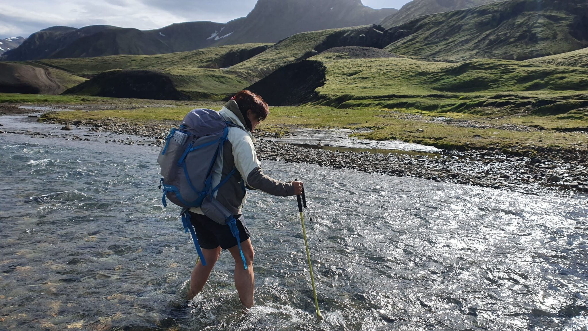
渡布拉萨尔斯河
(Brattháls)河流渡口继续前进, 在那里您将穿越卡尔达克洛夫斯克维斯尔河(Kaldaklofskvísl), 在这里, 山谷和周围山脉的全景令人惊叹, 这里是停下来拍摄壮观景观的好地方。.
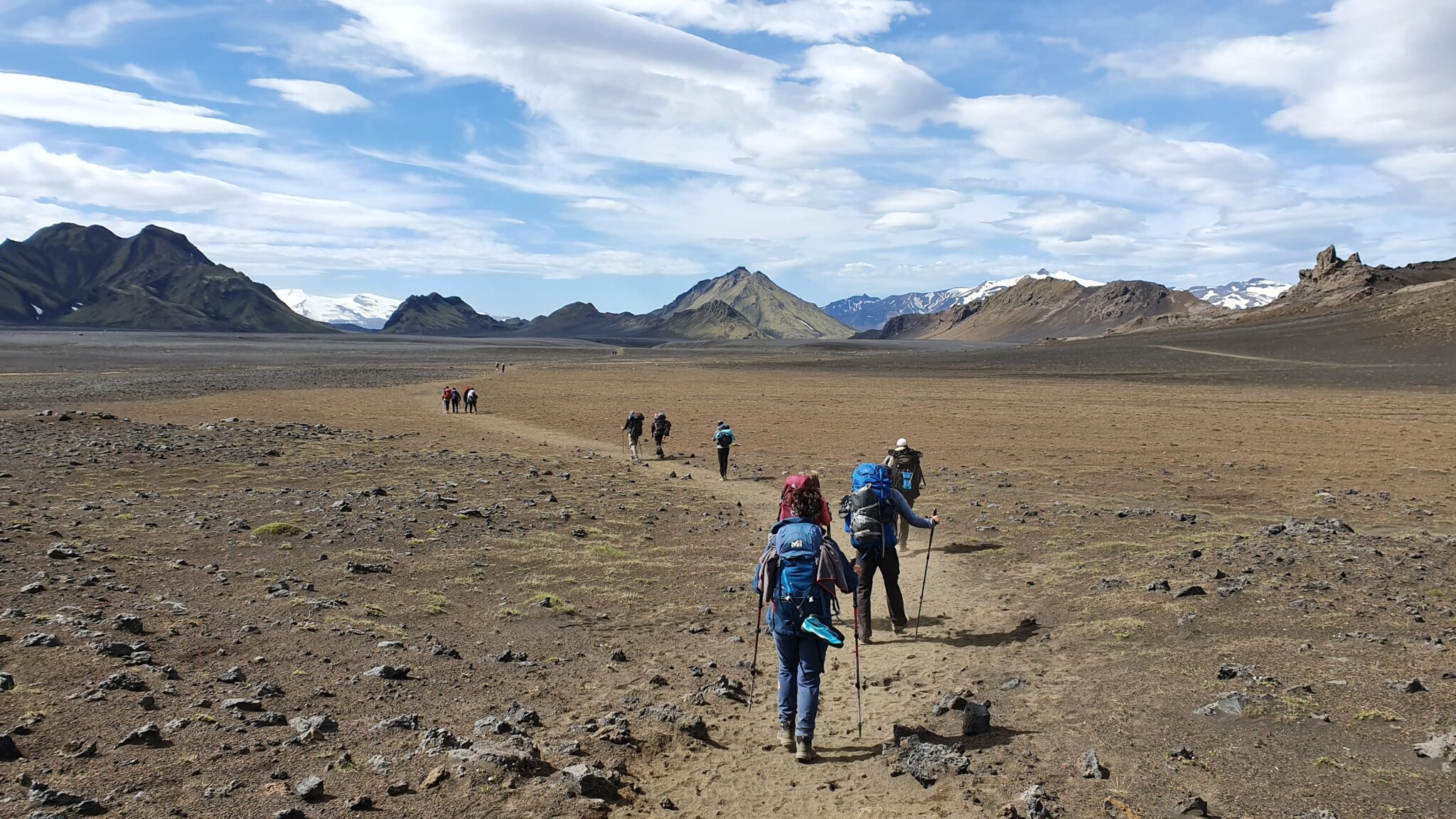
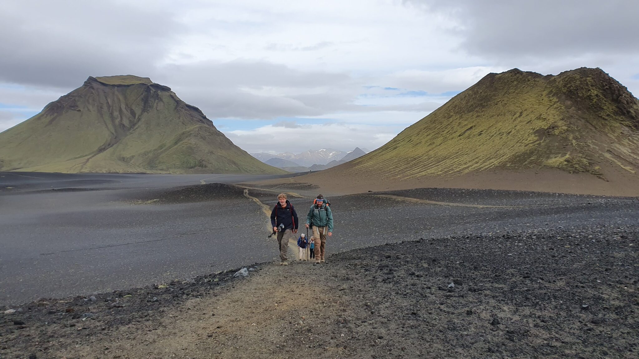
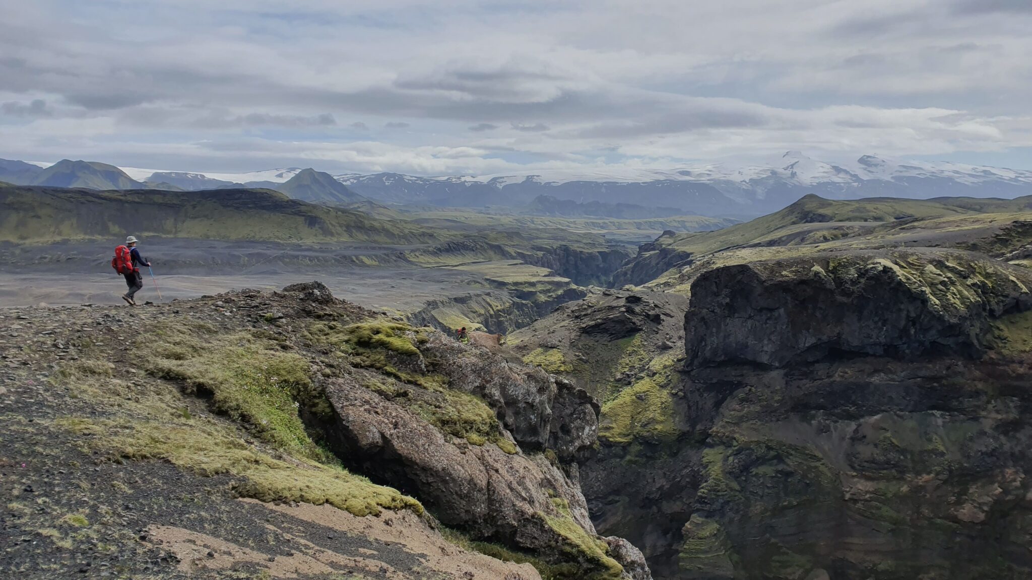
哈塔菲尔和迈里菲尔桑杜尔沙漠
(Marlifellssandur)的黑沙沙漠,过河后徒步旅行将带您穿越,沿途您将经过哈塔菲尔山(Mount Hattafell)附近,这座孤山高耸于沙漠景观之上,形成鲜明对比。.
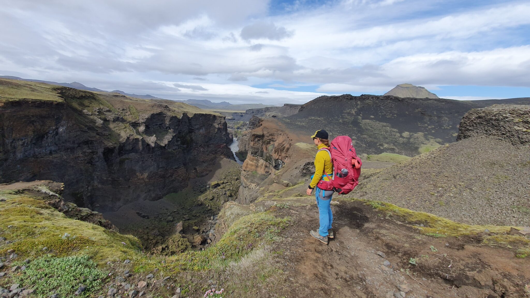
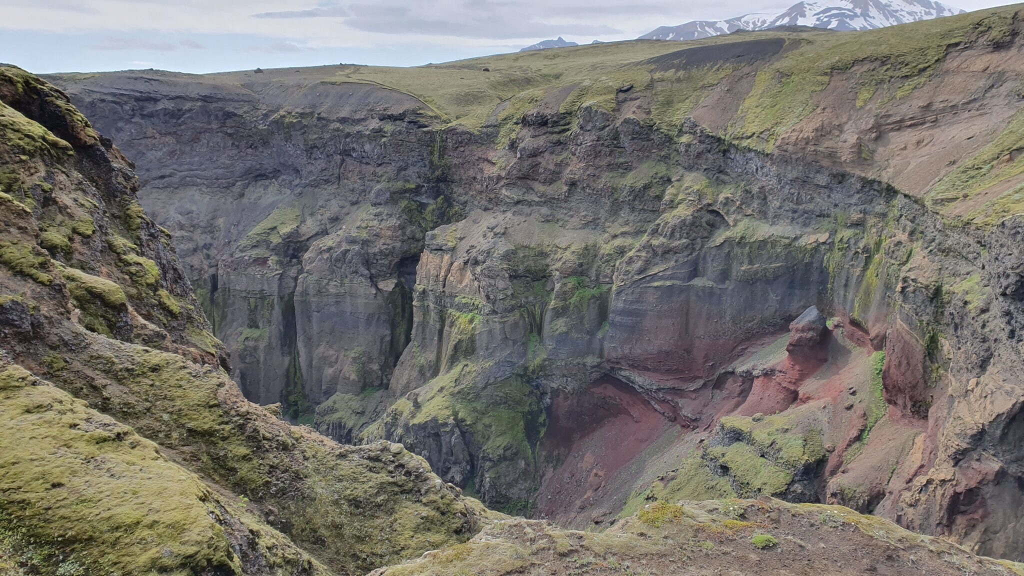
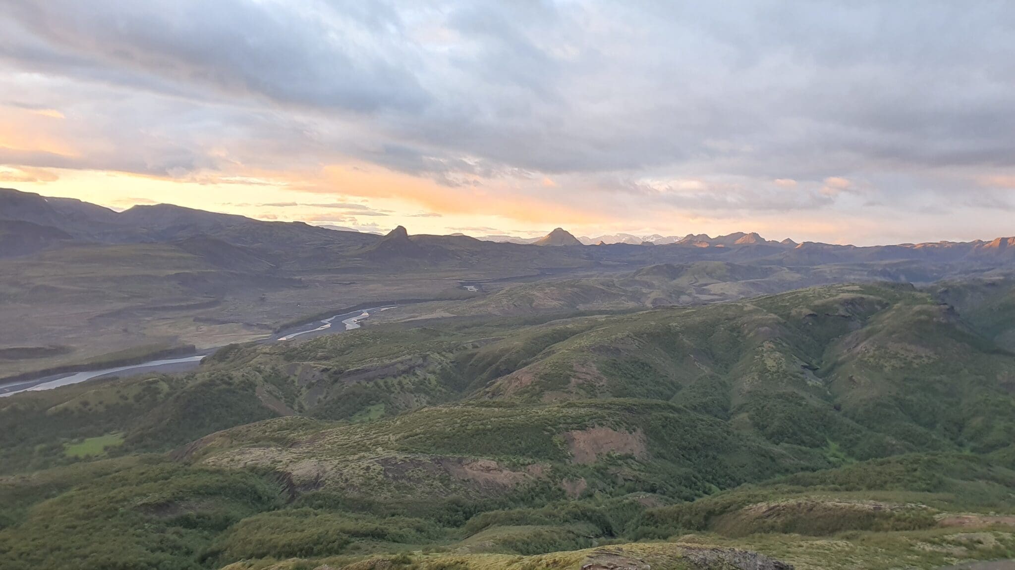
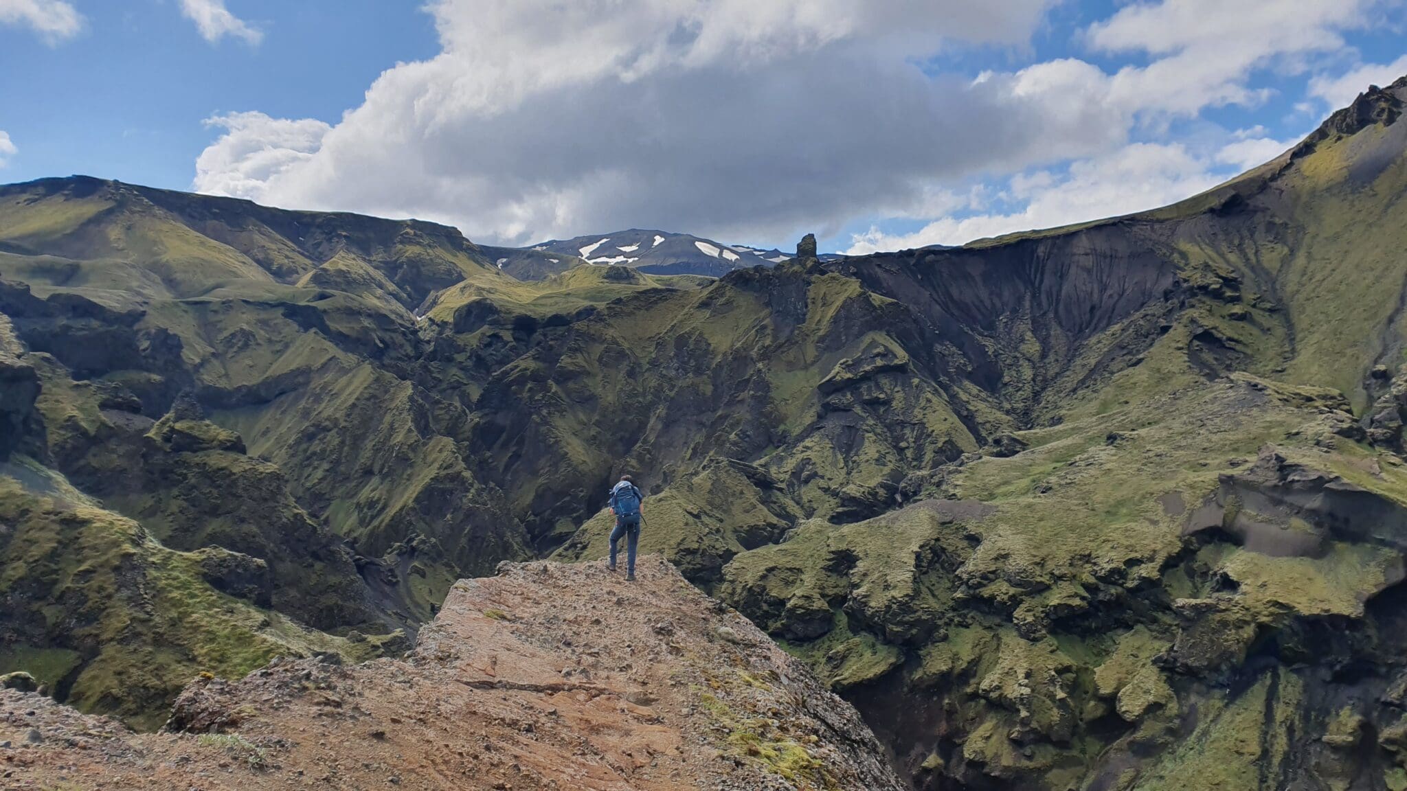
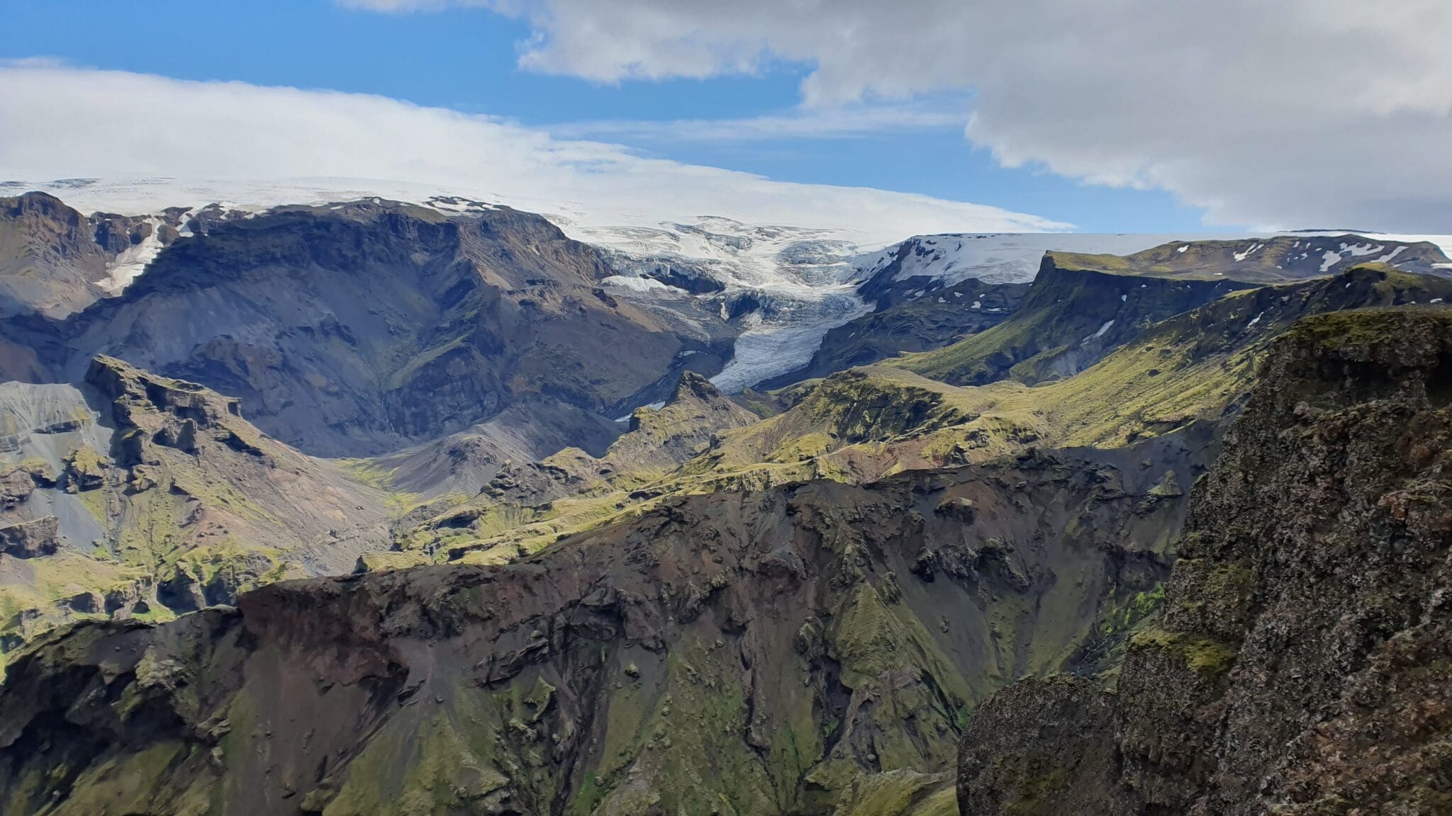
马卡弗利霍特峡谷
Emstrur之前,路线绕过了令人印象深刻的Markarfljót河峡谷,这个深而陡的峡谷可以欣赏到戏剧性的景色,是这段徒步旅行的亮点之一。.
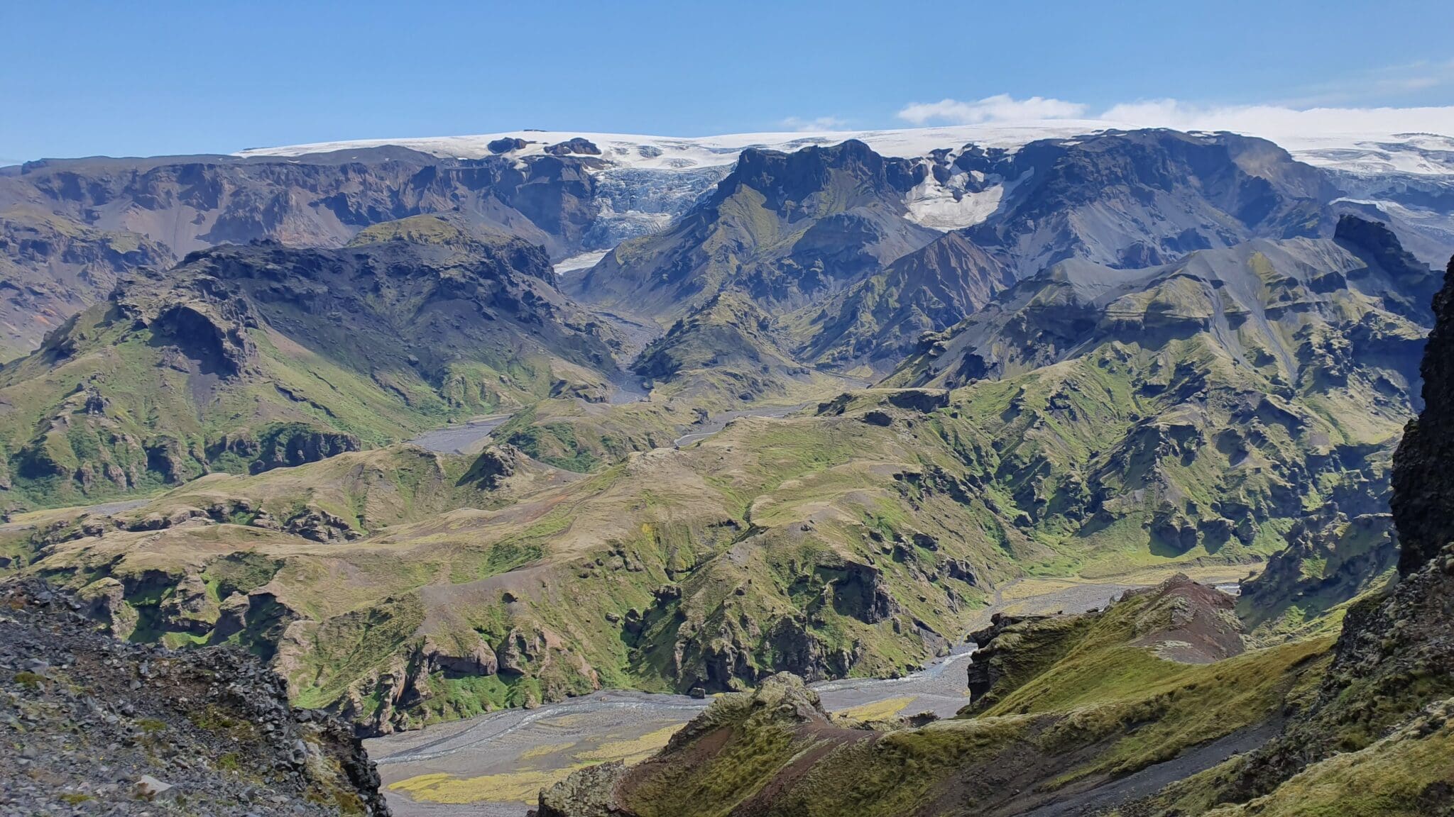
埃姆斯特鲁
Emstrur露营地结束,该营地位于较为干旱的地区,但可以欣赏到米达尔雪库尔和埃亚菲亚德拉雪库尔冰川的壮丽景色,在这里您可以休息,为下一阶段的徒步旅行做准备。.
距离:15公里
上升:260米
血统:258米
持续时间:4-5小时
埃姆斯特鲁
Emstrur露营地,徒步旅行从下降到山谷开始,穿过小溪和苔原景观,从黑沙沙漠到绿色地区的过渡是引人注目的。.
穿过弗雷姆里-埃姆斯特鲁阿河
这一阶段的挑战之一是穿越弗雷姆里-埃姆斯特鲁阿河,这条河可能根据一年中的不同时间而上升得相当高,渡过这条河时要谨慎。.
鹿角森林
进(advance),会注意到植被的变化,进入树木覆盖较多的区域,这片桤木(Alnus)森林提供了阴凉,与前几个阶段的开阔景观不同的环境。.
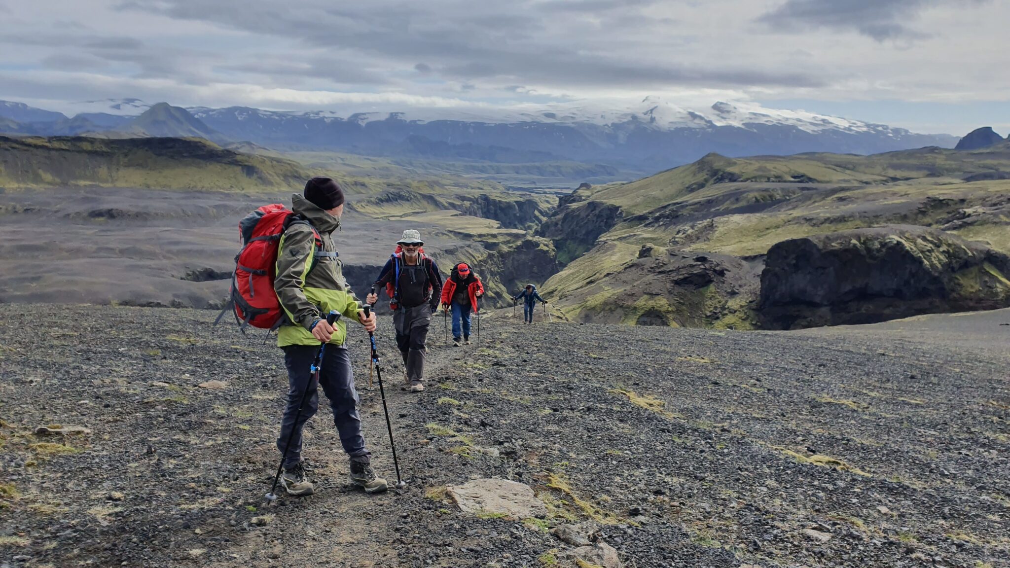
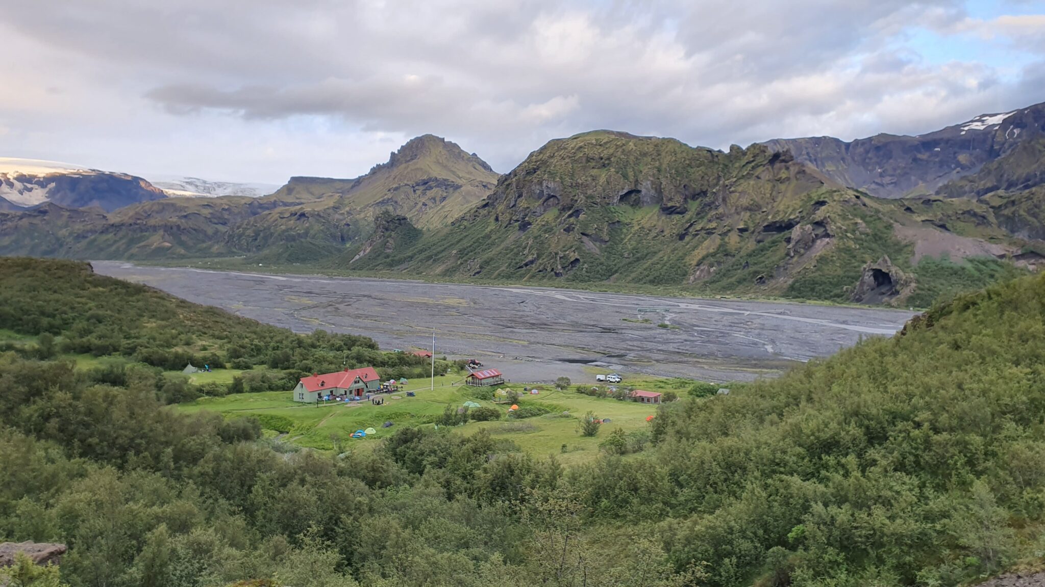
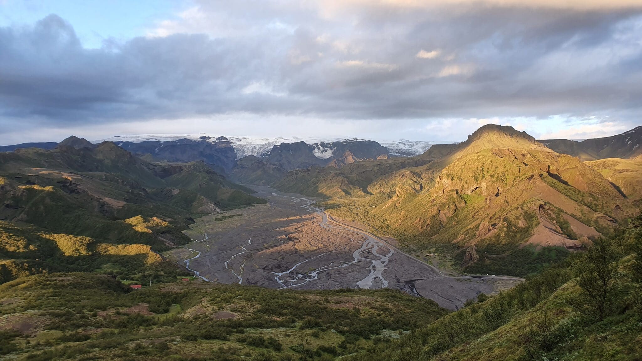
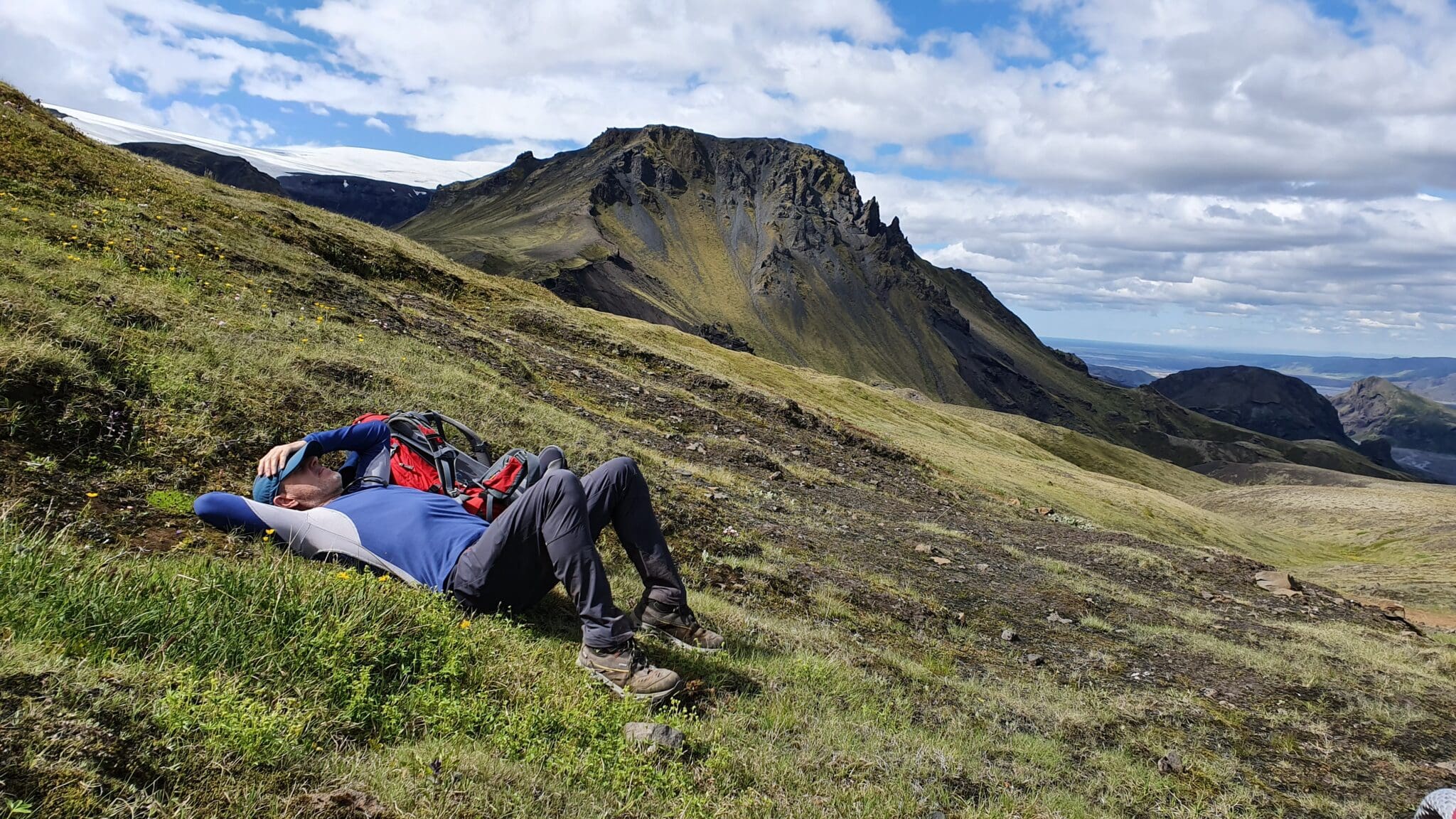
托尔斯默克山谷
Thórsmörk山谷以其壮丽的景色和茂密的植被而闻名,在这里,青山,冰川,河流创造出梦幻般的景观,是整个徒步旅行中最美丽的地方之一。.
距离:16公里
上升:214米
血统:482米
持续时间:6-7小时
2113 冰岛高地自助游, 睡在帐篷里, 订房过程中可以选择加码, 让旅途更舒适, 可用的加码内容有:

275.000 冰岛克朗
59.000 ISK
10.900冰岛克朗
59.000 ISK
49.900冰岛克朗
43.900 ISK
43.900 ISK
294.400 ISK
158.000 ISK
214.838 ISK
旅行提示、新指南和极光预报看起来不错时的单挑。没有垃圾邮件。.